


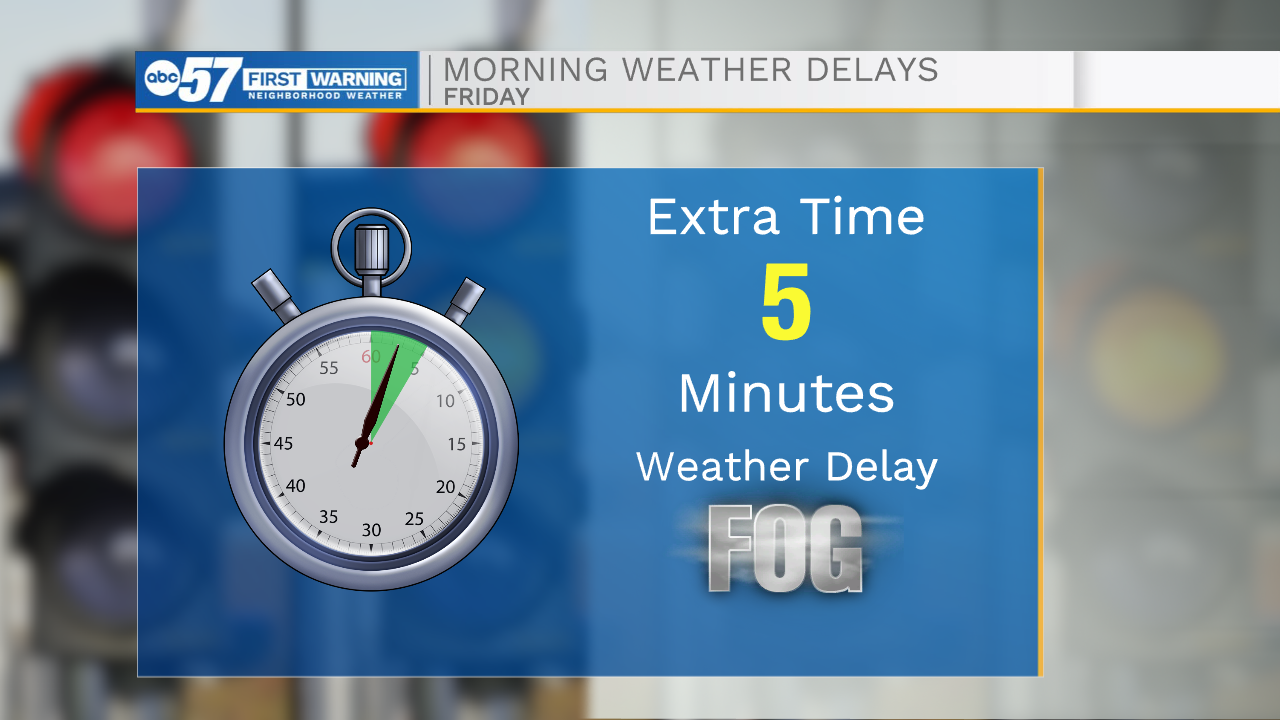
Get out the door a few minutes early today if you are still heading into work. There are areas of patchy to dense fog across Michiana. Remember to slow down. There could be a few slick spots on the roads, especially on bridges.
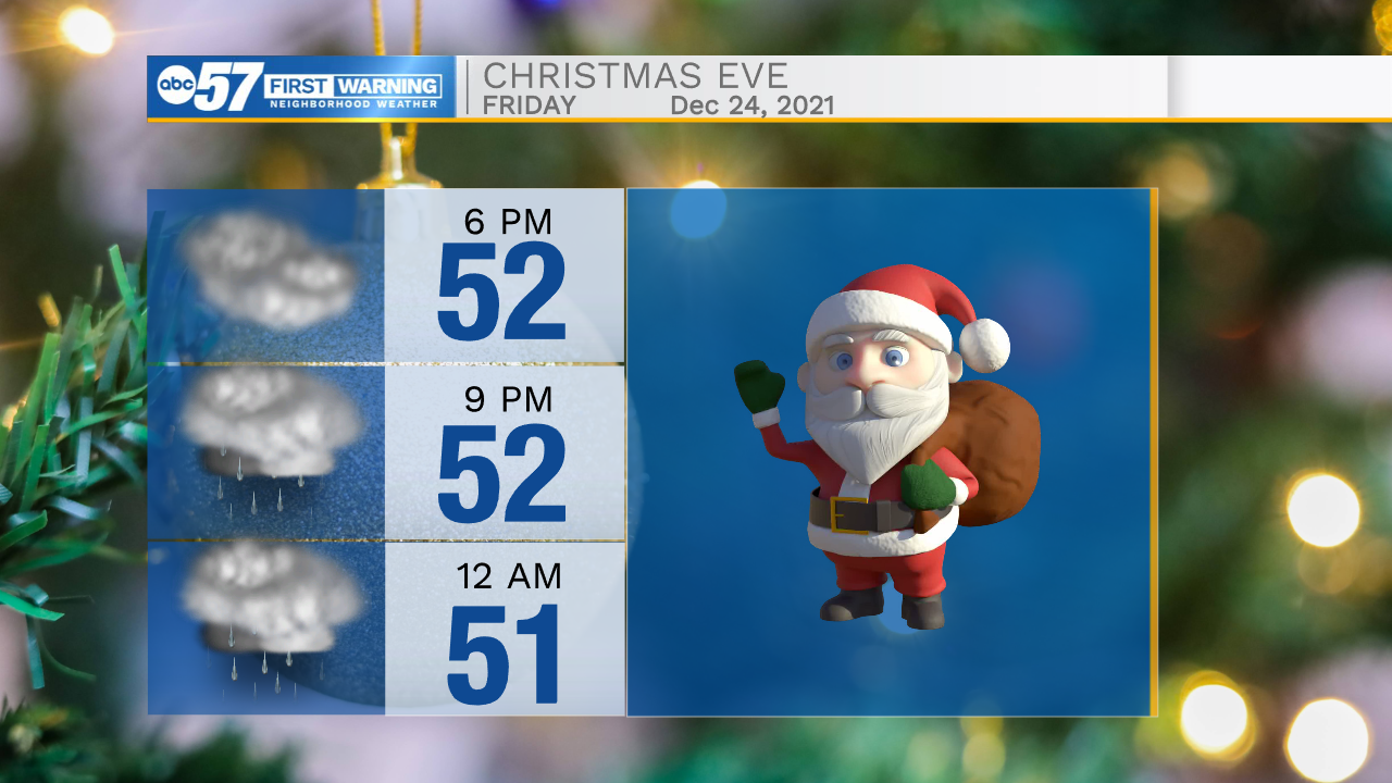
After the fog clears, it will be a cloudy day. Later this evening, we’ll see some mist/drizzle forming, before the precipitation eventually turns to rain showers through the overnight hours.
It’s a wet start to Christmas, but luckily, the rain looks like it will wrap up by Saturday afternoon.
Sunday stays dry. Another round of precipitation is likely Sunday overnight into Monday morning – it should fall mostly as rain, but a few wet snowflakes could mix in, although there shouldn’t be any huge impacts from this.
Today (Christmas Eve): Cloudy. Evening drizzle. High 52.
Tonight: Rain showers. Low 44.
Saturday (Christmas Day): AM rain. High 48.
Sunday: Mostly cloudy, rain overnight. High 42.