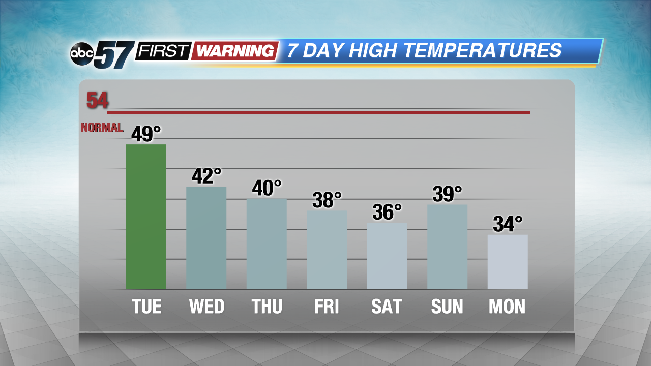
As new forecast model information comes in, one thing has become evident: a lengthy blast of mid-winter cold will occur. The likelihood of an extended streak of below-normal temperatures and bitterly cold wind chills is
high. It all begins Wednesday and Thursday with highs only expected to reach the lower 40s. That is just the beginning, though. Reinforcing shots of Canadian air will impact the area through the middle of the month, keeping highs below 40° beginning Friday.
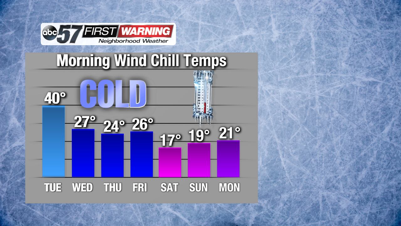
Some days we will even struggle to reach 35°! Put simply, that is big-time cold that doesn't happen all-too-often in November; especially early to mid-November. Add even the smallest amount of wind to temperatures in the 20s and 30s, and the result will be wind chill temperatures in the teens and twenties each morning. The coldest mornings will likely come this weekend into early next week with wind chills as low as 10-15° in spots!
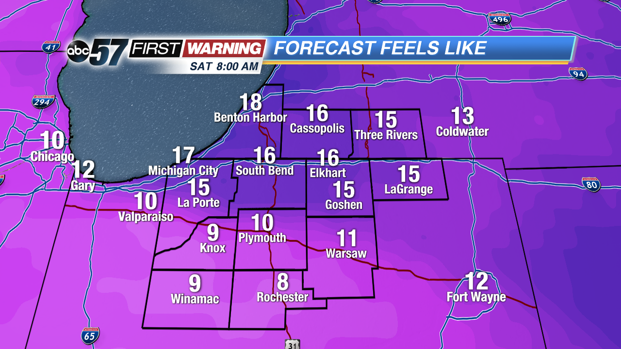 Saturday morning wind chill temperatures
It wouldn't be completely surprising to see some areas see wind chills drop into the upper single digits come Saturday morning. That will be a possibility south of US 30 away from Lake Michigan's influence. But it's not just the morning hours that will be exceptionally cold. The afternoon and evening hours will be unusually cold each day as well.
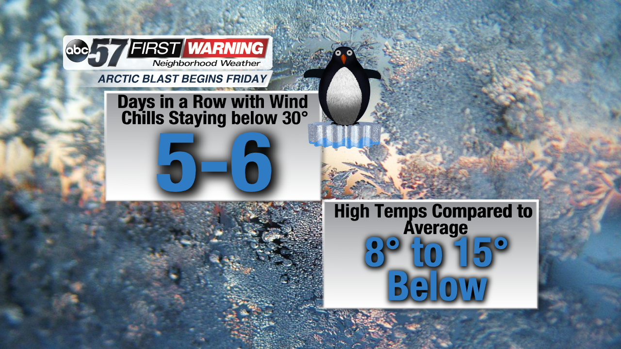
As it looks now, we may not see wind chill temperatures rise above 30° for upwards of 5-6 days beginning Friday. That means even during the warmest part of each day, it will still "feel like" it's in the 20s to near 30°. We
may see a minimal surge of "milder" air come Sunday, which could result in highs in the upper 30s. Wind chills could still stay below 30°, though. Looking ahead, we may see a return to average temperatures by the 20th or so. At the very least, we should break out of the big-time cold pattern by then. Overall, the remainder of November looks to stay below normal.