


It’s a foggy start to your Saturday morning. If you are hitting the roadways early, make sure to leave yourself 10 extra minutes, since fog is dense in a few areas. Off and on light rain showers and drizzle will stick with us throughout the day and into tonight. Finally, this system will clear into the early morning tomorrow, and cloud cover will move out with it. This will allow for sunshine to move into Michiana for Sunday. Highs tomorrow afternoon will top out near 60 degrees. Overall next week looks mostly warmer than average with highs holding in the 50s and 60s through Wednesday. Our next best chance for more scattered showers will arrive Tuesday and linger all the way into Thursday.
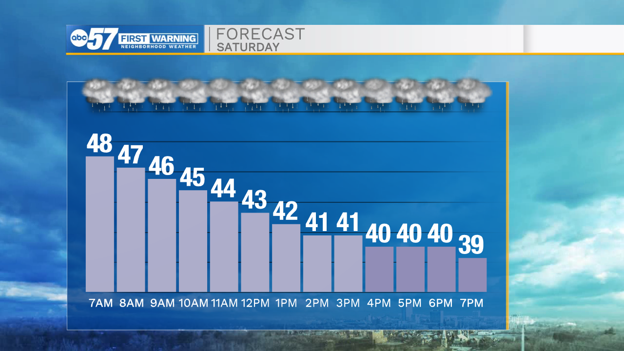
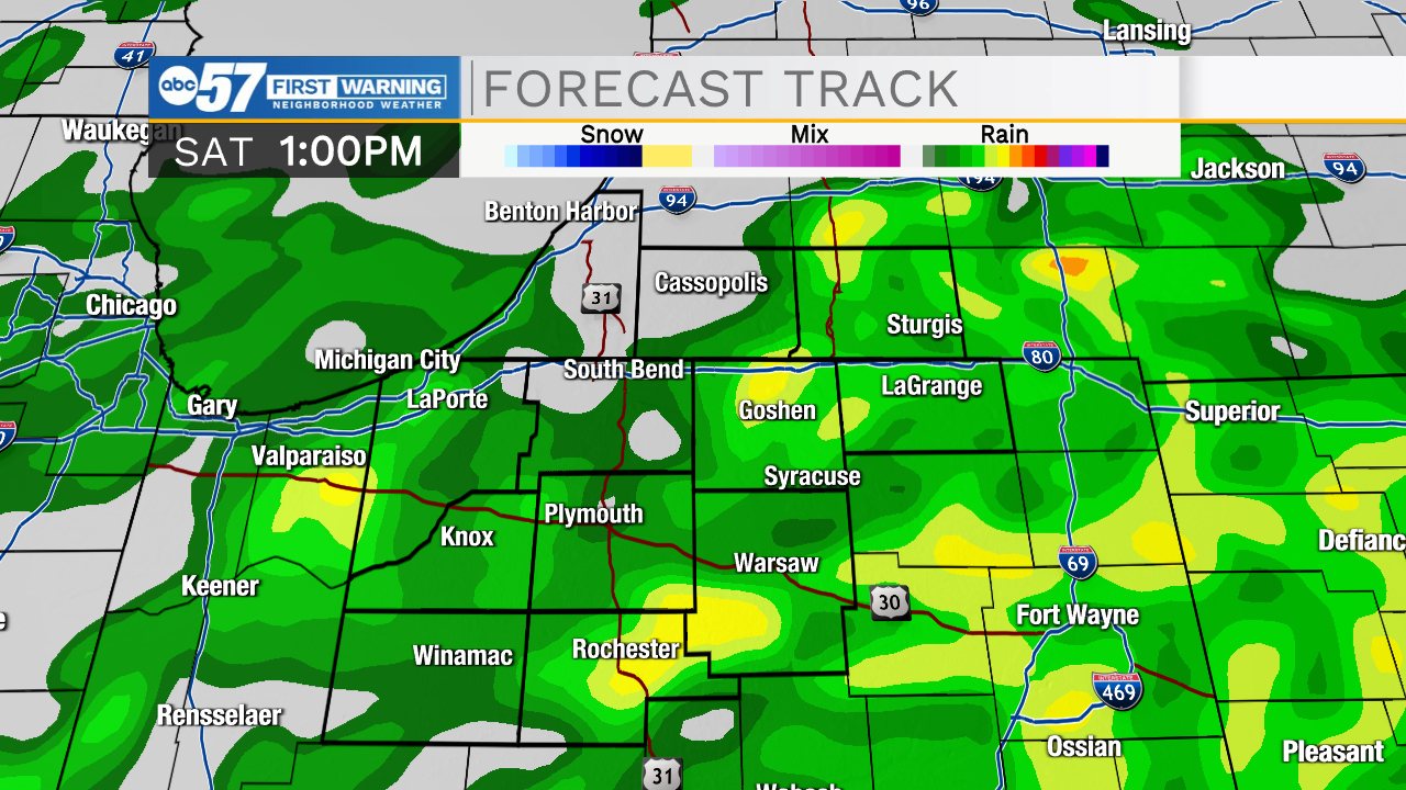

Today: Scattered showers. High 45.
Tonight: Partly cloudy. Low 32.
Tomorrow: Sunny. High 60.
Monday: Partly cloudy. High 69.