Historically dry start to March comes with hope for eventual rain


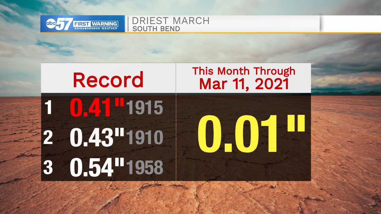
In the 125 years of weather data for South Bend, there has never been a drier start to March than this one.
A measly 0.01 inches of rain has fallen in South Bend so far this month.
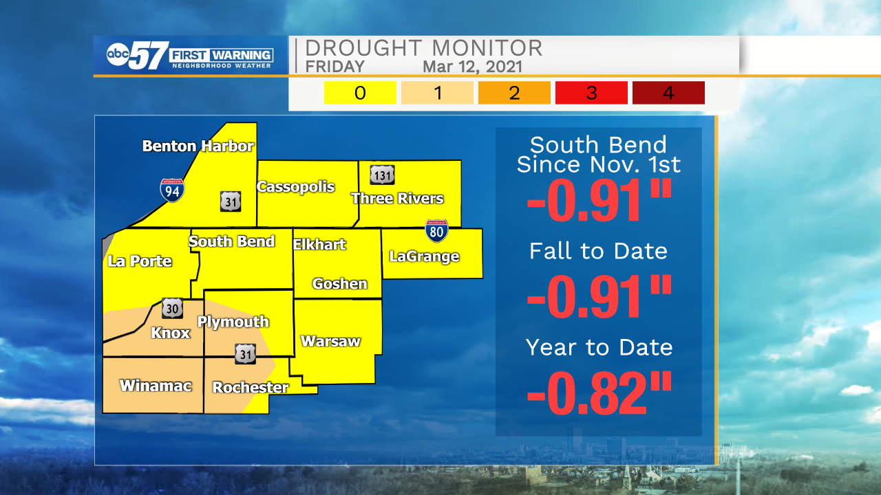
Additionally, the drought continues to build across Michiana. For the first time in five months, the entire ABC57 viewing area is included in the latest drought monitor, released on March 11.
However, even though prospects of breaking the drought seem bleak right now, there's a surprising amount of hope that things will change for the wetter.
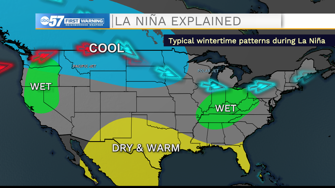
Our first card in our favor is the strong La Niña still in place. The climatological pattern typically brings Michiana a wetter-than-normal winter.
I took a look back at the 10 La Niña spring seasons (March, April and May) since 1990. Recently, above-normal precipitation is slightly favored in La Niña springs. If the La Niña is strong (which I am defining as an ONI of -1°C or more), above-normal rainfall is even more highly favored.
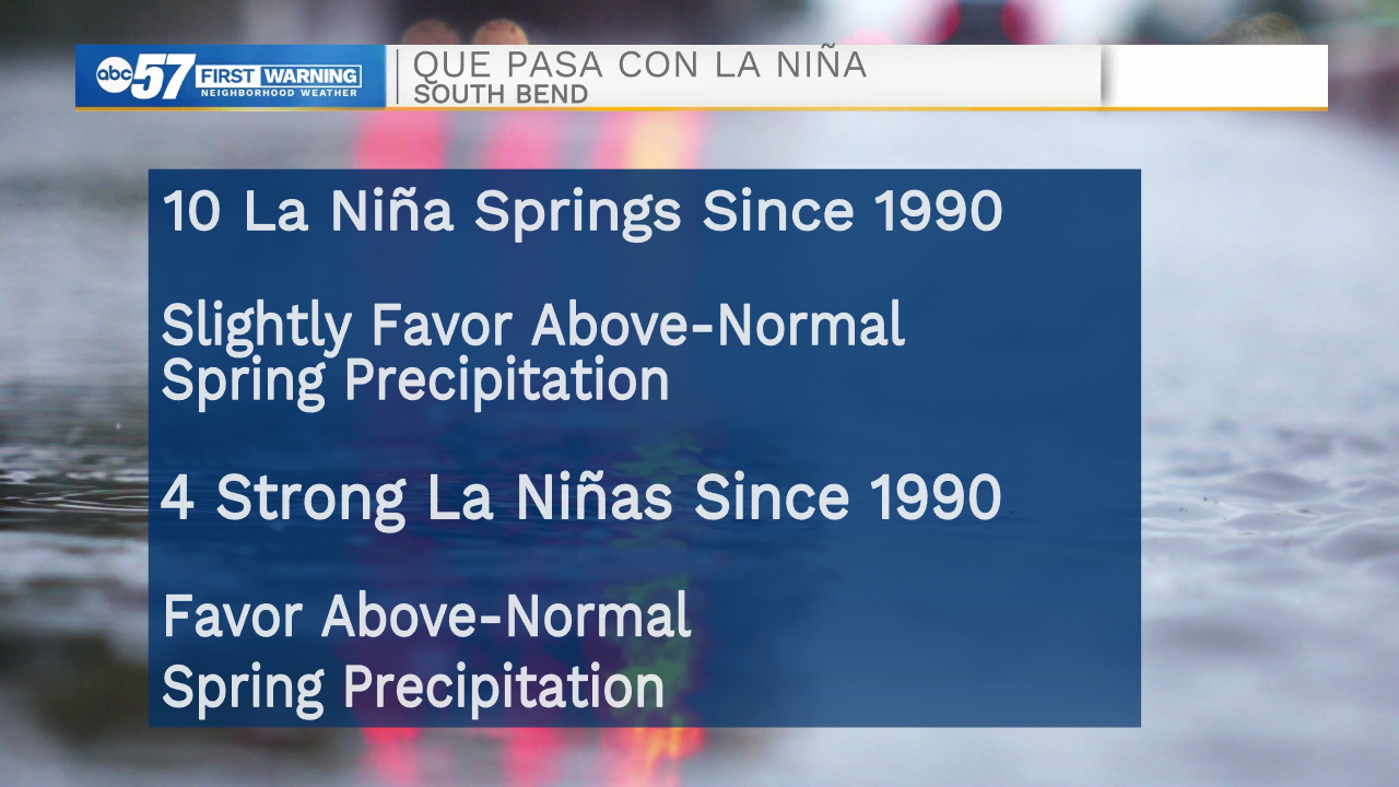
Right now, the ONI (Oceanic Niño Index) is -1.1°C, hinting that significant rain could be in our seasonal future. For an explanation of ONI, click here!
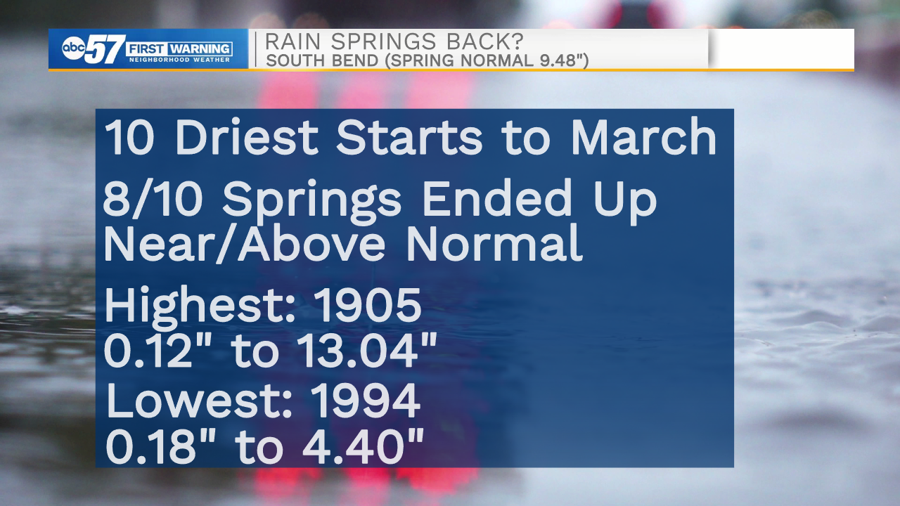
Also, a dry start to March often does not spell drought doom and gloom by the end of the spring. A majority of the driest starts to the month on record actually ended up near or above normal by the end of the season.
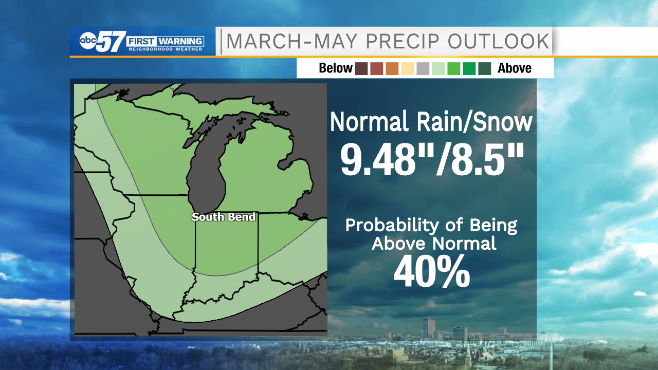
With all this in mind, the seasonal outlook from the Climate Prediction Center still has Michiana with a good shot to see above-normal precipitation over the course of March, April and May.
However, even with a few chances for precipitation next week, it looks unlikely that we'll have any significant rain or snow in the next few weeks.
**Breath in, breath out **
— Tom Coomes (@TomCoomes) March 12, 2021
❄️ Seeing snowflakes in March is not unusual. Whatever falls is most likely to be wet and not pile up. ❄️
The real focus is on how much precip can we get? I think models will continue to overestimate our dry conditions. #inwx #miwx pic.twitter.com/AScgvHa9N2
It'll be up to April and May to make up for March's slow start.