Hot and humid through midweek, much needed rain in the forecast
By:
Tom Coomes
Posted: Jun 12, 2017 4:26 PM EDT

-
2:28

Kicking off day two of the Gus Macker Basketball Tournament
-
0:50

Beautiful weekend starts this morning
-
2:32

Gus Macker Three-on-Three Basketball Tournament is taking over...
-
1:44

Feeling like a sauna next week
-
3:12

How to keep yourself and others protected during firework season
-
0:49

Showers creeping into Michiana
-
1:32

Judge approves $25 million water lawsuit settlement in Benton...
-
1:00

Scattered showers through the day
-
1:53

Hispanic Community Child Safety Meeting: A Call To Action
-
2:51

Obama Presidential Center features work of South Bend company
-
1:54

This week’s ABC57 Cub Reporter is Isaac Knefely
-
1:16

Real summer heat returns next week

Hot and humid weather continues through midweek. Highs will be back near 90 Tuesday and Wednesday with a heat index much higher. Record breaking warmth will be most felt overnight, with low above 70. The best chance of much needed rain will be Wednesday evening, storms are likely, some could be strong to severe. The heat gradually breaks through the weekend.
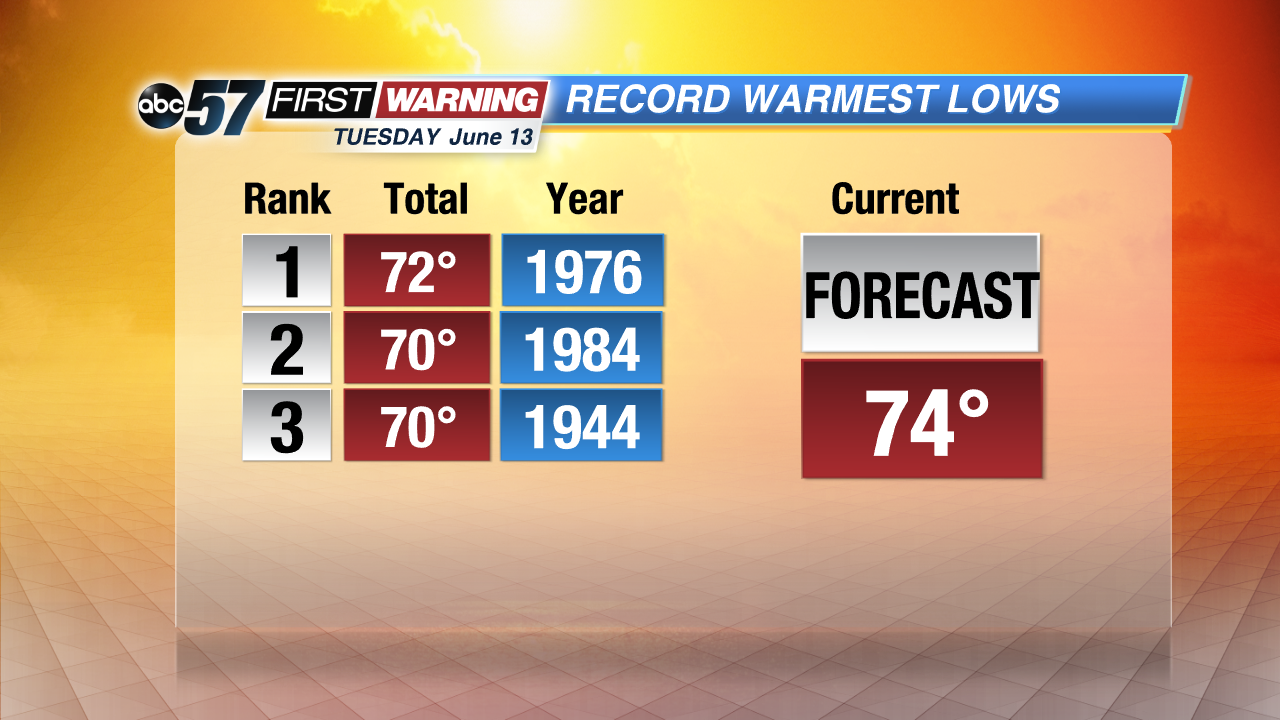 Overnight lows Tuesday are likely to tie or break a record for warmest on record. Another sign of how steamy the forecast is.
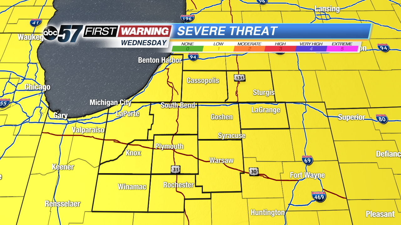 Severe threat for Wednesday is 1 of out 5. Storms could produce gusty wind and heavy rain.
Tonight: Mostly clear to partly cloudy, low of 74.
Tuesday: Partly cloudy, spotty showers/storms, high of 90.
Wednesday: Scattered showers and storms, more widespread by evening, highs in the upper 80s.
Thursday: Morning showers, partly cloudy, highs in the mid-80s.
Sign up for the ABC 57 Newsletter