


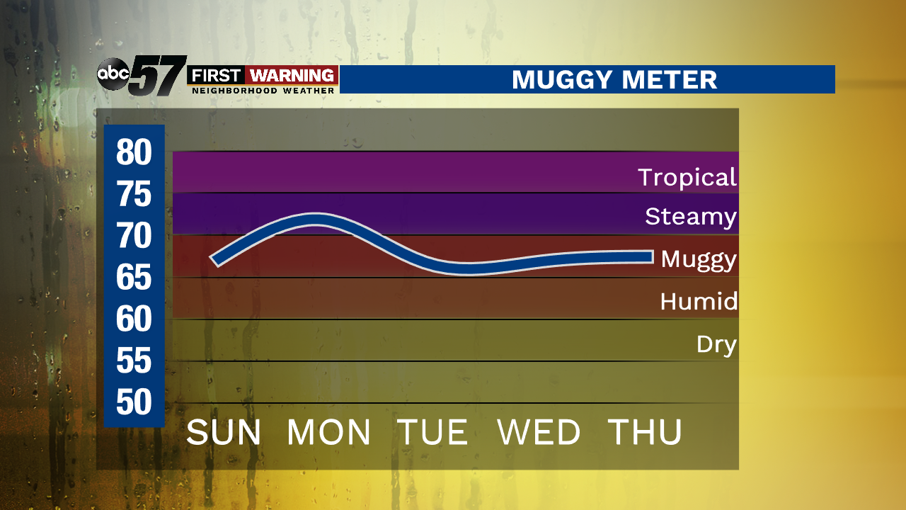
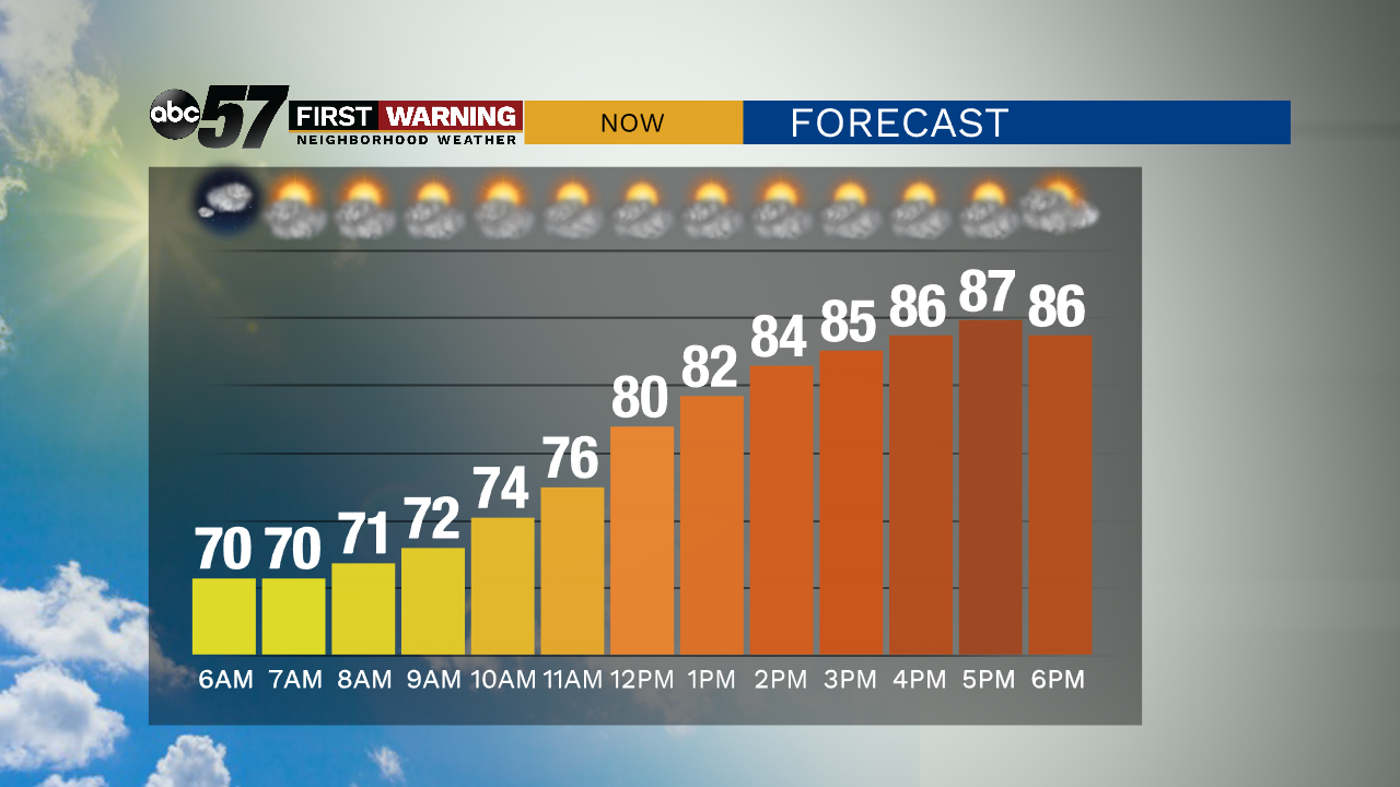
It will be a warm summer day to end the weekend. Sunday morning temperatures start in the 70s, and climb to the upper 80s by afternoon. It will feel humid outside.
There is a mix of sun and clouds today. Most of Sunday is dry, but we can't rule out a stray shower or thunderstorm this afternoon.
Overnight, temperatures will be in the upper 60s with partly cloudy skies.
The work week starts active. There is a chance for thunderstorms Monday afternoon and evening. Storm chances linger into Tuesday, then again Wednesday afternoon. Thursday and Friday will be dry and mostly sunny. Temperatures will be hot this week, with highs near 90 each day and high humidity.
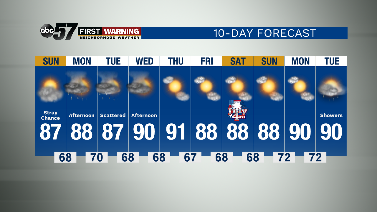
Today: Sun and clouds. High 87.
Tonight: Partly cloudy. Low 68.
Monday: Partly sunny. Afternoon thunderstorms likely. High 88.
Tuesday: Scattered showers and storms. High 87.