
-
2:10

Notre Dame men’s basketball embracing urgency as Shrewsberry...
-
2:37

Local Beef-A-Roo employees still owed paychecks as private equity...
-
1:42

More storms through 8:00 p.m.
-
1:06

2nd annual Inclusive Art Fair
-
2:20

Tracking severe weather through the mid-afternoon
-
3:17

Applications open for Fall Citizens Police Academy in South Bend
-
2:23

Elkhart County 4H Fair food vendors celebrate 50th year of business
-
2:16

Young football athletes learn about protecting their bodies,...
-
1:24

Storm track timing could be shifting
-
0:57

Unity Gardens brings music, food, and crafts for Westside BBQ...
-
1:50

Quiet evening, Storms after Midnight
-
0:57

Deer Creek Hunt Club throws a skeet shoot event for Deputy Jon...

ABC57 First Warning Neighborhood Weather Forecast
Tuesday, September 14th, 2021
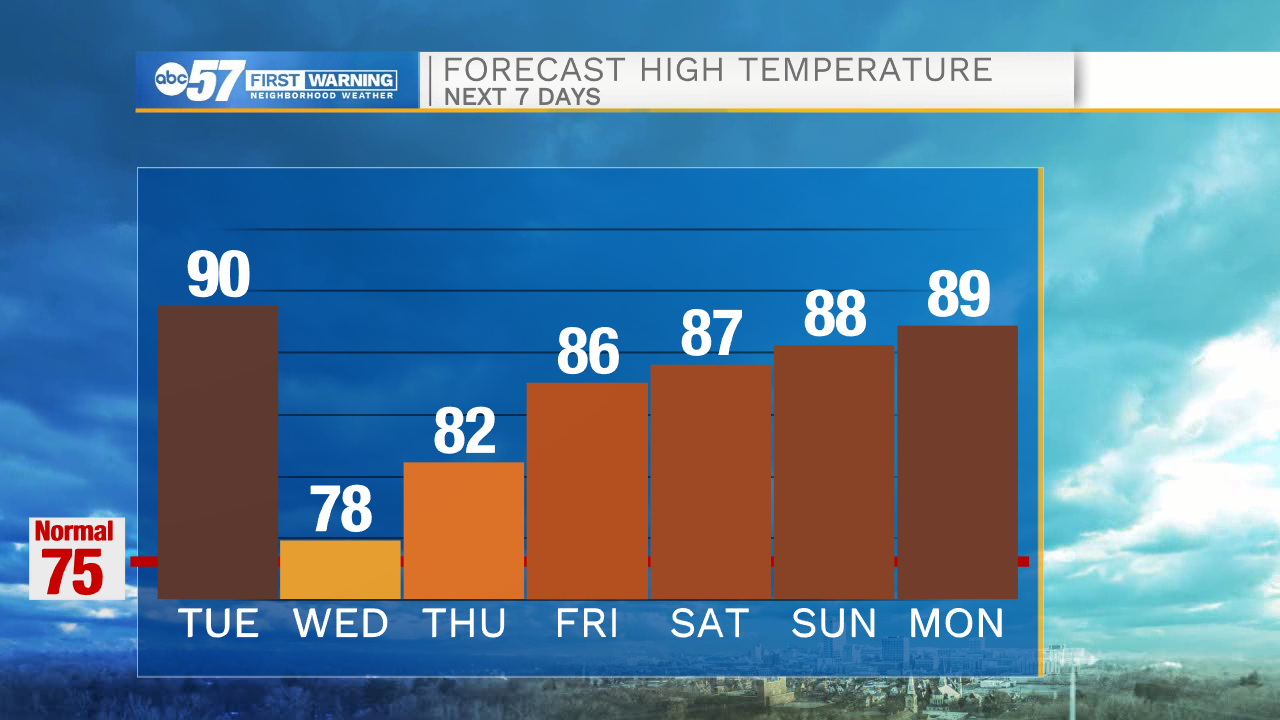
It's hot and humid once again today. A round of storms moves in this evening, ahead of a cold front. These storms could be strong to severe with gusty wind and heavy rain. Timing looks to be from 5-10pm from west to east. A couple of showers could linger into early Wednesday morning then we will have clearing for the afternoon. Temperatures cool into the upper 70s but rise again heading into the weekend. A stretch of sunshine will last into early next week.
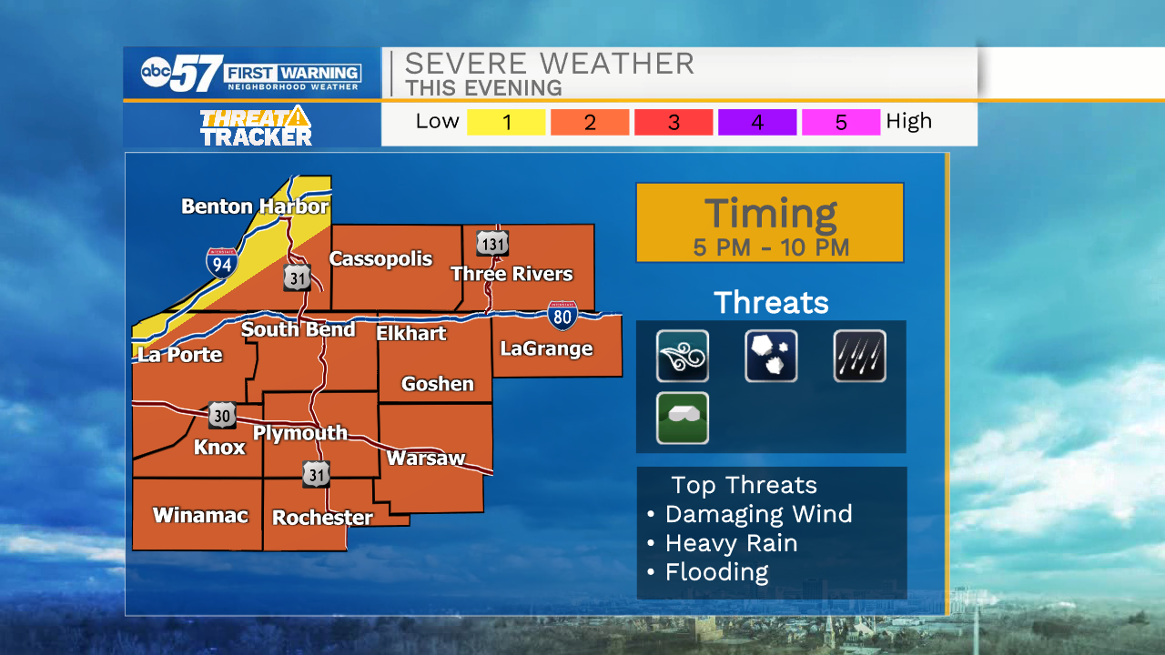
Today: Evening thunderstorms, severe possible. High 90.
Tonight: Chance of thunderstorms, mostly cloudy. Low 64.
Wednesday: Partly cloudy. High 78.
Thursday: Mostly sunny. High 82.
Sign up for the ABC 57 Newsletter