


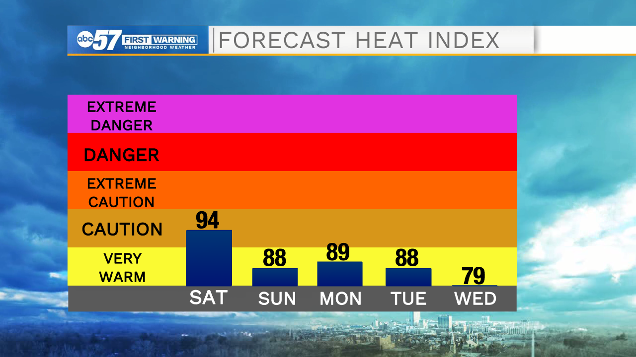
Hot, humid, and hazy are the words to describe Saturday. Temperatures soar into the upper 80s this afternoon with heat indices in the mid 90s. Be sure to drink plenty of water and take breaks from the heat, either in shade or in air conditioning.
Most of today is dry, but this evening a line of storms will move across Michiana. A few storms could be on the strong/severe side. The biggest threat is damaging gusty winds, although periods of heavy downpours could also be a concern. Flood risk looks low, as the storms move quickly.
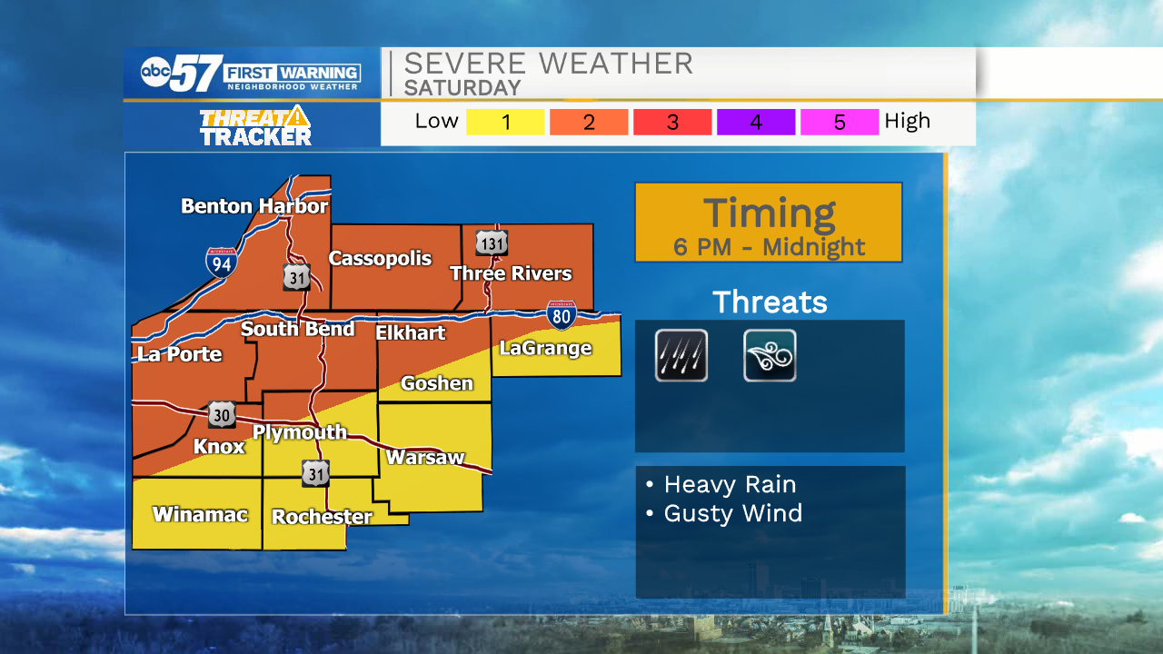
The line will impact our northern counties first, after 6 p.m.
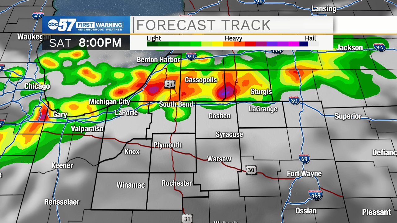
The line gradually moves to the southeast.
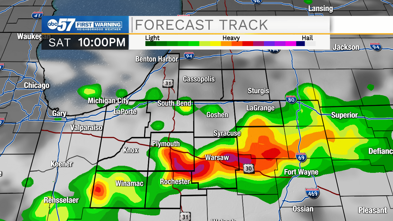
Most wrap up by midnight. Sunday should stay dry and mostly sunny. It’ll be another hot one with heat indices in the low 90s.
This week stays hot with some relief after showers Wednesday night into Thursday.
Today: Partly sunny and hot. PM thunderstorms. High 88.
Tonight: Storms before midnight. Low 72.
Sunday: Mostly sunny. High 88.
Monday: Sunny. High 88.