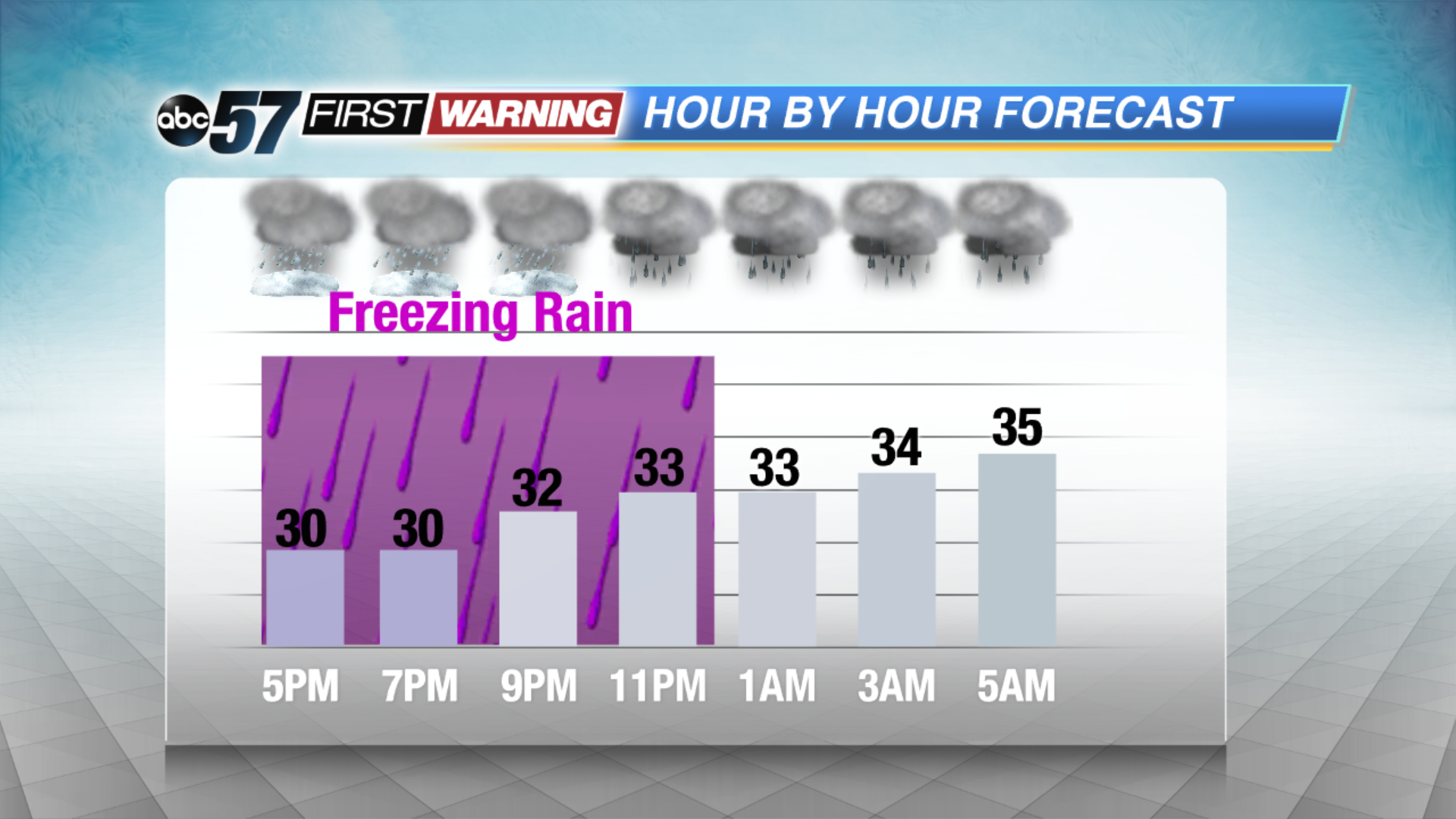
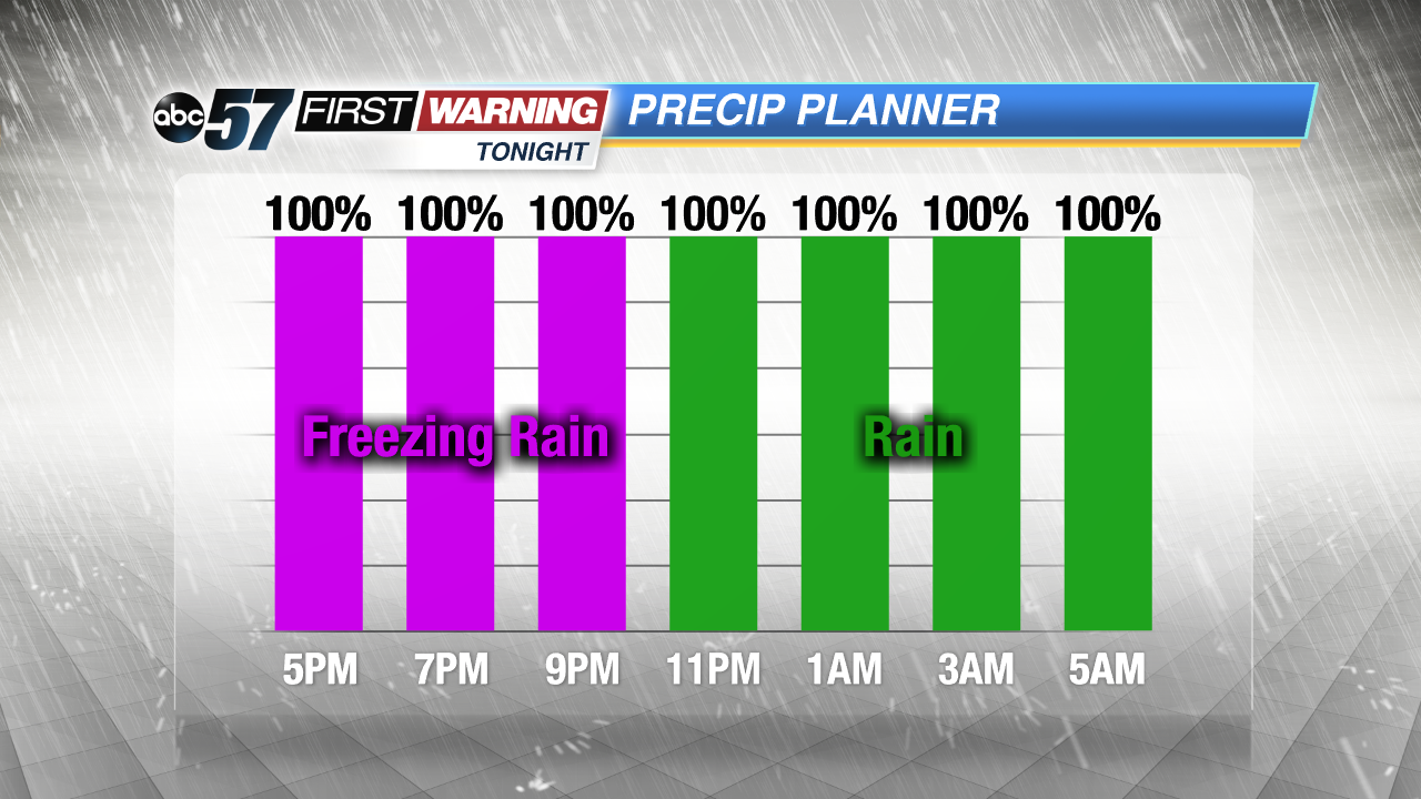
Icy Tuesday evening, wet Wednesday morning


UPDATE: Temperatures warm above freezing overnight, with rain and melting ice making for a wet drive Wednesday morning.
Roads stay extremely hazardous through Tuesday evening. Icy road condition last until nearly midnight, even as the air temperature rises above freezing the road temperature will be slower to warm /thaw.
Rainy, wet but not an icy start to Wednesday, with temperatures in the mid-30s. As temperatures fall Wednesday afternoon rain will mix with sleet and snow. Temperatures fall into teens and 20s Thursday, with light snow showers and even colder Friday with temps in the single digits to below zero by early Saturday, with more snow showers. A deep freeze, snowy pattern continues through next week.
Tonight: Freezing rain this evening, regular rain overnight, temps peaking around 36 by morning.
Wednesday: Cloudy with rain showers changing back to sleet and snow. High of 36 with falling temps throughout the day.
Thursday: Mostly cloudy with PM scattered snow showers, high of 24.
Friday: Cold with snow showers, high near 10.