


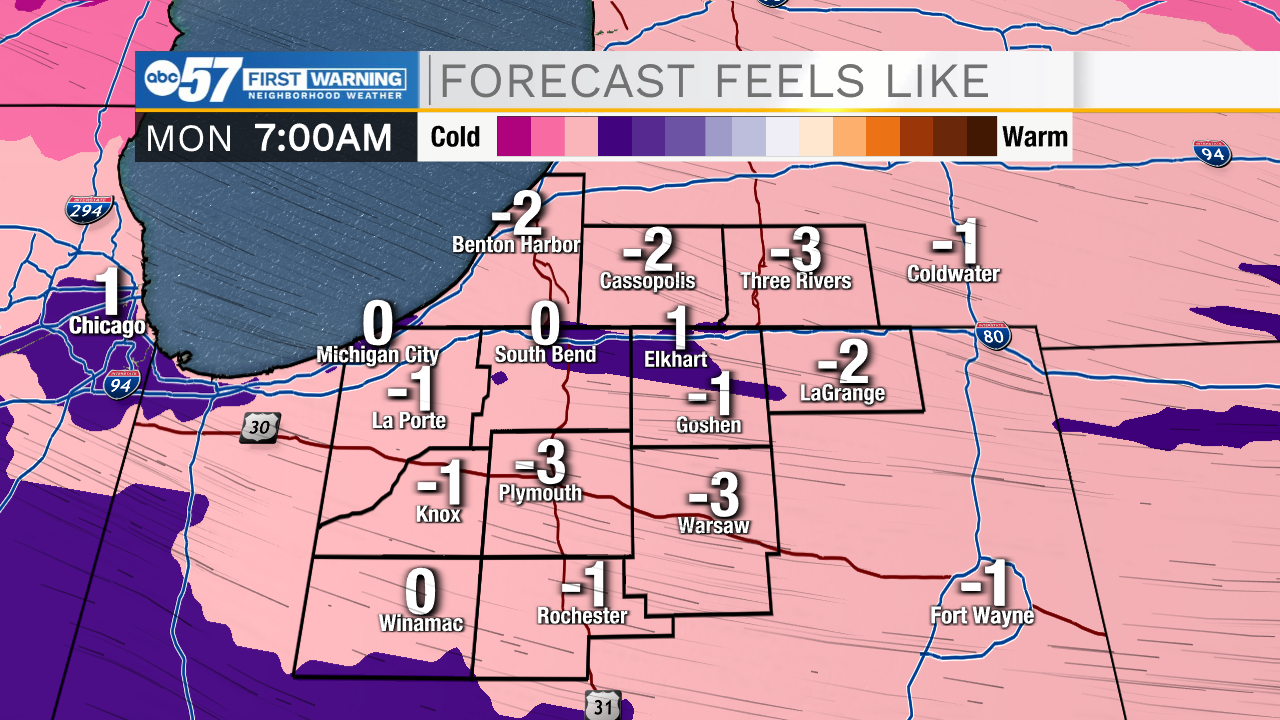
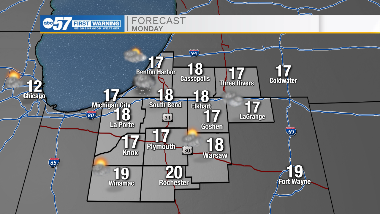
Temperatures will keep dropping into the lower teens tonight with some wind chills hitting the negatives. Bundle up before you head out the door! A few isolated lake effect snow showers are possible tonight, but overall better chances will return later in the day. Lake effect snow could linger into Tuesday morning. Areas that receive lake effect snow could add 1-2 inches of new snow accumulation. High temperatures tomorrow afternoon will only top out in the upper teens. Tuesday will be another cold one with temperatures dropping into the single digits, and feel like temperatures again in the negatives. Warmer/quieter weather settles in for the middle part of the work week. Temperatures will warm into the mid 30s. Isolated snow chances return to the forecast Friday evening and linger into next weekend.
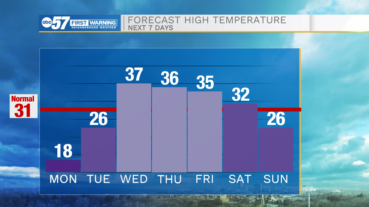
Tonight: Isolated snow showers. Low 12.
Tomorrow: Isolated lake effects snow. High 18.
Tuesday: AM flurries. High 26.
Wednesday: Mostly cloudy. High 37.