June Outlook
June like most months in 2016 will start with cooler than normal temperatures. After a wet spring rainfall also looks to be more sparse as we start the month. However the pattern that starts the month likely won't last through the end.
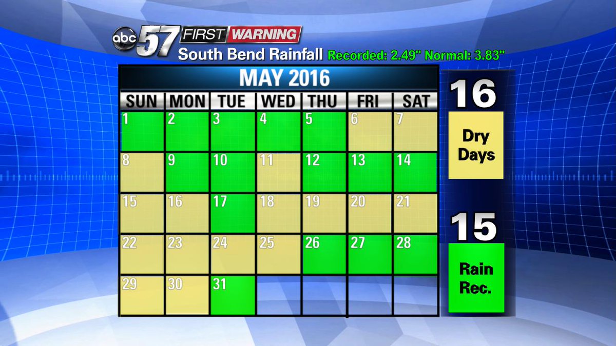
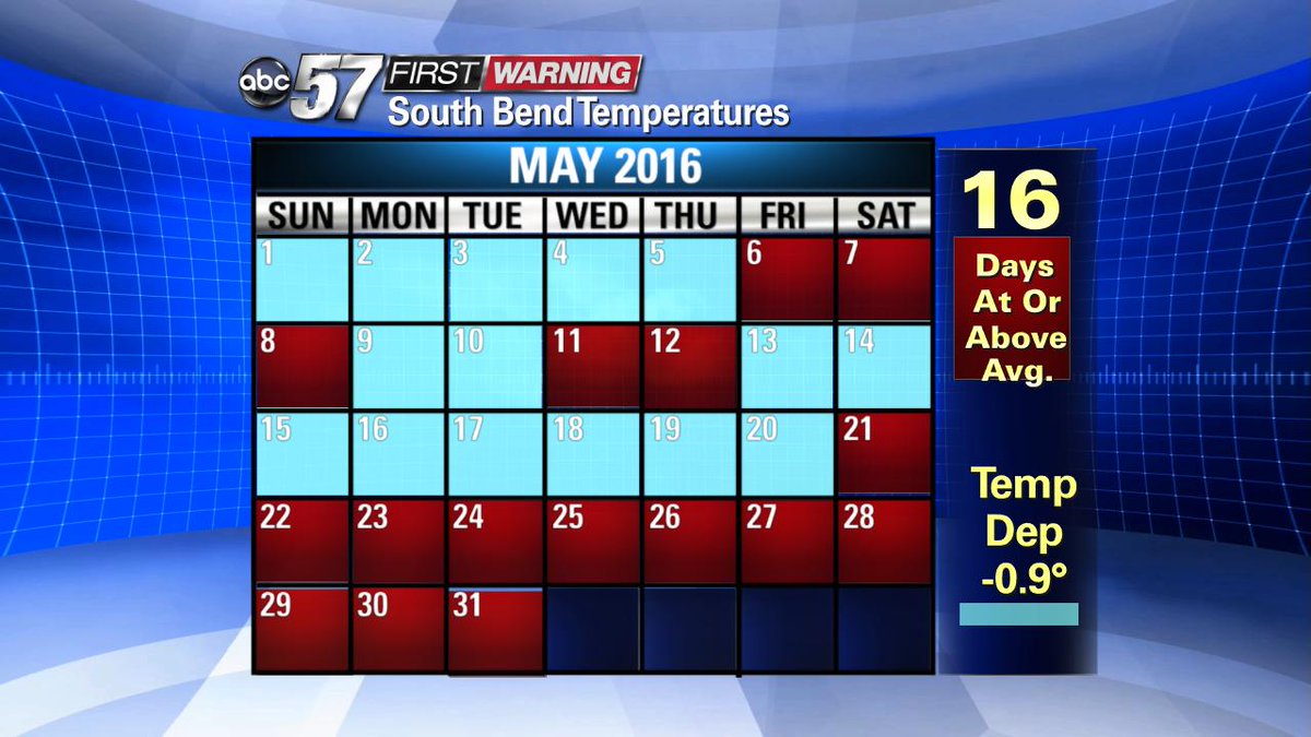
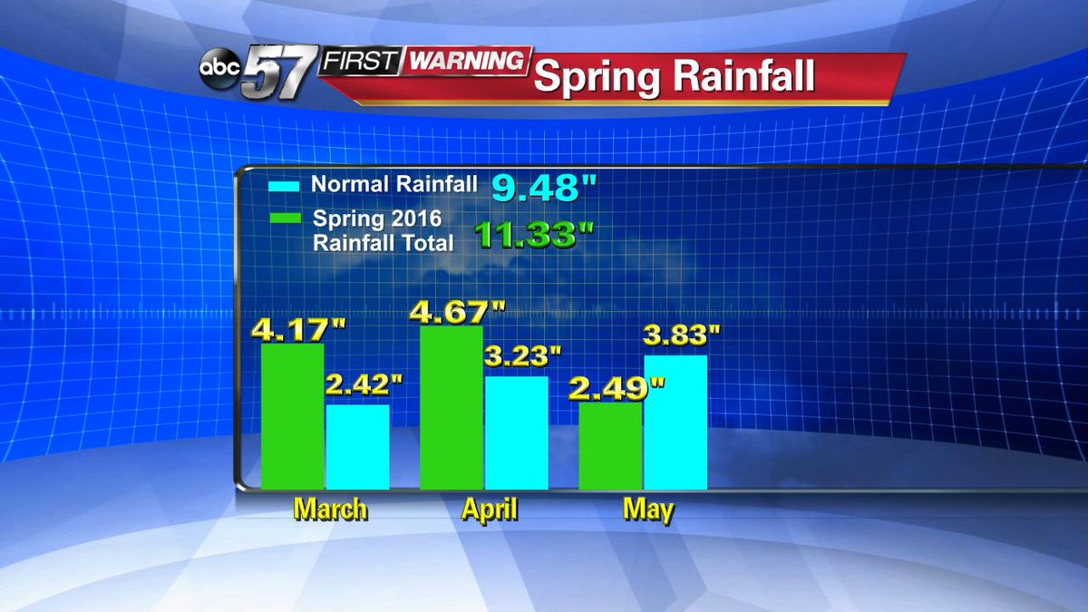
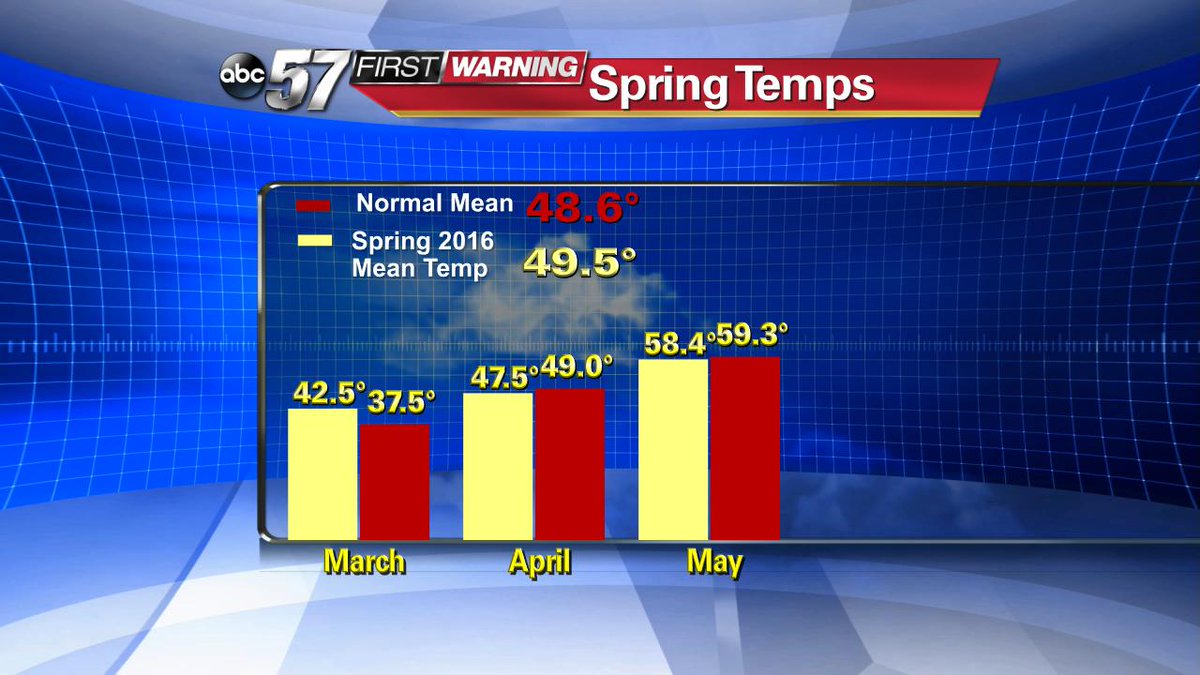
The end of May was much different than most of spring that was know for being cooler and wetter than normal. The drier weather looks to continue into the start of June, the warmer weather will not.
The outlook for the next six to ten days is expected to be cooler and drier than normal.


This is reflected in the forecast with only a slight chance for rain over the next 7 days and temperatures near to below normal. Next Monday highs will be five to ten degrees below normal.


This pattern is not expected to last the entire month. By the middle of the month the pattern begins to shift warmer, a more likely probability of above normal temperatures. Precipitation is a bit more difficult, with no strong signal of above or below normal in the pattern. That being said, June is a month known for thunderstorms and a few heavy downpours an easily make up for long dry spells.


June 2016 will likely average out with near to below normal temperatures. At this point no major heatwave is in the foreseeable future. The precipitation pattern could be a bit more concerning for gardeners and farmers. With rain looking more sparse it's good advice to continue to water regularly. If the pattern stays dry we may see some hotter days but with low humidity. Humidity acts as a buffer keeping highs lower, even though it can make it feel warmer.

Get the latest forecast here.
