
-
1:27

Community Build underway at Kathryn Park
-
2:34

Day two of searching for a missing child continues
-
3:47

The Elkhart community is searching for answers after a 2-year-old...
-
1:04

Overall pleasant for Michiana
-
1:52

South Bend Common Council issues an official apology to residents...
-
0:54

Slightly cool out the door
-
1:54

Suspect identified, charged in fatal hit-and-run of Timothy Johnson
-
0:39

Prairie Street Cemetery works to clear storm damage
-
1:36

Reaching out for support gives father a second chance in life
-
2:08

St. Joseph County police investigating Bypass incident from Saturday...
-
2:07

Color guard coach charged with Sexual Misconduct with a Minor
-
1:09

Pleasant for the rest of today

Tonight: Snow/mix ending, slick spots possible with a hard freeze. Low 28.
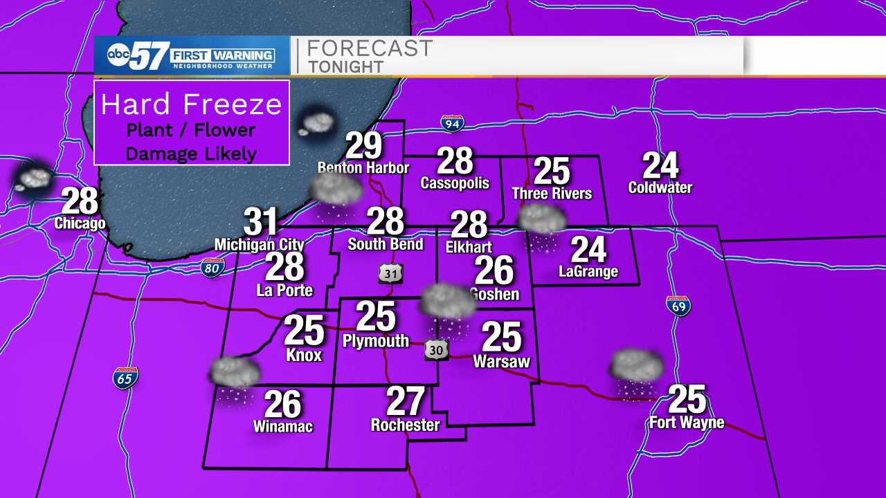
A hard killing freeze Tuesday and Wednesday morning will have a lasting impact beyond feeling cold for a couple mornings. This will likely stunt or damage much of the fruit crop in the area that has bloomed early. This phenomenon is happening more as early springs warms, leaving orchards and vineyards prone to an April freeze. Temperatures rise gradually through the end of the week, 50s and 60s. Rain showers look likely Saturday and next week trends much warmer as 70s return.
Wednesday: Partly cloudy. High 44
Thursday: Sunny. High 54.
Friday: Partly cloudy. High 62.
Sign up for the ABC 57 Newsletter