
-
2:12

South Bend City Council passes resolution urging pause on Midwest...
-
0:46

Niles City Council vote yes on putting marijuana question on...
-
0:29

Multiple Fire Departments battle residential fire in Berrien...
-
2:10

Notre Dame men’s basketball embracing urgency as Shrewsberry...
-
2:37

Local Beef-A-Roo employees still owed paychecks as private equity...
-
1:42

More storms through 8:00 p.m.
-
1:06

2nd annual Inclusive Art Fair
-
2:20

Tracking severe weather through the mid-afternoon
-
3:17

Applications open for Fall Citizens Police Academy in South Bend
-
2:23

Elkhart County 4H Fair food vendors celebrate 50th year of business
-
2:16

Young football athletes learn about protecting their bodies,...
-
1:24

Storm track timing could be shifting

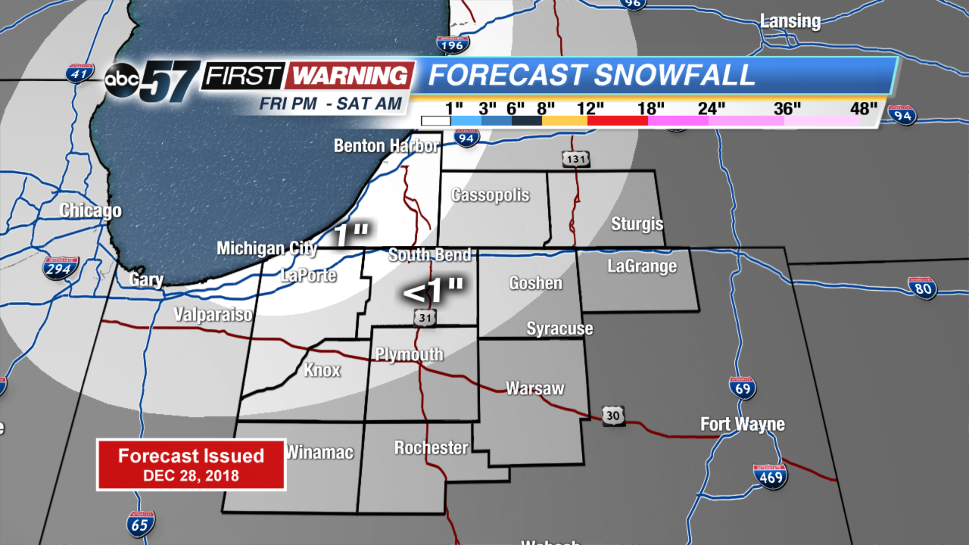
Light snow showers Friday night may bring some white to the grass and bare ground, the pavement will be wet. Temperatures fall into the upper 20s, a few slick spots are possible.
The weekend is colder, high in the 30s. The next storm will bring rain Monday and likely put 2018 into third place for the wettest year on record in South Bend. A punch of cold air arrives to start 2019, bringing a chance of lake effect snow showers. The cold snap does not look to last through all of next week.
Tonight: Light lake effect snow, low of 28.
Saturday: Chance of snow early, high of 33.
Sunday: Mostly sunny, high of 38.
Monday: Rainy, high of 40.
Sign up for the ABC 57 Newsletter