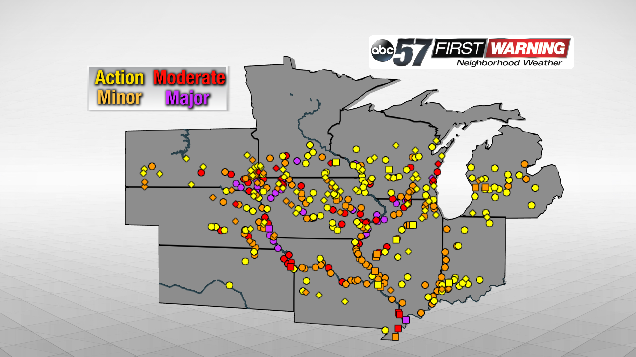
 River levels as of March 18th at 11 a.m.
Flooding has continued to worsen across parts of the Midwest over the last week or so. Many locations along the Missouri River and Mississippi River are in Moderate or Major flood stage as of March 18th. Moreover, several river crests have been historic and even record-breaking from South Dakota and Nebraska to Iowa and Illinois. Michiana has not been affected by this late winter flooding for a couple of reasons. First, we didn't have a substantial amount of snow on the ground. Second, our rivers weren't susceptible to ice jams because the ice had melted. Lastly, our ground has warmed up enough to prevent it from being entirely frozen. Those three components have combined to support the significant flooding that is ongoing across the Midwest.
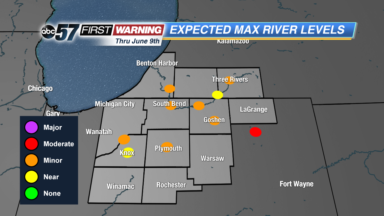 Maximum river levels expected thru June 9th.
NOAA
Maximum river levels expected thru June 9th.
NOAA
While extreme flooding isn't expected, we are certainly not immune to at least some flooding this spring. The
long-range flood outlook put out by the National Weather Service incorporates several parameters to highlight which rivers are most likely to experience flooding. Locally, the St. Joseph River, Elkhart River, Yellow River, and Kankakee River were analyzed thru June 9th. And, as mentioned above, none of them have a substantial risk for seeing Moderate or Major flooding. That's the good news. Of course, that still leaves the door open for Minor flooding.
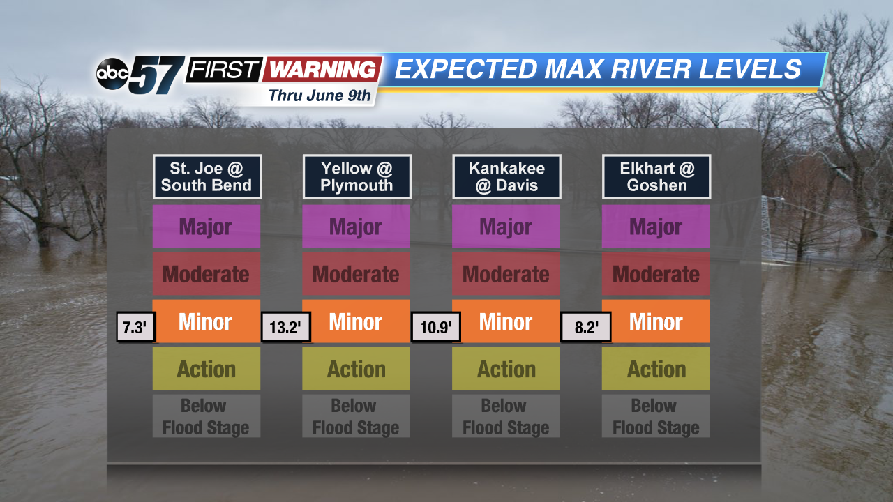 Highest expected levels for area rivers thru June 9th.
NOAA
Highest expected levels for area rivers thru June 9th.
NOAA
But, as you'd probably expect, Minor flooding is nothing compared to what we see when our rivers enter Moderate and Major flood stage. According to the National Weather Service, Minor flooding is used to indicate minimal or no property damage with some public inconvenience possible. While this may not sound overly concerning, it is important to note that the outlook does mention our vulnerability to the track of storm systems this spring. The weather pattern thru May could support a few more significant systems capable of dropping quite a bit of rain. If we see two or three of these within a short duration of time (i.e., a week or so) then we could be talking about a higher risk for river flooding and flash flooding. This will especially be true if any one system brings rainfall on the order of more than two inches.
