
-
3:08

Officials recover body of missing teenager in Lake Michigan off...
-
2:45

NCAA’s new eligibility rule could reshape Notre Dame roster...
-
1:08

Storms start this afternoon
-
0:56

Calm morning, storms tonight
-
2:43

South Bend residents see future plans for former Drewry’s Brewery
-
2:45

Damage assessment continues in Elkhart County following EF-2...
-
0:44

Indiana and Illinois set record for tornadoes
-
1:27

Community Build underway at Kathryn Park
-
2:34

Day two of searching for a missing child continues
-
3:47

The Elkhart community is searching for answers after a 2-year-old...
-
1:04

Overall pleasant for Michiana
-
1:52

South Bend Common Council issues an official apology to residents...

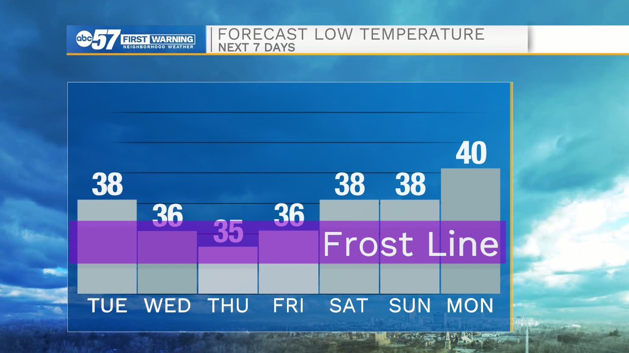
Temperatures fall midweek, as temperatures struggle to break 50 Wednesday and Thursday, and the wind chill will be in the 40s to upper 30s. Most nights will fall into the 30s, a few into the mid-30s which brings the concern for patchy frost. Friday morning has the greatest potential for frost, but still not a high risk. There's little change through the weekend, high temperatures range 55 to 60.
Tonight: Partly cloudy. Low 38.
Wednesday: Mostly sunny. High 52.
Thursday: Mostly cloudy, isolated shower possible, breezy. High 48
Friday: Mostly sunny. High 56.
Sign up for the ABC 57 Newsletter