
-
0:57

Fairly average summer weekend
-
0:54

Mild morning setting up beautiful weekend
-
2:29

Kevin Ward Meyers was a man with a lengthy criminal record
-
1:02

Majestic Care of Goshen holds charity garage sale, with proceeds...
-
0:56

Elkhart School Board discusses transferring Osolo Elementary...
-
1:10

Detroit Pistons Youth Academy basketball camp wraps up Friday...
-
9:25

ABC57 breaks down what led to the shooting of an ISP trooper...
-
2:58

Backup diesel generators at AWS Data Center Campuses in New...
-
1:04

Hot next week, but not extreme
-
1:17

Quiet Friday overall, Fair weekend
-
1:21

Isolated storms coming to an end this morning
-
1:02

Food Truck Philanthropy takes over downtown South Bend

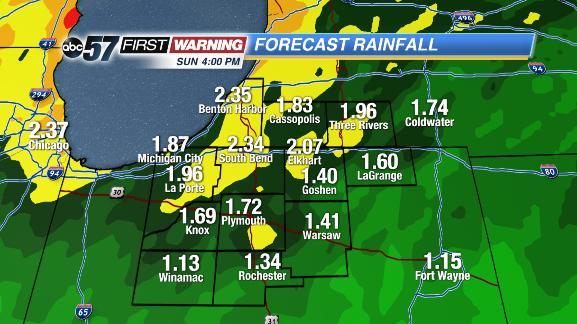
Rainy and cooler this weekend. Heavy rain will start Saturday along a cold front that will drop temperatures through the day. The official high for Saturday will be just after midnight. Rain continues into Sunday as temps continue to drop. Monday morning snow showers are possible as temps fall into the 30s.
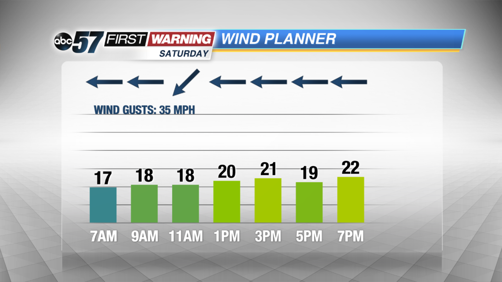
Tonight: Chance of showers before midnight, widespread heavy rain / storm by morning, low 50.
Saturday: Rainy, thunder possible, temperatures fall from the mid-50s.
Sunday: Rain showers, highs in the mid-40s.
Monday: Rain and snow showers, highs in the upper 30s.
Sign up for the ABC 57 Newsletter