
-
0:49

Gas leak at remains of Zimmy’s Tavern leads to temporary evacuation...
-
2:12

South Bend City Council passes resolution urging pause on Midwest...
-
0:46

Niles City Council vote yes on putting marijuana question on...
-
0:29

Multiple Fire Departments battle residential fire in Berrien...
-
2:10

Notre Dame men’s basketball embracing urgency as Shrewsberry...
-
2:37

Local Beef-A-Roo employees still owed paychecks as private equity...
-
1:42

More storms through 8:00 p.m.
-
1:06

2nd annual Inclusive Art Fair
-
2:20

Tracking severe weather through the mid-afternoon
-
3:17

Applications open for Fall Citizens Police Academy in South Bend
-
2:23

Elkhart County 4H Fair food vendors celebrate 50th year of business
-
2:16

Young football athletes learn about protecting their bodies,...

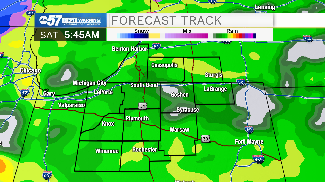
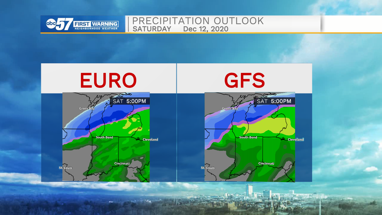
Thursday is the mildest day this week as highs warm into the 50s, with the aid of more sunshine. The next storm system will turn the wind easterly Friday and keep temperatures in the 40s, the wind turns more southerly into Saturday with widespread rain. Key point is most of the day Friday is dry before rain Friday night. As temperatures cool Saturday night rain could mix with snow but accumulation is still questionable at this point.
Tonight: Mostly clear. Low 28.
Thursday: Mostly sunny. High 52.
Friday: Increasing clouds, rain by the evening. High 46.
Saturday: Rainy. High 48.
Sign up for the ABC 57 Newsletter