
-
3:46

South Bend couple calls on Commissioners for help with flooding...
-
2:37

Marshall County Health Department rewarding students at immunization...
-
2:14

Heat is raising electricity bills, but learn how you can reduce...
-
2:25

South Bend Police Athletic League uses free summer sports camps...
-
3:15

Michigan Dark sky expert weighs in on light pollution as data...
-
3:23

Sunshine Protection Act could bring changes to Daylight Saving
-
2:25

South Bend businesses affected by construction
-
1:32

Widespread 90s start today
-
0:57

Warmer stepping out the door
-
3:52

Hyperscale CEO hears residents concerns over expanding Dowagiac...
-
0:50

City of South Bend addresses trouble some short-term rentals
-
1:56

Lake Michigan Hills celebrates its 66th annual Chamber Golf Outing

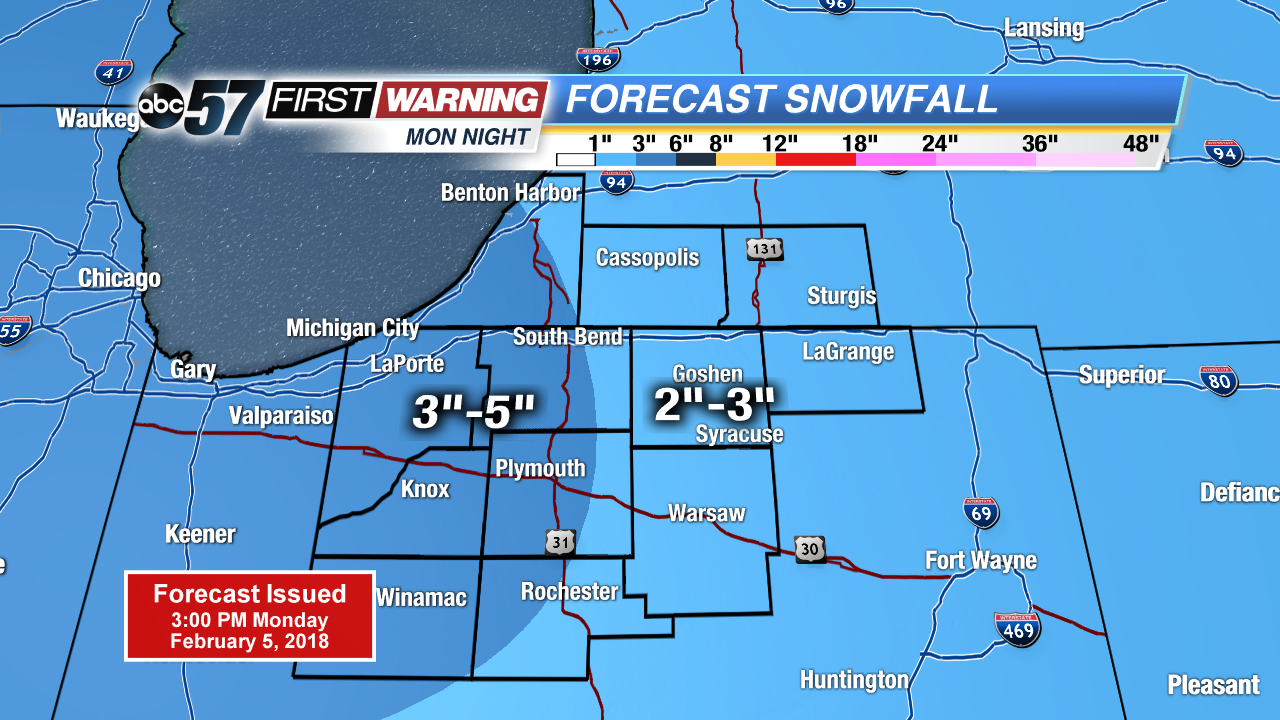
Another round of snow starts Monday evening and lasts through early Tuesday morning. A widespread three inches of snow is likely before the AM drive. A few flurries may last through the morning.
A brief lull in the snow Tuesday, highs will struggle to warm into the low 20s. The next round of snow in the active weather cycle swings through Wednesday morning, likely to bring another three inches to many. There’s another break Thursday before a similar system Thursday night and Friday.
Tonight: Snow showers, low of 12.
Tuesday: Mostly cloudy, high of 20.
Wednesday: Snow showers, high of 22.
Thursday: Partly cloudy, high near 20, chance of snow late.
Sign up for the ABC 57 Newsletter