More hot summer-like temperatures Sunday

-
1:09

Rain showers to end the workweek
-
5:36

Benefit Car Show supporting Berrien County’s first responders...
-
2:51

Governor Whitmer appeals FEMA federal aid denial for Southwest...
-
3:17

Benton Harbor leaders weigh Jean Klock Park upgrades amid debate...
-
1:40

Pollinator Playpath, a trail for kids, now open at Corson Riverwoods...
-
0:32

Ryan Newman racing Saturday at Plymouth Motor Speedway
-
3:08

Officials recover body of missing teenager in Lake Michigan off...
-
2:45

NCAA’s new eligibility rule could reshape Notre Dame roster...
-
1:08

Storms start this afternoon
-
0:56

Calm morning, storms tonight
-
2:43

South Bend residents see future plans for former Drewry’s Brewery
-
2:45

Damage assessment continues in Elkhart County following EF-2...

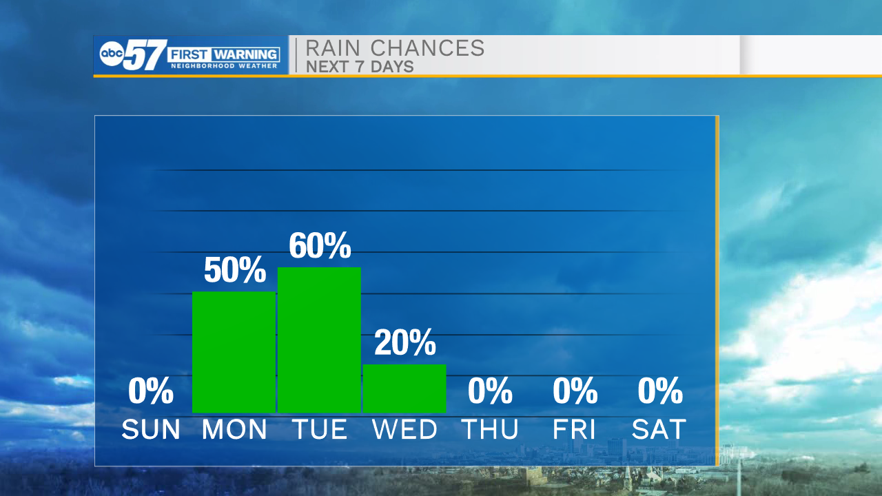
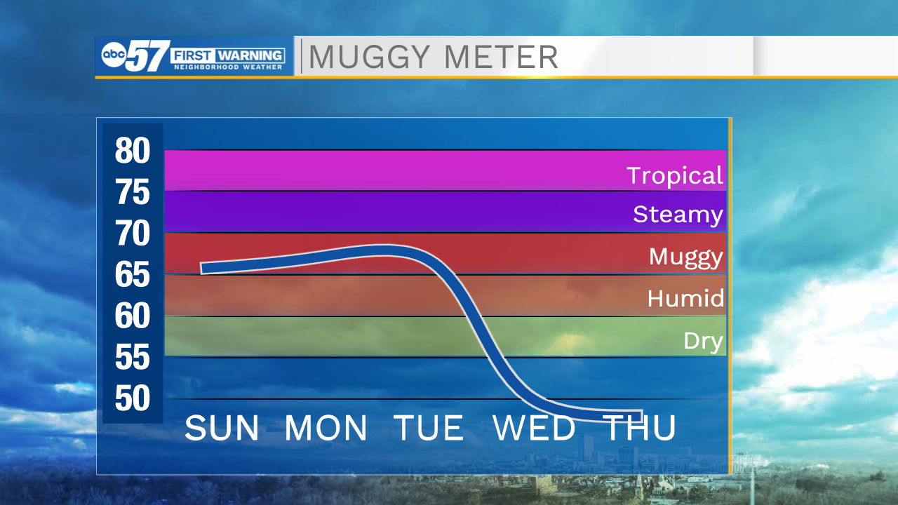
It will be a nice and quiet evening for all of us here in Michiana. Temperatures tomorrow morning will drop into the lower 60s. Tomorrow afternoon will be another hot one with temperatures topping out in the upper 80s. Rain showers will move into Michiana on Monday and stick around into the afternoon and evening. We will catch a small break from the rain but then a line of showers and storms will arrive Tuesday morning. A few of those storms could be on the stronger side. After our next cold front moves through on Tuesday, temperatures will drop into the upper 60s to lower 70s. Beautiful fall weather will stick around through the end of the ten day forecast.
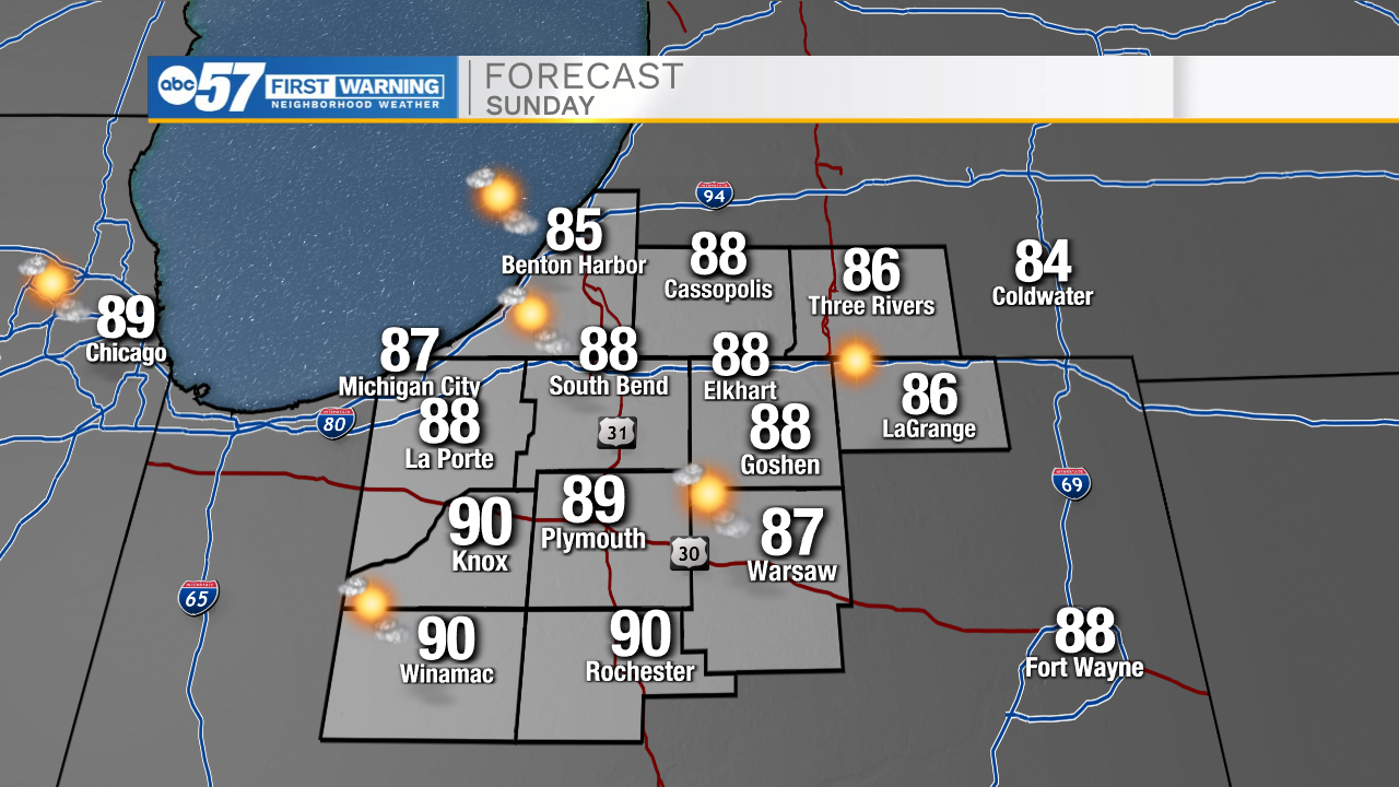
Tonight: Clear. Low 60.
Tomorrow: Mostly sunny. High 80.
Monday: Scattered showers. High 80.
Tuesday: Scattered showers/storms. High 76.