
-
2:03

More storms tonight
-
3:39

RedBud Weekend, America 250 Edition
-
49:01

An ABC57 News special
-
2:06

Strong storms arriving in Michiana soon
-
4:24

The future of Michiana
-
3:45

Understanding America’s founding values and what’s changed...
-
3:19

Southwest Michigan fruit farming as American as it gets
-
5:48

Immigrant groups find their ’American dream,’ a seat at...
-
6:07

’We’re still here,’ The lasting Native American legacy
-
5:35

Symbol of the Golden Dome
-
6:01

From cars and RVs to washing machines, a look at Michiana’s...
-
7:29

Tracing 250 years of service and sacrifice in Michiana

Snow squalls continue Tuesday night, ending by mid-morning Wednesday. A band of heavy lake effect snow cut across St. Joseph, Berrien and La Porte Counties, roads may be covered in the morning.
Snow ends Wednesday morning and skies clear for the afternoon. The pattern ahead has more sunshine but temperatures struggle to warm. Highs stay in the lower 40s to end the week, the weekend still looks fair, with highs in the mid to upper 40s. Next week high temperatures stay below normal.
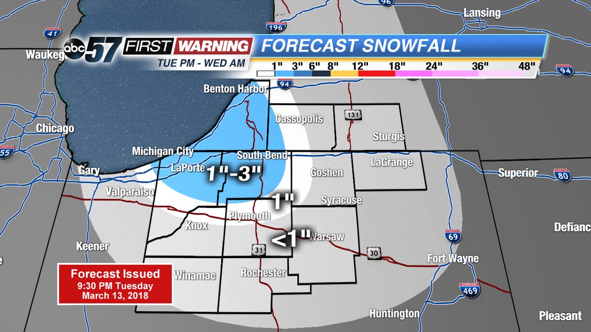
Tonight: Lake effect snow showers, low of 22.
Wednesday: Morning snow showers, then clearing, highs near 40.
Thursday: Partly cloudy, high of 40.
Friday: Sunny, highs near 40.
Sign up for the ABC 57 Newsletter