More sunshine and cooler temperatures to round out the weekend


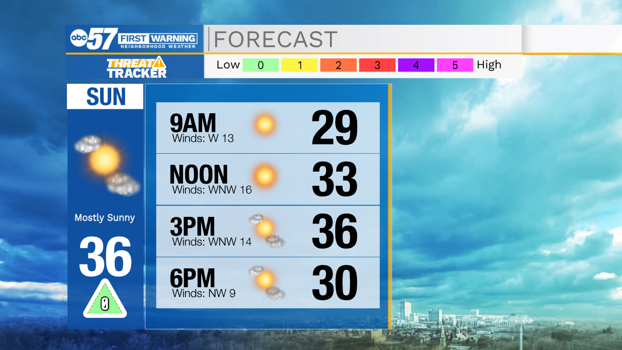
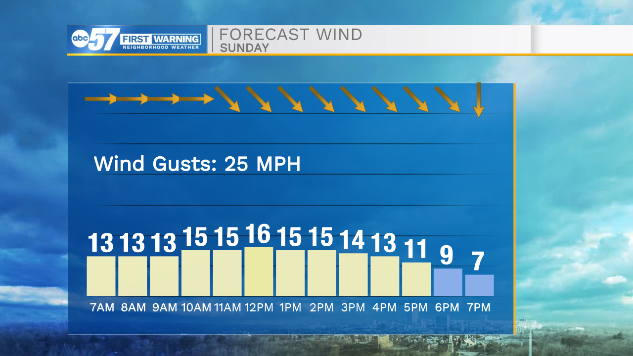
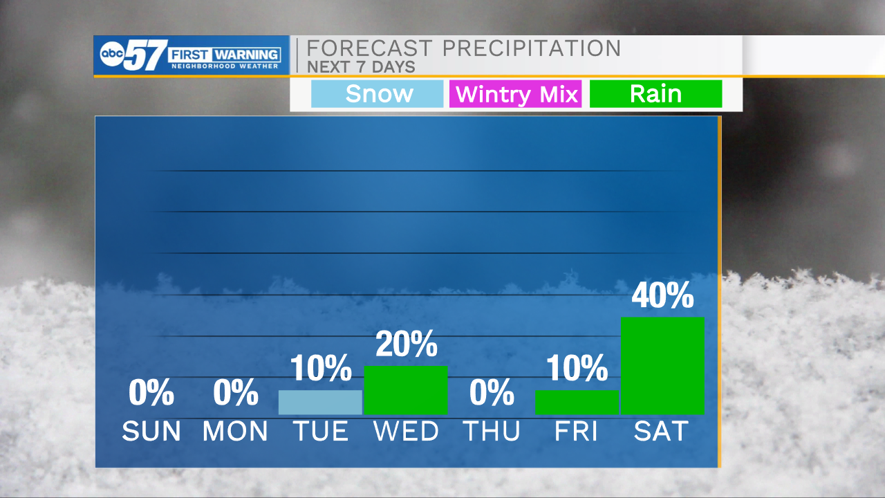
The nice and quiet weather will stick around through the evening and overnight. If you are heading out tonight, definitely grab the heavier coat because temperatures will drop back into the 20s. Tomorrow morning lows will fall into the mid 20s. We are tracking more sunshine for your Sunday, so if you didn’t get a chance to get outside to enjoy it today, there will be plenty of time tomorrow. We will stay on a warming trend heading into the work week. Highs on Monday will be in the lower 40s, Wednesday the mid 40s, and next weekend potentially the lower 50s. Next weekend will also be our next best chance for more impactful weather. Scattered rain showers look to move in on Saturday, and clear out into next Sunday.
Tonight: Mostly clear. Low 26.
Tomorrow: Mostly sunny. High 36.
Monday: Mostly sunny. High 40.
Tuesday: Mostly sunny. High 42.