Morning flurries and cold today but we warm this week
By: Emily Kennedy
Posted: Nov 17, 2020 2:30 AM EDT

-
2:28

Kicking off day two of the Gus Macker Basketball Tournament
-
0:50

Beautiful weekend starts this morning
-
2:32

Gus Macker Three-on-Three Basketball Tournament is taking over...
-
1:44

Feeling like a sauna next week
-
3:12

How to keep yourself and others protected during firework season
-
0:49

Showers creeping into Michiana
-
1:32

Judge approves $25 million water lawsuit settlement in Benton...
-
1:00

Scattered showers through the day
-
1:53

Hispanic Community Child Safety Meeting: A Call To Action
-
2:51

Obama Presidential Center features work of South Bend company
-
1:54

This week’s ABC57 Cub Reporter is Isaac Knefely
-
1:16

Real summer heat returns next week

ABC57 First Warning Neighborhood Weather Forecast
Tuesday, November 17th, 2020
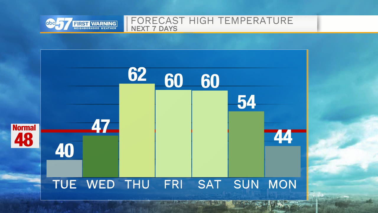
Lake effect mix/snow showers are falling for NW Michiana this morning. The winds out of the NW keep Tuesday chilly, only warming to 40 degrees. It starts to warm back up for Wednesday with plenty of sunshine. Thursday is even nicer as we top out in the low 60s!
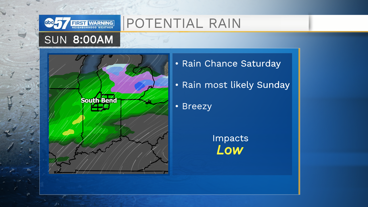
Daytime highs remain near 60 degrees through Saturday but clouds move in for the weekend. The next chance of rain is mostly likely Sunday but a couple of showers are possible on Saturday.
Today: Morning flurry possible, partly cloudy. High 40.
Tonight: Mostly clear. Low 26.
Wednesday: Mostly sunny. High 47.
Thursday: Mostly sunny. High 62.
Sign up for the ABC 57 Newsletter