
-
1:42

More storms through 8:00 p.m.
-
2:20

Tracking severe weather through the mid-afternoon
-
3:17

Applications open for Fall Citizens Police Academy in South Bend
-
2:23

Elkhart County 4H Fair food vendors celebrate 50th year of business
-
2:16

Young football athletes learn about protecting their bodies,...
-
1:24

Storm track timing could be shifting
-
0:57

Unity Gardens brings music, food, and crafts for Westside BBQ...
-
1:50

Quiet evening, Storms after Midnight
-
0:57

Deer Creek Hunt Club throws a skeet shoot event for Deputy Jon...
-
1:44

Two rounds of storms Monday
-
1:07

Mini heat wave starts out the door
-
2:23

La Porte community rallies for Sammy Strong Benefit, raising...

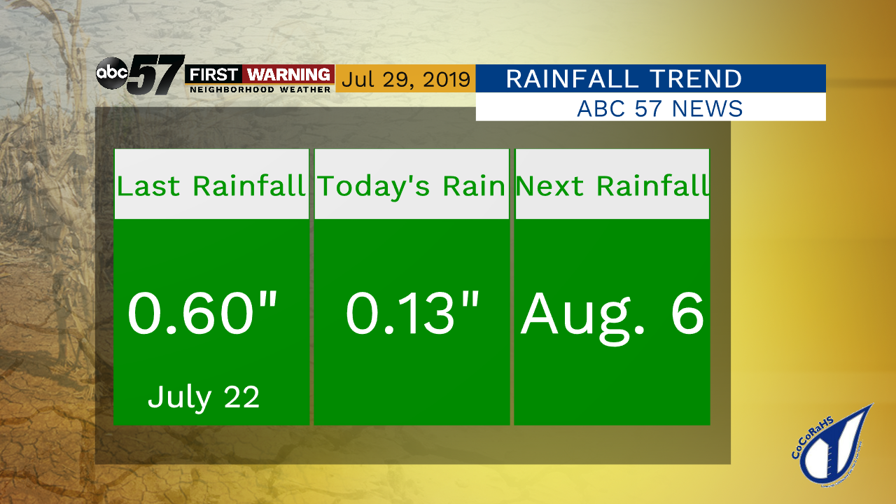
Rain ending this evening, areas of fog will develop early Tuesday morning with low visibility possible.
Another mild and dry stretch of weather is setting up over the next seven days. Temperatures will stay below normal with highs in the upper 70s and low in the 50s through midweek. Temps climb closer to normal into the mid-80s by the weekend. Sweltering heat and humidity stay out of the forecast. While the trend is dry it’s not critical at this time thanks to the milder temps but you might need to water the law and garden.
Tonight: Rain ending, areas of fog, low 64.
Tuesday: Fog fading, mostly sunny, high of 78.
Wednesday: Sunny, high of 76.
Thursday: Sunny, high of 78.
Sign up for the ABC 57 Newsletter