
-
2:28

Kicking off day two of the Gus Macker Basketball Tournament
-
0:50

Beautiful weekend starts this morning
-
2:32

Gus Macker Three-on-Three Basketball Tournament is taking over...
-
1:44

Feeling like a sauna next week
-
3:12

How to keep yourself and others protected during firework season
-
0:49

Showers creeping into Michiana
-
1:32

Judge approves $25 million water lawsuit settlement in Benton...
-
1:00

Scattered showers through the day
-
1:53

Hispanic Community Child Safety Meeting: A Call To Action
-
2:51

Obama Presidential Center features work of South Bend company
-
1:54

This week’s ABC57 Cub Reporter is Isaac Knefely
-
1:16

Real summer heat returns next week

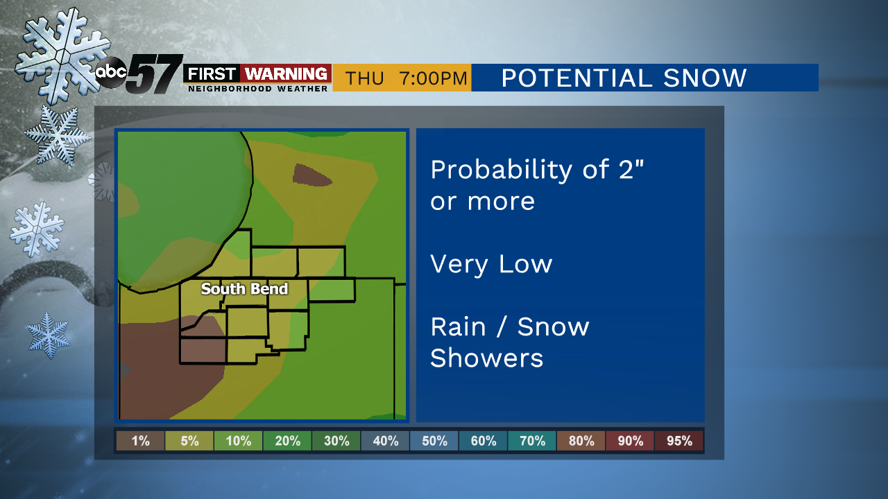
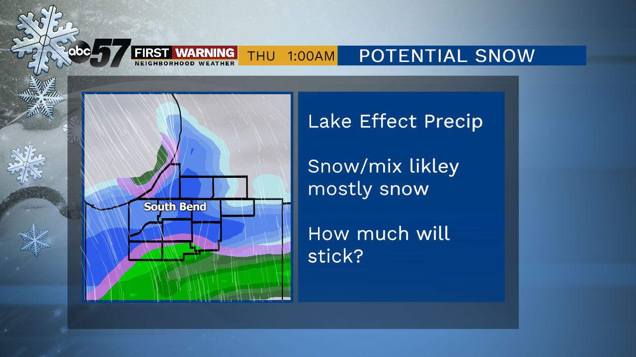
The biggest story through this week will be temperatures getting colder, very cold for early November. Tuesday is fair but chilly and Wednesday highs remain in the 40s before taking a big drop. Thursday the cold arrives, lasting through early next week. There are a few chances for snow, the first being Thursday, when there could be some morning accumulation.
Tonight: Mostly cloudy with fewer clouds late. Low of 33.
Tuesday: Mostly sunny. High of 42.
Wednesday: Mostly cloudy, breezy. High of 48.
Thursday: Rain/snow showers. High of 36.
Friday: Partly cloudy. High of 34.
Sign up for the ABC 57 Newsletter