Nice and bright today before active pattern sets up into the weekend


ABC 57 First Warning Neighborhood Weather
Wednesday, May 13th, 2020
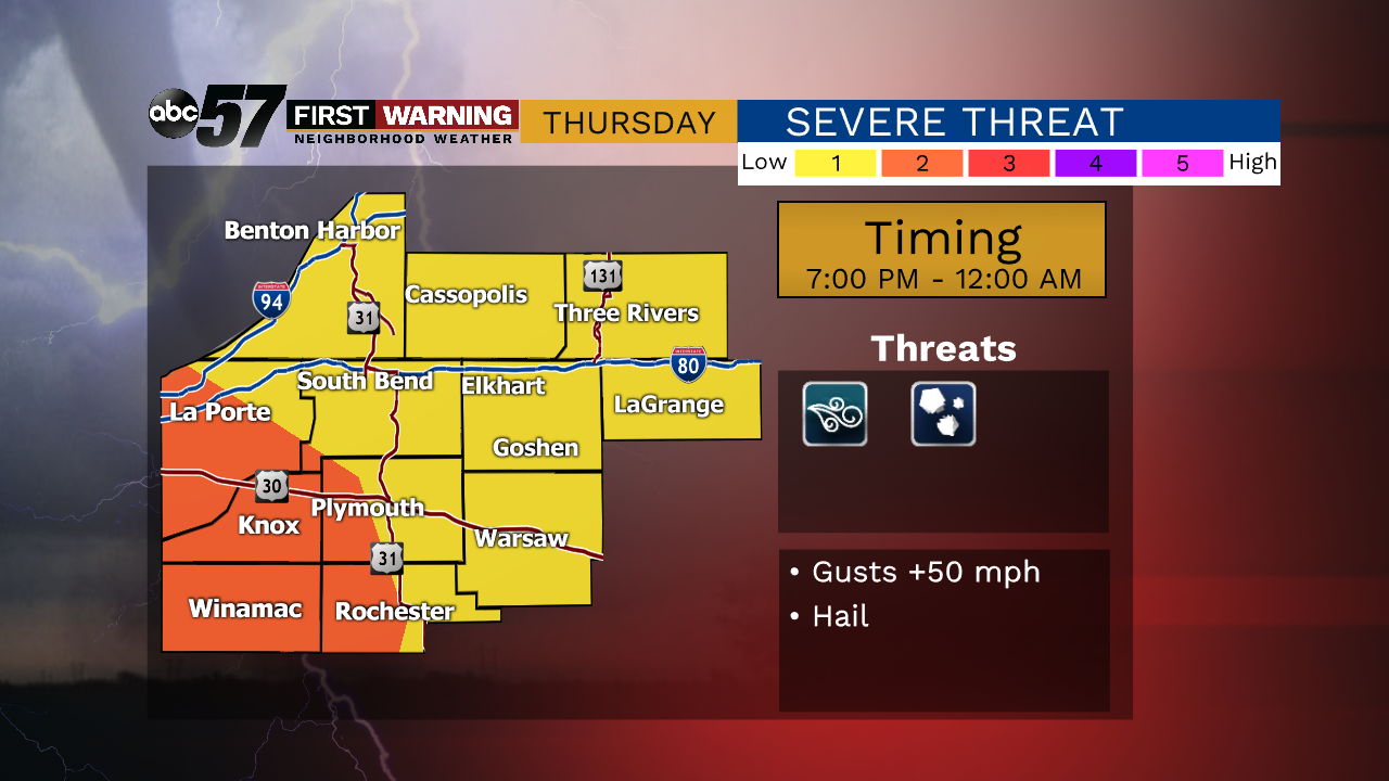
Another sunny day but daytime highs are even warmer, topping out in the mid-60s. A few showers and storms move in tonight, lasting on and off on Thursday. The round of storms Thursday evening could be strong, maybe severe. Strong wind gusts look to be the biggest threat. Showers linger into Friday morning, otherwise clouds break up heading into the evening. The weekend remain active with shower and storm chances but neither Saturday or Sunday look to be a washout. Temperatures continue to climb next week with our first 80 degree day in the forecast!
Today: Mostly to partly sunny. High of 65.
Tonight: Scattered thunderstorms. Low of 52.
Thursday: Scattered thunderstorms. High of 72.
Friday: AM showers then mostly to partly cloudy. High of 70.