NOAA's winter outlook points towards winter with active pattern
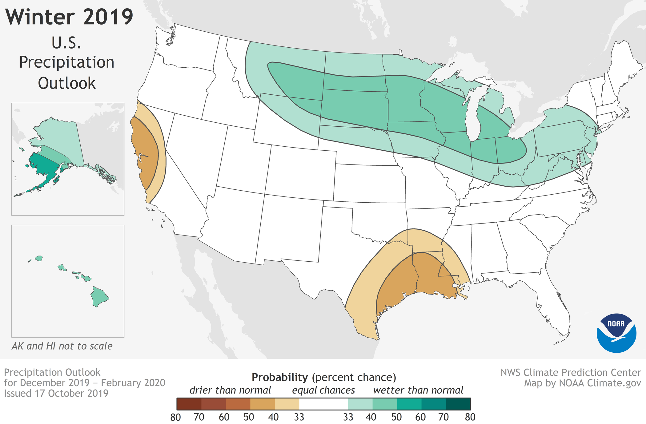 Winter 2019-2020 U.S. Precipitation Outlook from NOAA.
"Wetter-than-average weather is most likely across the Northern Tier of the U.S. during winter, which extends from December through February," according to NOAA.
Of course, "wetter" can refer to rain, snow, a mix of the two, or even sleet. So NOAA's use of "wetter-than-average" does not mean we will just see more rain this winter.
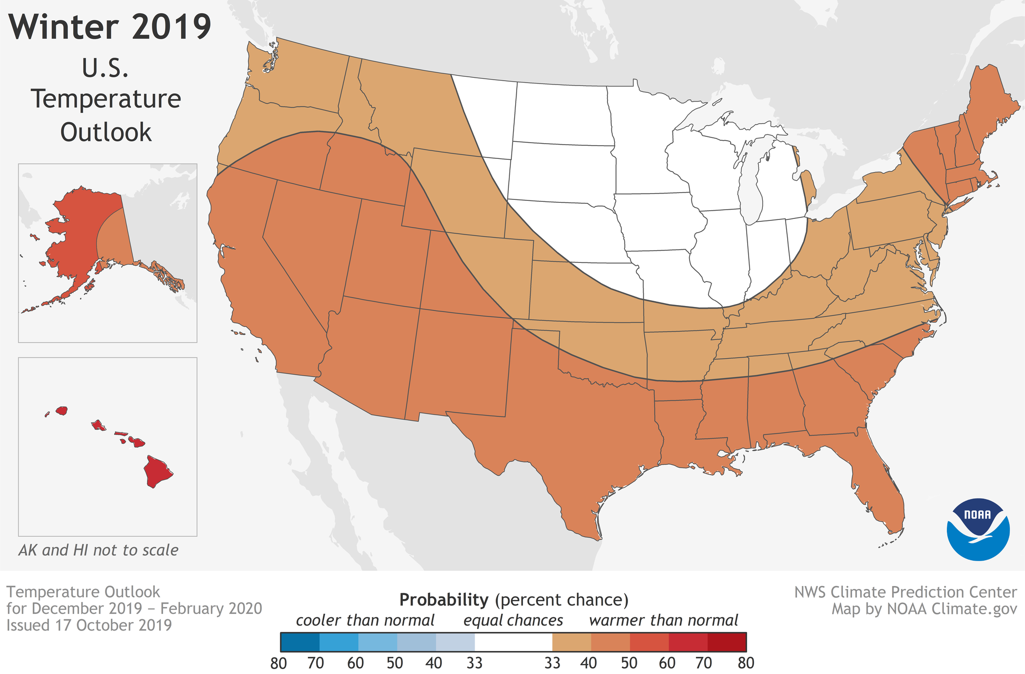 Winter 2019-2020 U.S. Temperature Outlook from NOAA.
There is no blue on the temperature outlook map, which means no parts of the country are "favored" to be decidedly below normal this winter.
However, Michiana is safely in the zone (white area) that favors "equal chances for below-, near- or above-average temperatures."
That suggests that the opportunity for plenty of shots of cold winter air is there for not only Michiana, but the Northern Plains and the western Great Lakes.
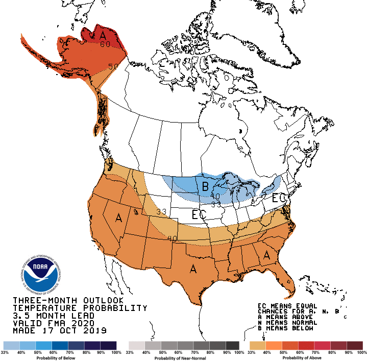 NOAA temperature outlook for February, March and April.
As of now, NOAA is suggesting the potential for a good amount of cold air for the period February-April across the Great Lakes and Upper Midwest.
Michiana is not technically in the blue shade on the map above, but some variables that meteorologists look at support a healthy amount of colder air from late winter to early spring.
The ABC 57 First Warning Neighborhood Weather Team will be working on an official winter outlook for Michiana over the coming weeks, so be sure to be on the lookout for that!
