
-
1:16

No shortage of sunshine today
-
1:37

Memorial Day parade forecast
-
4:51

Local band ’The Erly’ stops by ABC57 ahead of June 3 performance
-
1:17

VERY foggy first few hours of the morning
-
1:57

A local taste brings New Carlisle community together on race...
-
0:45

Pancakes help raise funds to support the Alzheimer’s Association
-
1:03

Lighter rain expected into the afternoon
-
1:04

Non-severe storms expected
-
1:16

Showers start this morning
-
1:59

Mac & Cheese festival turns Four Winds Field into a kitchen
-
0:45

Michiana Spring Clay tour encourages people to try and take a...
-
2:56

Fresh Cuts, Fresh Starts: Re-Entry Program Gives Back in Elkhart

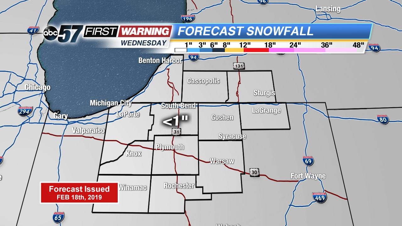
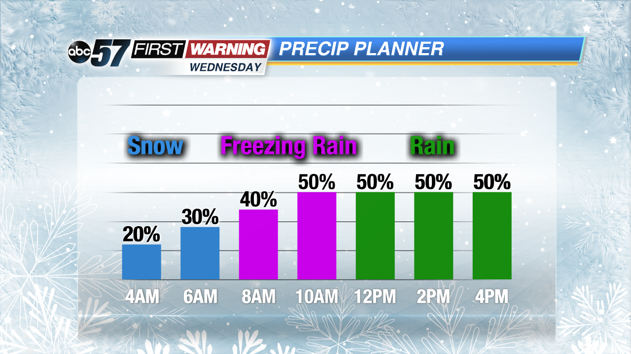
The last full week of February is more fair than messy, most days featuring some sunshine with near to above normal temperatures. The exception is Wednesday, a day that could have a messy morning. Snow, sleet and freezing rain are all possible (in that order). A warm front will wedge its way northward, as temperatures slowly rise, the precipitation type will change. Extreme icing is not a concern but slick roads are possible from early morning through mid-afternoon.
Tonight: Mostly cloudy, low of 14.
Tuesday: Partly cloudy, high of 30.
Wednesday: Snow to sleet to freezing rain to rain, high of 38.
Thursday: Partly cloudy, high of 34.
Sign up for the ABC 57 Newsletter