Powerful fall storm latest: snow in Plains, huge temperature drop in Michiana


Once again a significant winter storm is hitting parts of the northern Rocky Mountains. The pictures above and below are show conditions in Montana as of late Wednesday morning.
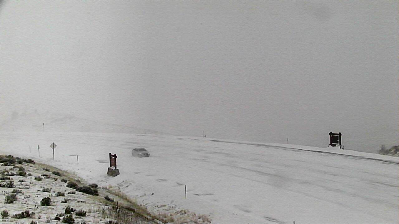 Road conditions in Montana at 11:30 a.m. local time Wednesday.
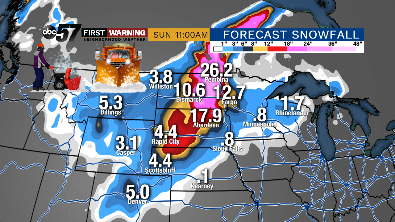 Potential snowfall through Sunday morning.
This has the potential to be record-shattering and historic for those who wind up getting hit the hardest.
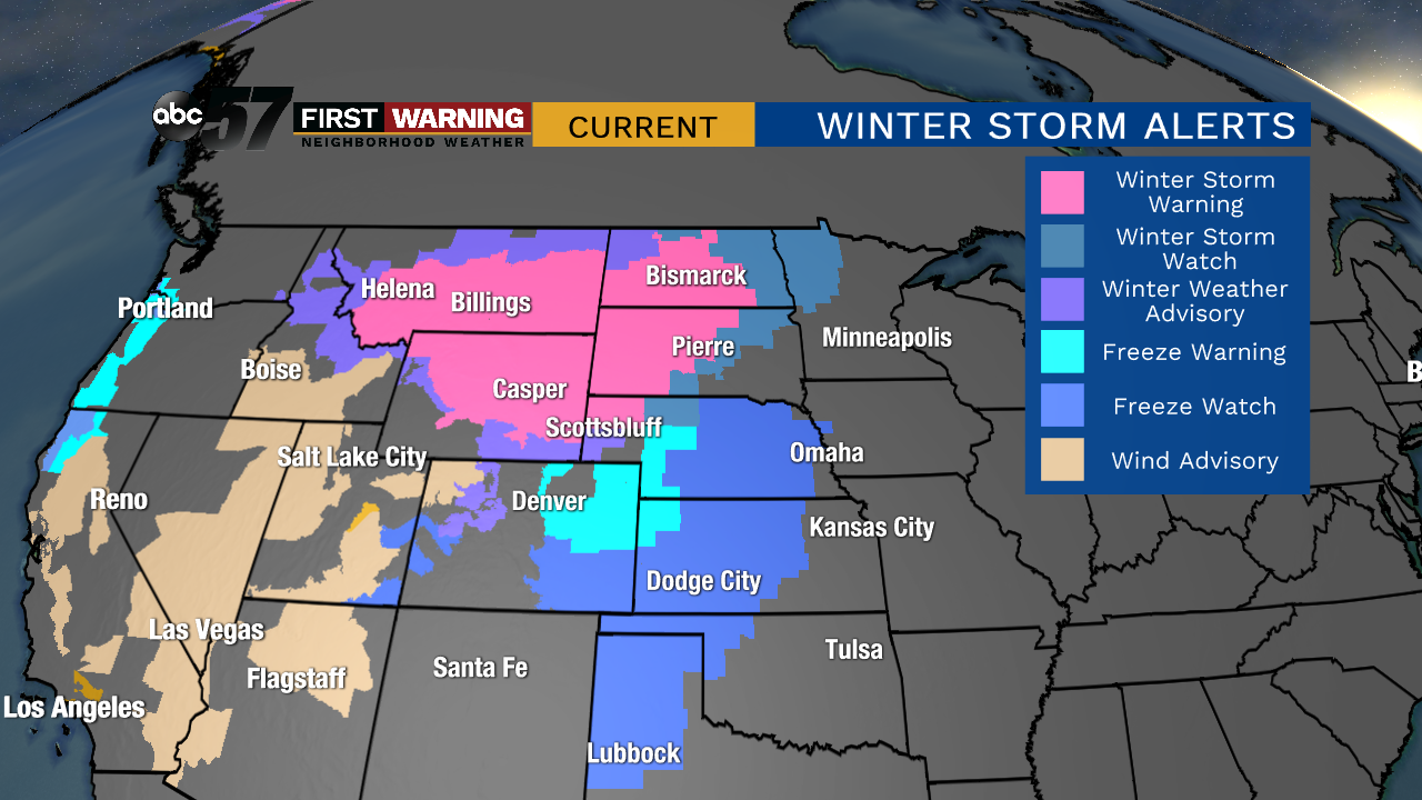 Winter weather alerts as of early Wednesday afternoon.
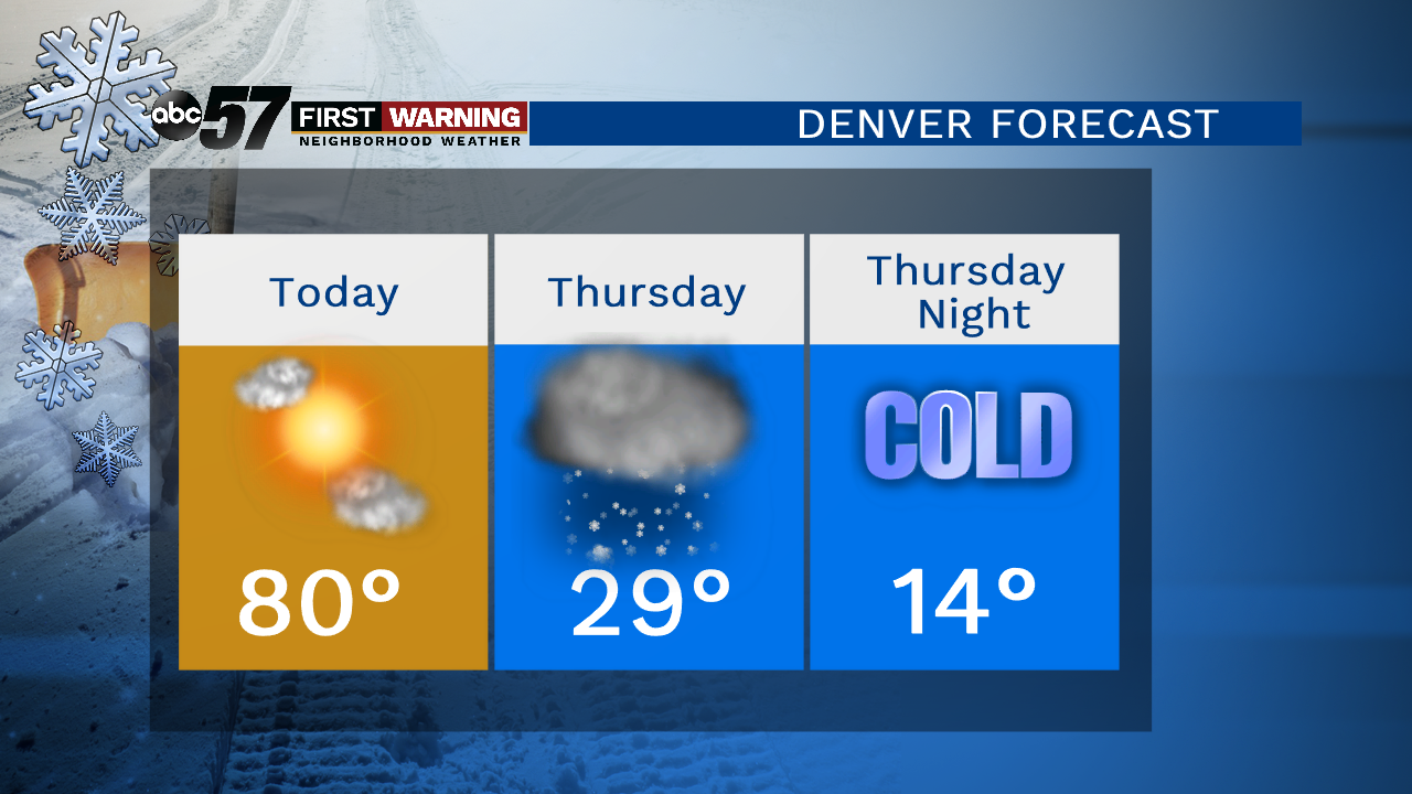 Denver's 36-hour forecast.
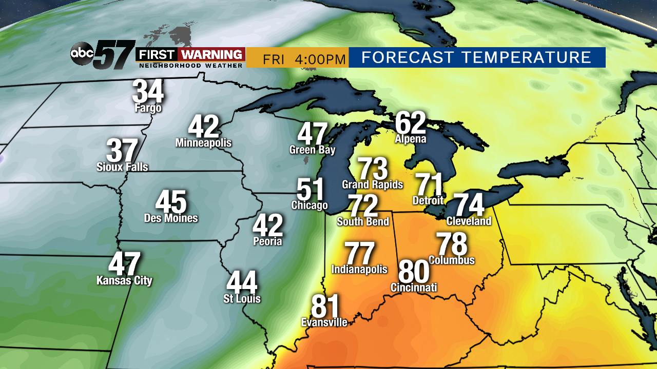
In addition to the heavy snow, that is the major story line with this system: the significant temperature drop set to happen.
 Major temperature drop behind the cold front throughout the day Friday.
It's possible we go from the lower 70s to the 40s in a matter of hours Friday evening. That's how powerful this cold front will be.
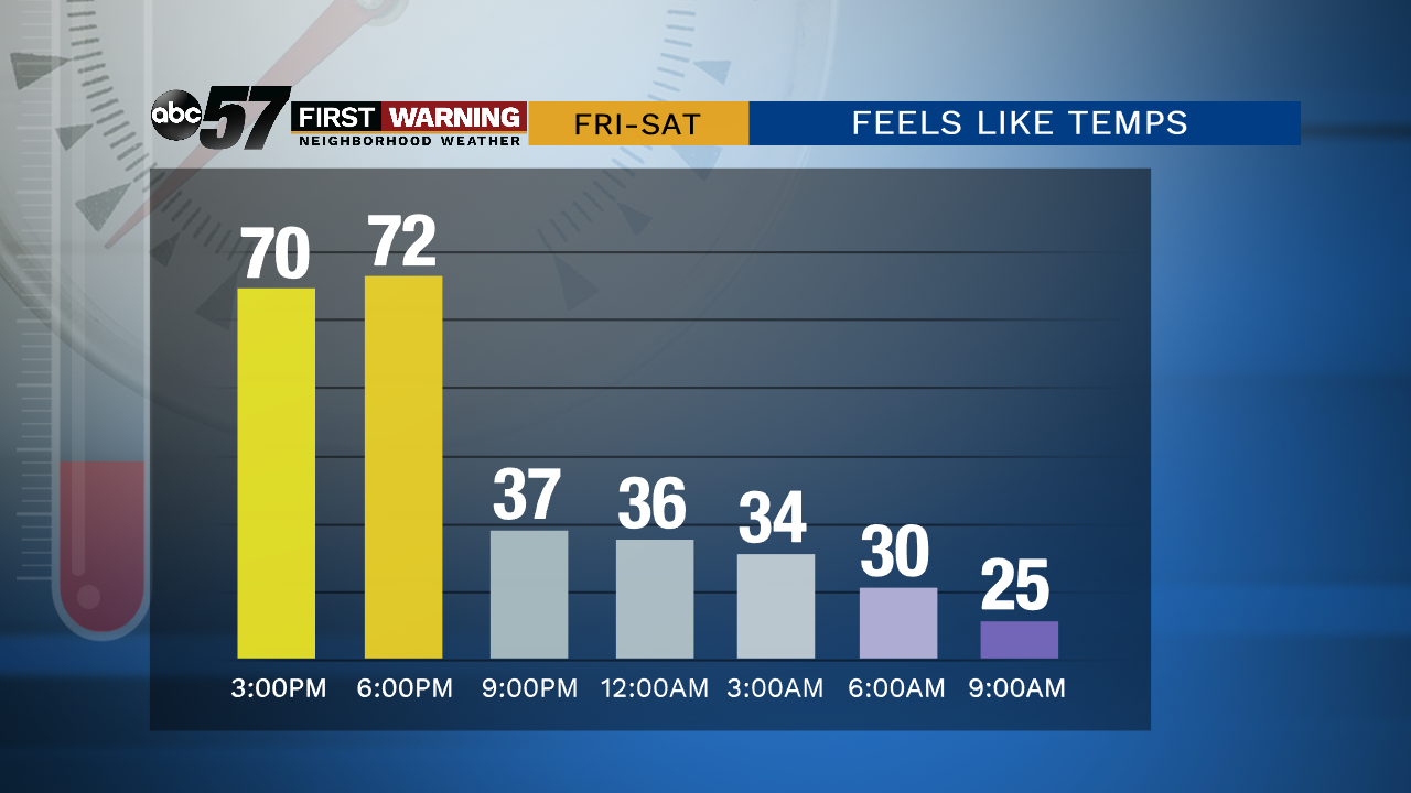 Feels like temperatures in South Bend Friday evening thru Saturday morning.
The exact timing of the cold frontal passage is still slightly uncertain, but in all likelihood, a big-time temperature drop will occur between 5 p.m. and 10 p.m.
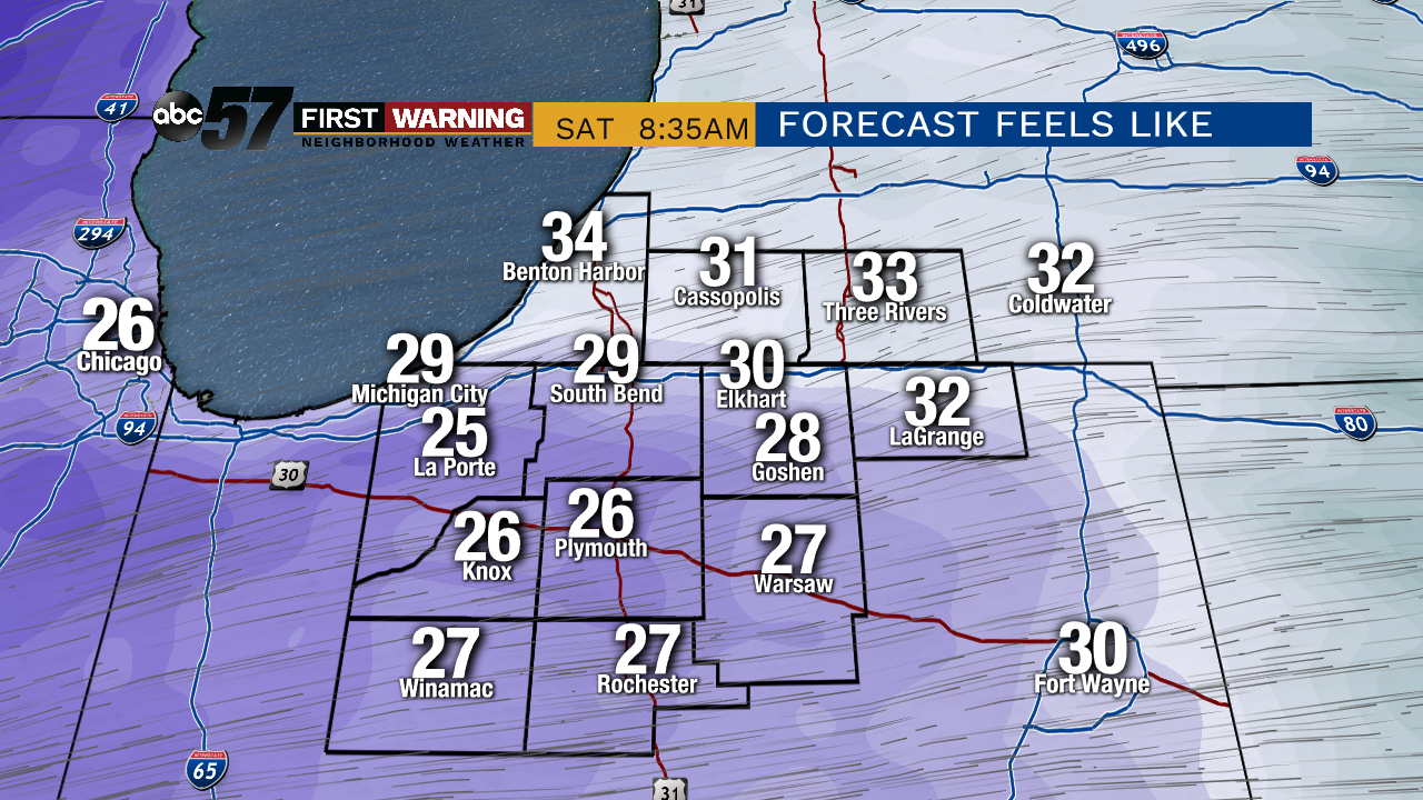 Feels like temperatures Saturday morning.
High temps will stay in the 50s and lows in the 30s and 40s for the foreseeable future. Joy!