


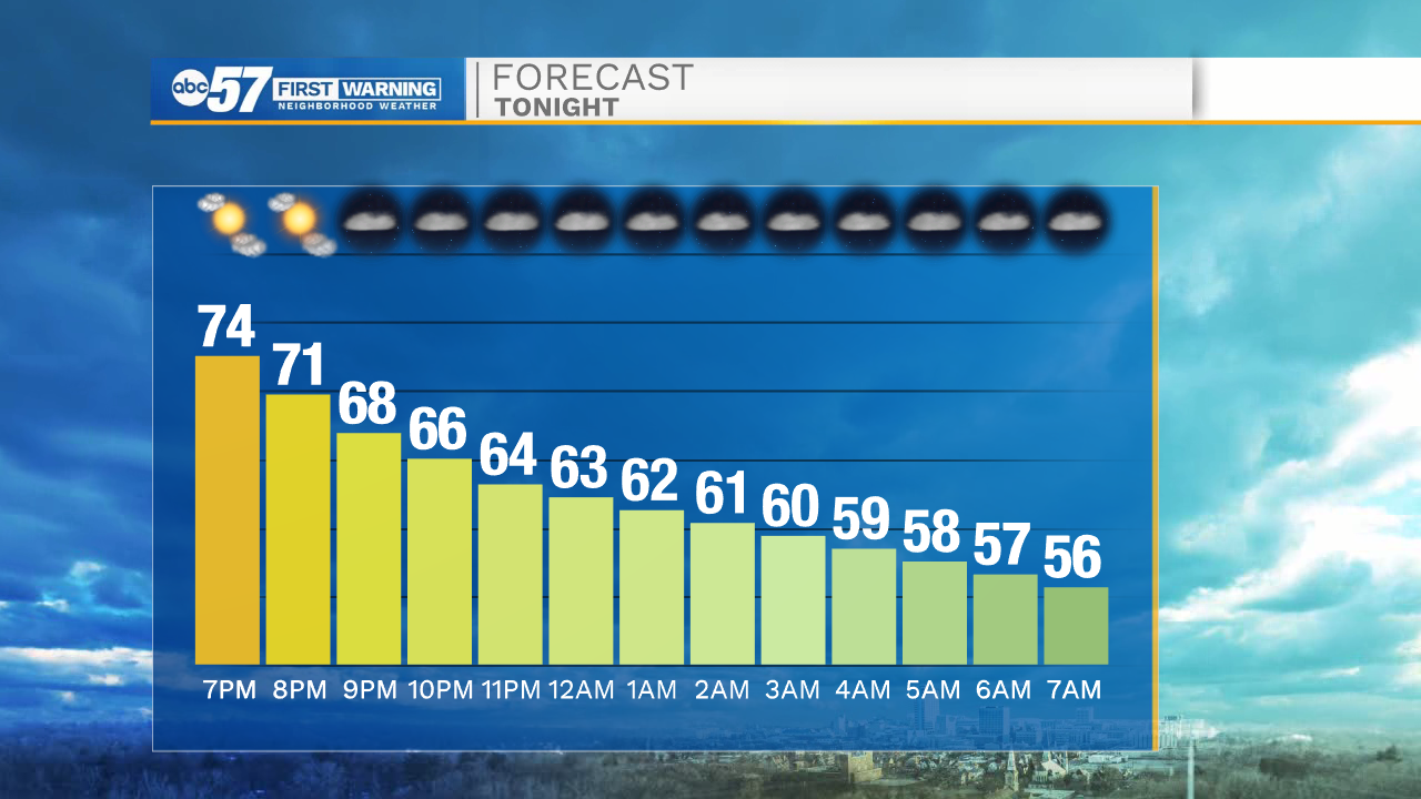
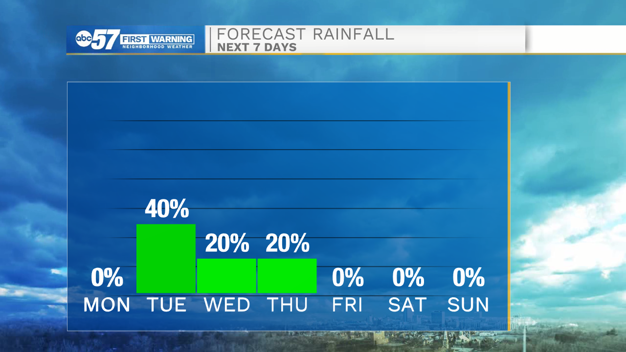
This evening temperatures will begin to drop into the upper 60s by 8pm. It will be another cool overnight, so you can open the windows and give the air conditioner a break. Tomorrow morning lows will be in the mid 50s. Mostly sunny skies and temperatures in the lower 80s are expected tomorrow afternoon. Tuesday will be our next best chance for scattered showers and a few thunderstorms here in Michiana. A few of those storms could be on the strong to low end severe side with primary threats of quarter sized hail and 60mph wind gusts. Low isolated rain chances will stick around through early Thursday morning.
A late week cool down will arrive Friday, bringing more temperatures in the mid 70s. Sunshine is set to return Friday afternoon and last through the weekend. High temperatures next weekend will be in the mid to upper 70s. There is a very low rain chance for Saturday night, but most should expect to remain dry. Better rain chances look to arrive early the following week.
Tonight: Mostly clear. Low 56.
Tomorrow: Mostly sunny. High 82.
Tuesday: Scattered showers and storms. High 80.
Wednesday: Isolated showers. High 82.