
-
1:56

Lake Michigan Hills celebrates its 66th annual Chamber Golf Outing
-
1:56

Fun and 4H at the LaGrange County Fair
-
1:44

La Porte County workers take precautions during this week’s...
-
2:23

Mark Quatrani’s standout season at Notre Dame ends with selection...
-
2:50

Jack Radel becomes Notre Dame’s highest MLB draft pick in more...
-
2:38

Explosive diarrhea cases on the rise in Michigan
-
3:44

Investigation into Friday’s State Trooper shooting under investigation,...
-
3:30

Law enforcement officers react to rash of NW Indiana officers...
-
2:51

South Bend neighbors react to talks of regulations on short-term...
-
7:52

Nappanee police K9 assists in arrest of attempted murder suspect
-
0:56

Heat wave starts today
-
1:59

Kosciusko County Fair opens 109th year with parade, new alcohol...

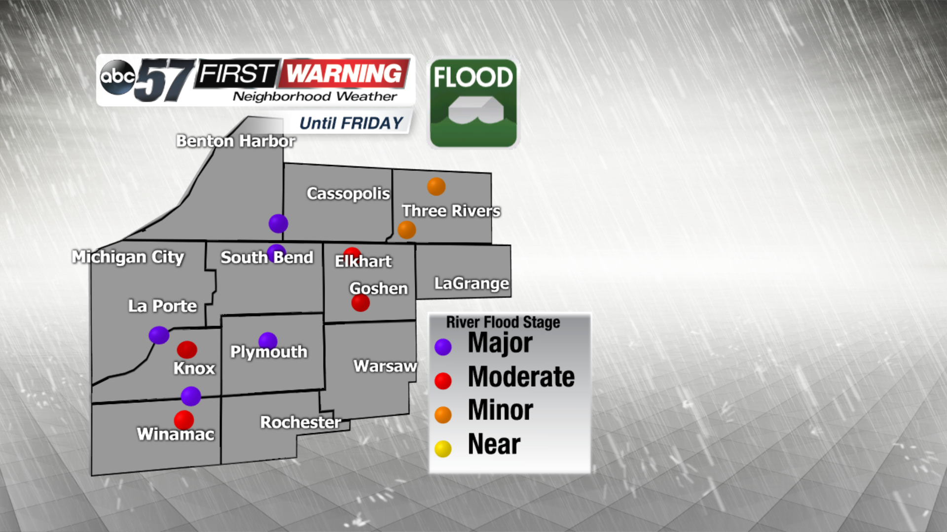
Heavy rain continues to fall Tuesday night, an additional one to three inches will keep flood waters rising. Many roads are flooded and conditions will only get worse. Use extreme caution and do not cross flooded roads or barricades.
Wednesday, the rain comes to an end but the flood waters will continue to rise. Many rivers are forecast to reach record crests Thursday and Friday, 10 feet above flood stage. Flood waters are expected to recede starting Saturday.
Temperatures will be much colder Wednesday, a wintry mix in the morning and falling temperatures could turn some roads slick or icy. There is more rain the forecast by Friday morning.
Tonight: Rainy, heavy at times, lows in the mid-30s.
Wednesday: AM wintry mix, temperatures fall from the mid-30s.
Thursday: Partly to mostly cloudy, highs in the low 40s.
Friday: Morning rain showers, highs in the mid-40s.