
-
1:09

Rain showers to end the workweek
-
5:36

Benefit Car Show supporting Berrien County’s first responders...
-
2:51

Governor Whitmer appeals FEMA federal aid denial for Southwest...
-
3:17

Benton Harbor leaders weigh Jean Klock Park upgrades amid debate...
-
1:40

Pollinator Playpath, a trail for kids, now open at Corson Riverwoods...
-
0:32

Ryan Newman racing Saturday at Plymouth Motor Speedway
-
3:08

Officials recover body of missing teenager in Lake Michigan off...
-
2:45

NCAA’s new eligibility rule could reshape Notre Dame roster...
-
1:08

Storms start this afternoon
-
0:56

Calm morning, storms tonight
-
2:43

South Bend residents see future plans for former Drewry’s Brewery
-
2:45

Damage assessment continues in Elkhart County following EF-2...

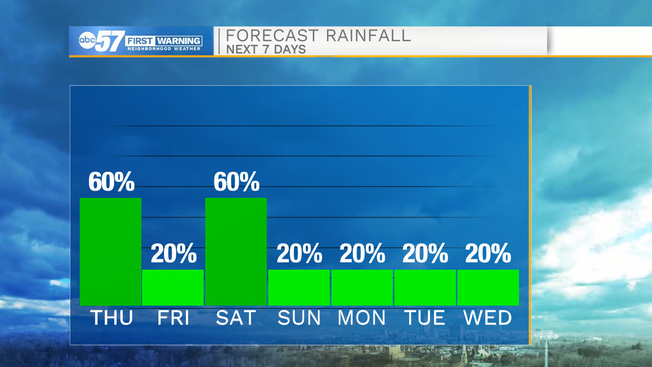
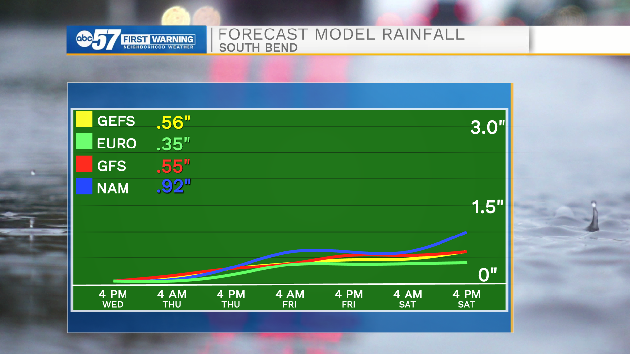
Feeling a little muggy for April, Thursday brings our best chance of rain, scattered showers and thunderstorms, upwards of a quarter inch of rain, higher totals under downpours. The pattern stays active, but showers wane into Friday, Saturday has a greater rain potential, more than a half inch, but there's still some doubt on the exact track of the system. Temperatures cool into the 60s, still seasonably mild, but we may see the return of frosty low temperatures by the end of next week.
Tonight: Mostly cloudy, chance of isolated shower/ storm. Low 62.
Thursday: T-Showers. High 70.
Friday: AM rain chance then mostly cloudy. High 66.
Saturday: Showers: High 68
Sign up for the ABC 57 Newsletter