


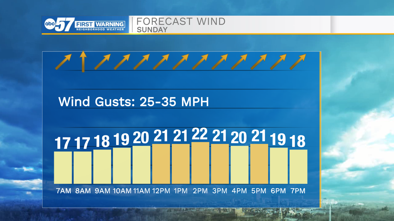
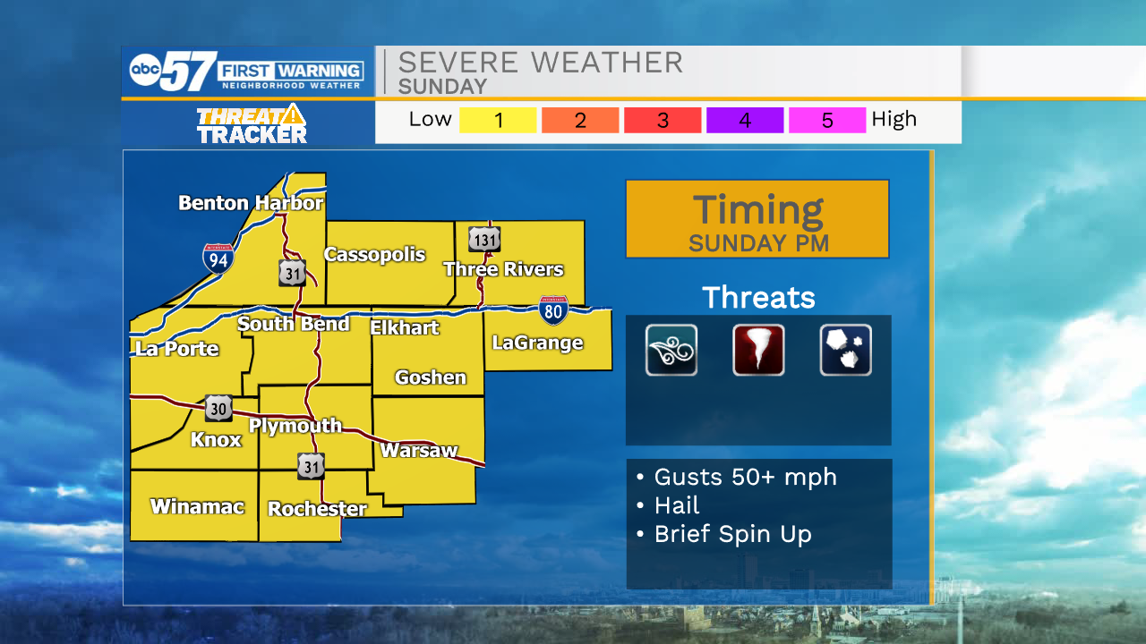
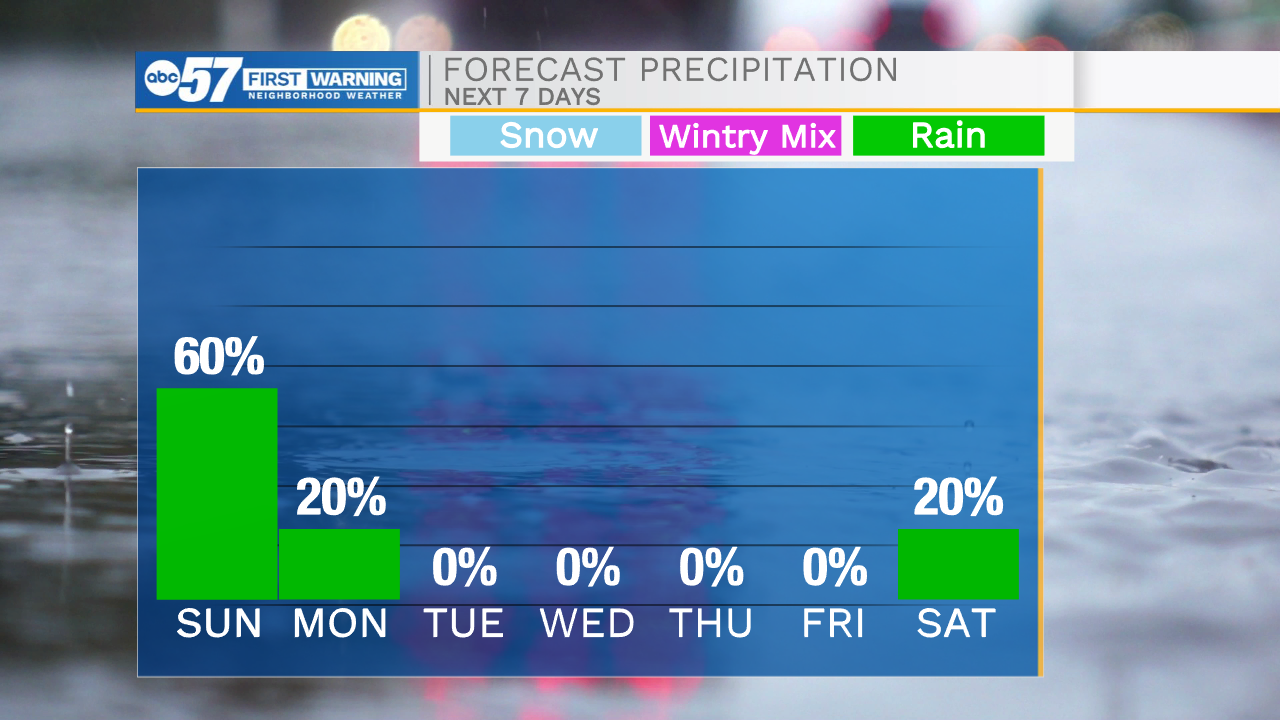
The dry and quiet weather will stick around through the overnight hours. Temperatures tomorrow morning will only drop into the mid 60s. Rain chances return to the forecast for far western Michiana by late morning, then central Michiana by early afternoon. As storms progress eastward, a few could turn strong to severe. The biggest threat looks to be gusty winds, but a brief spin up or two can’t be ruled out. Highs tomorrow afternoon will top out in the mid 70s. Rain showers will linger into Monday morning and finally clear around lunchtime. Temperatures will continue to drop heading into the middle part of the week. Highs Tuesday and Wednesday will be in the upper 40s. The 60s return to the forecast by Friday and look to stick around into next weekend. I am keeping rain chances out of the forecast for later in the week, but may need to be added heading into next weekend.
Tonight: Mostly cloudy. Low 64.
Tomorrow: Thunderstorms/rain. High 75.
Monday: AM showers. High 58.
Tuesday: Partly cloudy. High 48.