
-
2:28

Kicking off day two of the Gus Macker Basketball Tournament
-
0:50

Beautiful weekend starts this morning
-
2:32

Gus Macker Three-on-Three Basketball Tournament is taking over...
-
1:44

Feeling like a sauna next week
-
3:12

How to keep yourself and others protected during firework season
-
0:49

Showers creeping into Michiana
-
1:32

Judge approves $25 million water lawsuit settlement in Benton...
-
1:00

Scattered showers through the day
-
1:53

Hispanic Community Child Safety Meeting: A Call To Action
-
2:51

Obama Presidential Center features work of South Bend company
-
1:54

This week’s ABC57 Cub Reporter is Isaac Knefely
-
1:16

Real summer heat returns next week

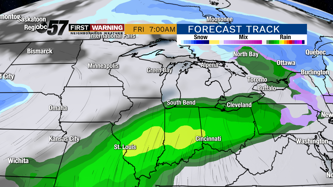
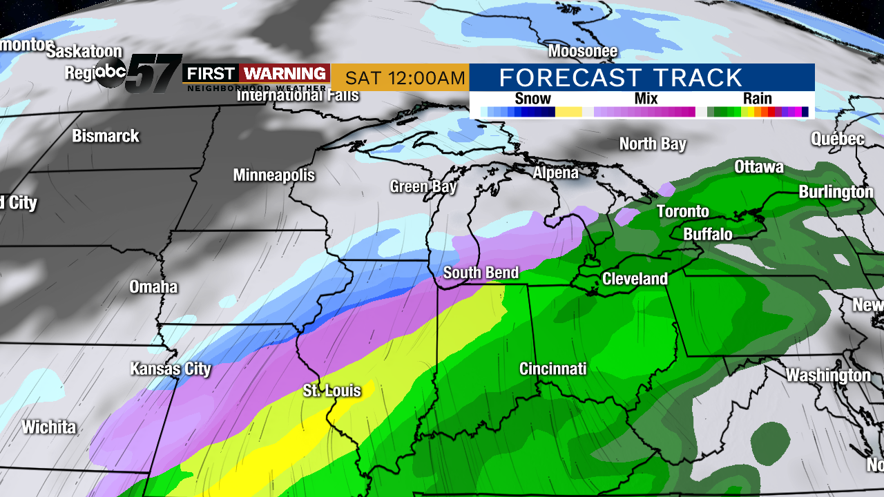
Winter remains on hold for the rest of this week. Tuesday won’t be as sunny and there’s a chance of drizzle/flurries but temperatures remain too mild for any accumulation. Wednesday will be the coldest day this week before temperatures spike near 50 to end the week. Rain is likely Thursday-Friday, changing to a sloppy rain/snow Saturday as temperatures fall.
Tonight: Partly cloudy. Low of 28.
Tuesday: Mostly cloudy, slight chance of snow/mix. High of 38.
Wednesday: Partly cloudy. High of 28.
Thursday: Mostly cloudy, PM rain. High of 46.
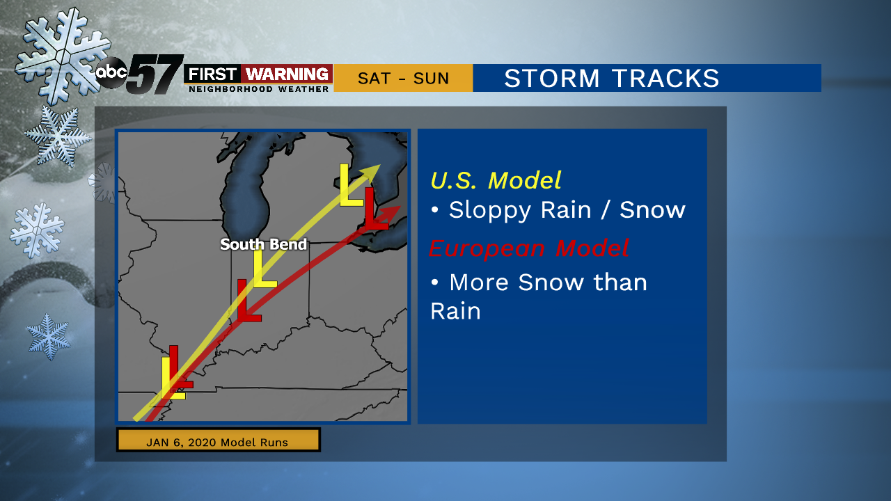
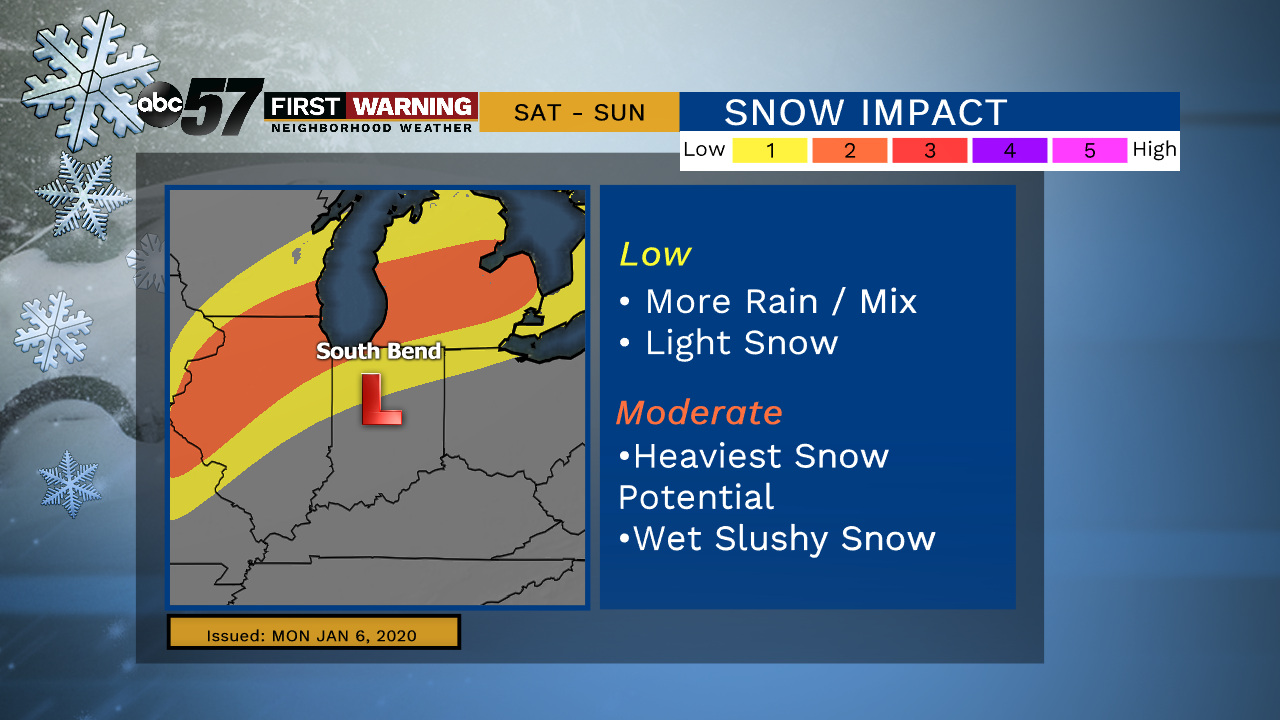
The track of the system on Saturday along with how quickly temperatures cool will be the forecast focus. This will determine how sloppy or snowy the impact will be.
Sign up for the ABC 57 Newsletter