
-
1:44

Feeling like a sauna next week
-
3:12

How to keep yourself and others protected during firework season
-
0:49

Showers creeping into Michiana
-
1:32

Judge approves $25 million water lawsuit settlement in Benton...
-
1:00

Scattered showers through the day
-
1:53

Hispanic Community Child Safety Meeting: A Call To Action
-
2:51

Obama Presidential Center features work of South Bend company
-
1:54

This week’s ABC57 Cub Reporter is Isaac Knefely
-
1:16

Real summer heat returns next week
-
2:28

South Bend storm drain mural project complete
-
5:17

Three local students return as national powerlifting champions
-
1:09

Rain showers to end the work week

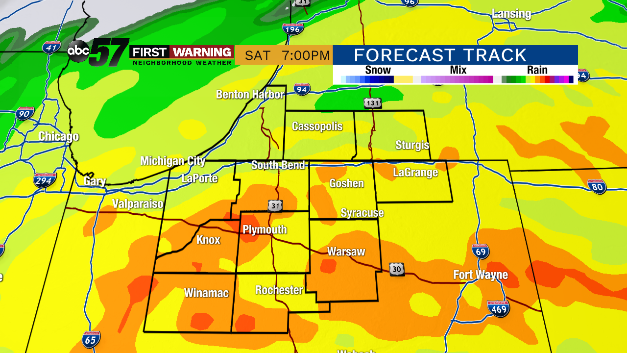
Saturday will be a wet day, rain starts in the early afternoon and lasts through much of the evening. The heaviest rain will be between 3:00 p.m. and 9:00 p.m. Rain and clouds gradually clear into Sunday. The weather is mild to end the weekend, then temperatures fall through midweek. Precipitation is possible the middle of next week but timing and temperature are key factors as to whether it’s rain or snow and a lot can still change.
Today: Mostly cloudy turning partly cloudy. High of 50.
Tonight: Increasing clouds. Low of 34.
Saturday: Rainy by the afternoon, occasional downpours. High of 54.
Sunday: Mostly to partly cloudy. High of 58.
Monday: Partly cloudy. High of 54.
Sign up for the ABC 57 Newsletter