


As of Monday morning, Barry is now a tropical depression with max. wind around 30 mph and will likely become just a remnant low or post-tropical cyclone this afternoon. So this storm is basically done with the strong winds.
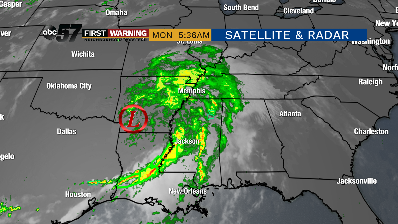
The rain and moisture associated with the system is still present on radar this morning. Flash flood warnings continue in Louisiana early on, even after seeing feet of rain in most of the state. Rainfall totals across the southern Gulf Coast have topped 5 inches for many in Louisiana and even 10 inches in isolated spots.
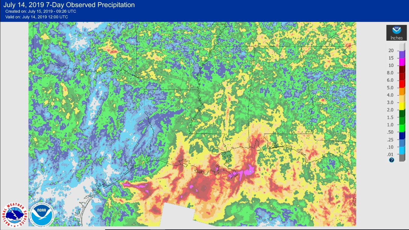 From the National Weather Service. Luckily, the highest rainfall totals over the last 7 days have been over the Gulf.
Those rain bands will likely fade away as the low continues moving north and east. And it's likely that Michiana will see at least some the leftover rain bands over the next couple of days. Heavy rain could be possible at times during this stretch and rainfall totals could top the 1 inch mark, mainly for the southern and eastern portions of Michiana.
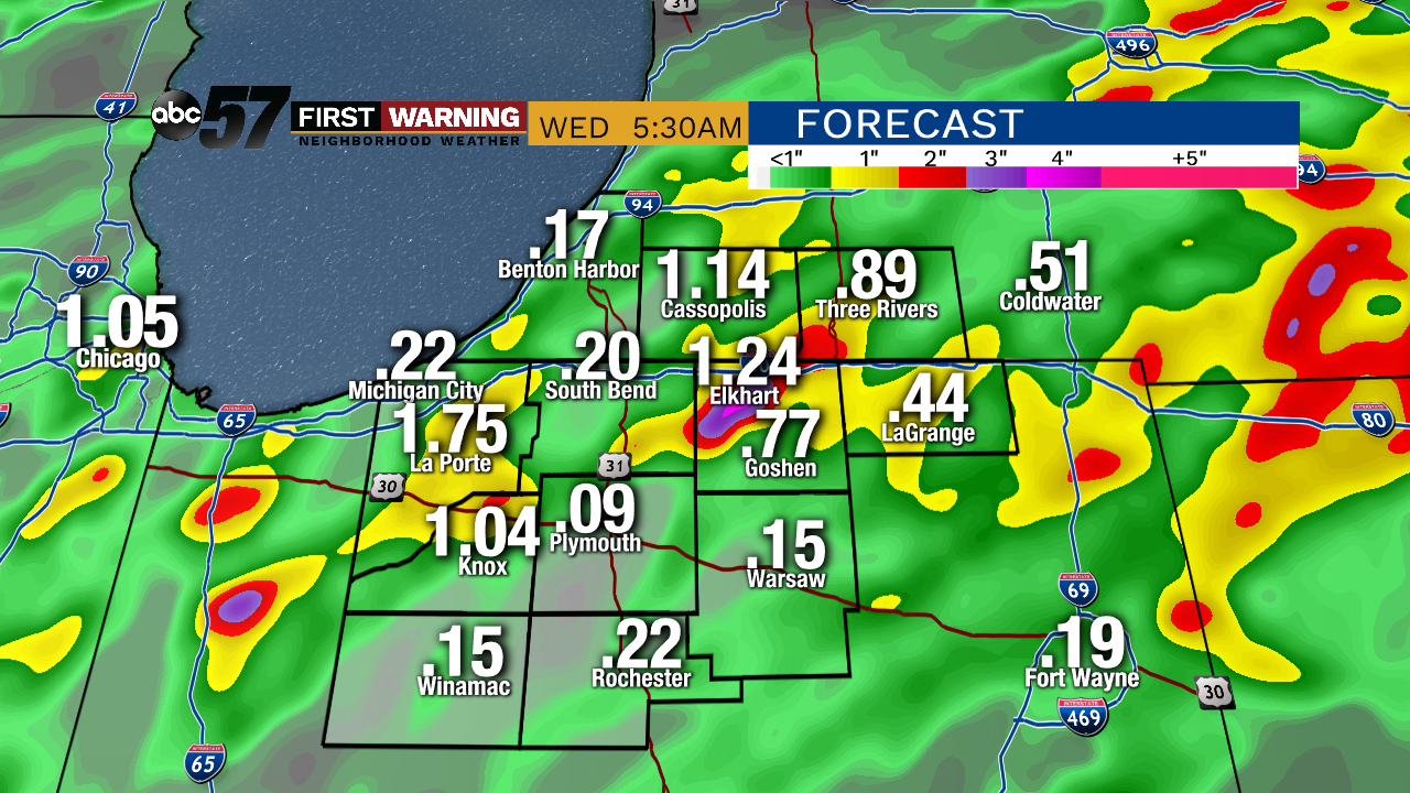 Most will NOT see much impact from the tropical leftovers of Barry. A couple isolated pockets of 2 inches of rain or more are possible.
Flooding is not a big concern luckily, but ponding on the roads and some field flooding in rural areas could be possible. Whatever standing water is left will likely evaporate quickly as more summer heat rolls into the area to wrap up the work week. Highs in the mid 90s are likely with "feel like" values between 105 and 110 degrees in the afternoon hours.