


Getting out the door this Monday morning should be pretty easy going. Later today, a round of rain (possibly mixed with snowflakes) moves in this afternoon. Temperatures climb near 40 degrees. It’ll be breezy today.
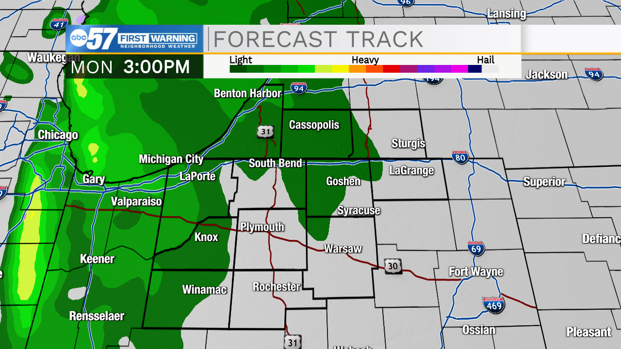 Rain moves in after 3 p.m. Monday
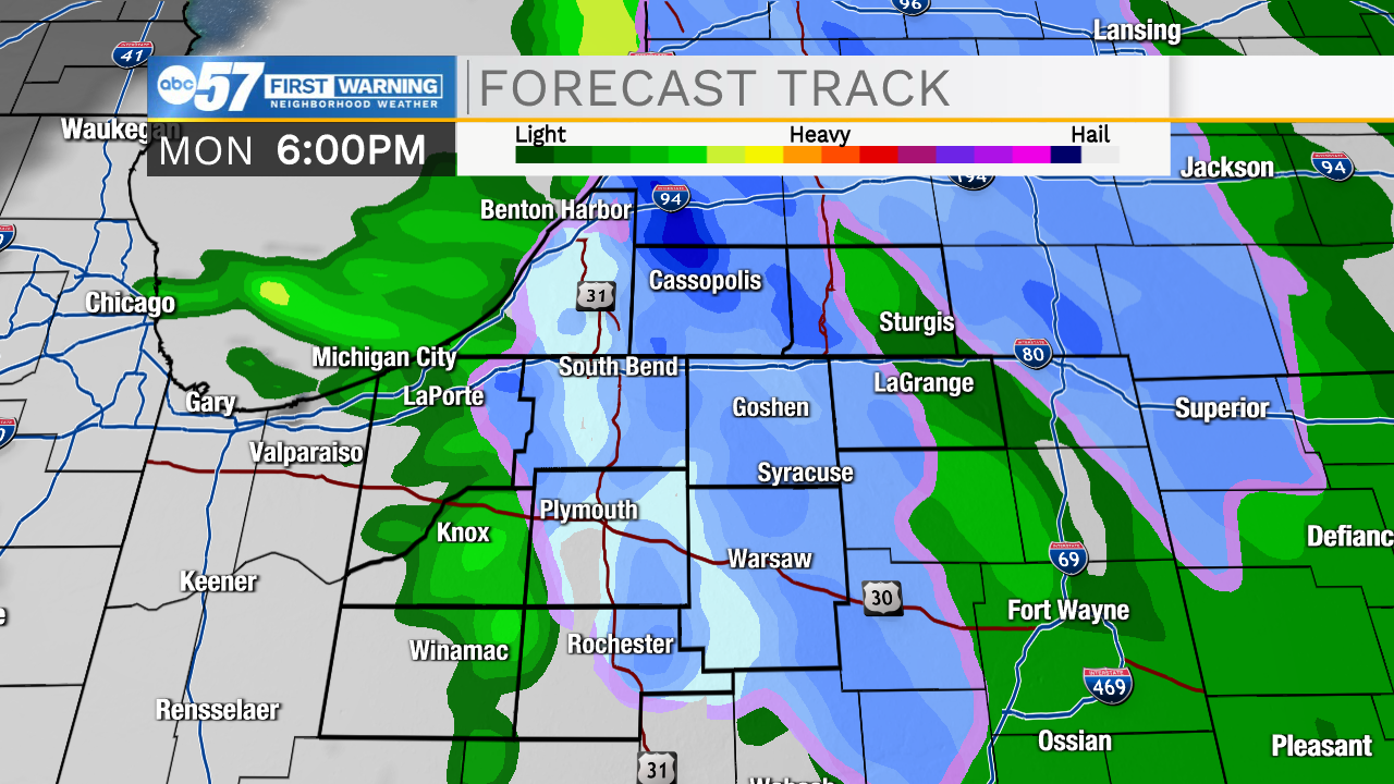 Precipitation turns to a wintry mix or snow showers as temperatures cool this evening
Even though you might see a few snow showers this evening, little or no snow will accumulate on the ground. Precipitation wraps up late this evening, and the rest of the week trends dry. We’ll have to wait until Sunday for our next best snow chance.
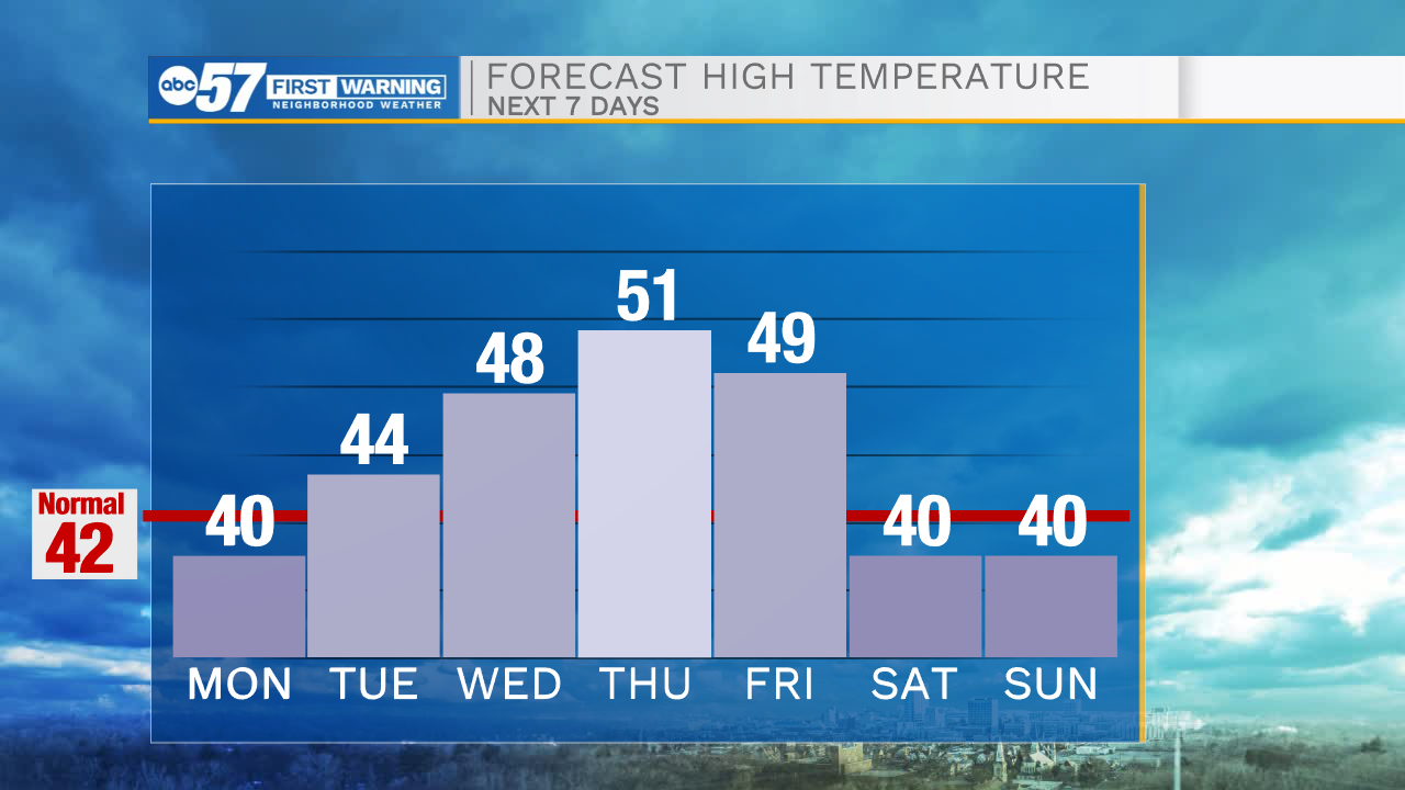
Temperatures drop near freezing tonight. Enjoy a warming trend this week – mid to upper 40s for Tuesday and Wednesday. We might even climb above 50 on Thursday.
Today: Mostly cloudy. Afternoon rain/snow. High 40.
Tonight: Mostly cloudy. Low 32.
Tuesday: Partly cloudy. High 44.
Wednesday: Partly to mostly cloudy. High 48.