
-
1:03

Mentone Egg festival brings a clutch of people to enjoy its history
-
0:46

9th annual Hall of Heroes Comic Con concludes its first day
-
2:39

South Bend Barber celebrates retirement after 59 years
-
0:45

OC fireworks reveal their new showroom
-
0:57

Thousands take part in Sunburst Run to raise funds
-
2:00

Annual Studebaker car show takes over Ironwood Plaza
-
0:55

Beautiful weekend expected
-
1:05

Truly wonderful conditions
-
0:41

One person left with serious injuries after high-speed pursuit...
-
2:15

Fort Wayne Tin Caps put an end to the SB Cubs winning streak
-
1:21

This weekend is the annual Hall of Heroes Comic Con
-
0:46

Elkhart Police Department respond to shots fired call at the...

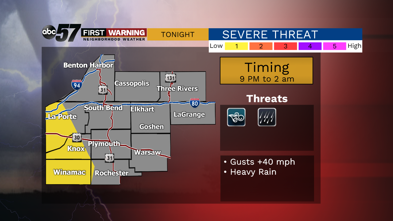
A few spotty evening showers then widespread rain with some rumbles of thunder late evening that continues into Wednesday morning. Severe weather is unlikely but some wind gusts +40 mph and heavy rain are possible.
Wet weather will last through midweek, Wednesday is wet, with a few lulls it what will be a day of steady rain and showers continues Thursday. Temperatures fall through Thursday too, in what will be a damp and breezy day. The forecast turns fair again to end the week and temperatures warm to 70 on Saturday. Mild temperatures won't last however, highs in the 50s last for much of next week.
Tonight: Scattered showers and thunderstorms. Low of 56.
Wednesday: Rainy. High of 60.
Thursday: Scattered showers, breezy. High of 50.
Friday: Mostly sunny. High of 57.