
-
0:57

The Unity Gardens brought music, food, and crafts for their Westside...
-
1:50

Quiet evening, Storms after Midnight
-
0:57

Deer Creek Hunt Club throws a skeet shoot event for Deputy Jon...
-
1:44

Two rounds of storms Monday
-
1:07

Mini heat wave starts out the door
-
2:23

La Porte community rallies for Sammy Strong Benefit, raising...
-
1:57

The Potawatomi Zoo opens its gates to Zoo Nights Live
-
2:50

Carson Kvapil wins his first O’Reilly Auto Parts Series win...
-
1:10

William Tuffs honored as the only Indiana man who took part of...
-
0:50

Beacon Health held a Health and Wellness fair for the community
-
1:03

Warm conditions start overnight
-
1:02

Another pleasant day

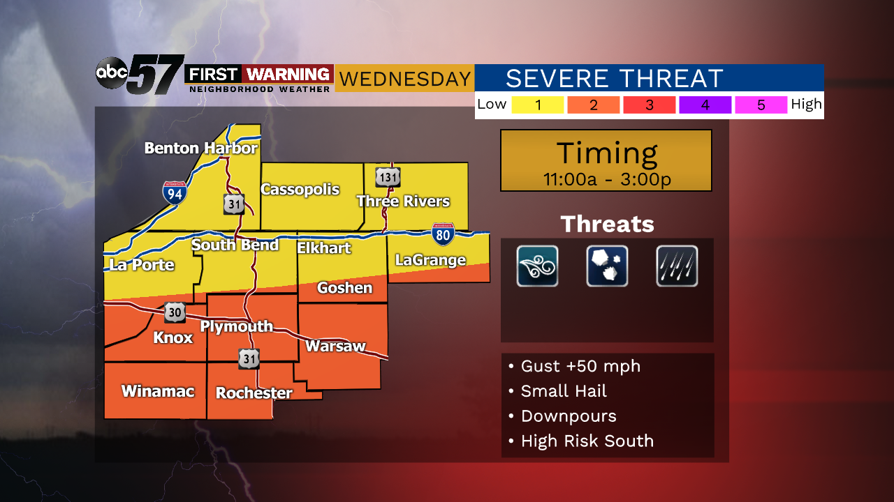
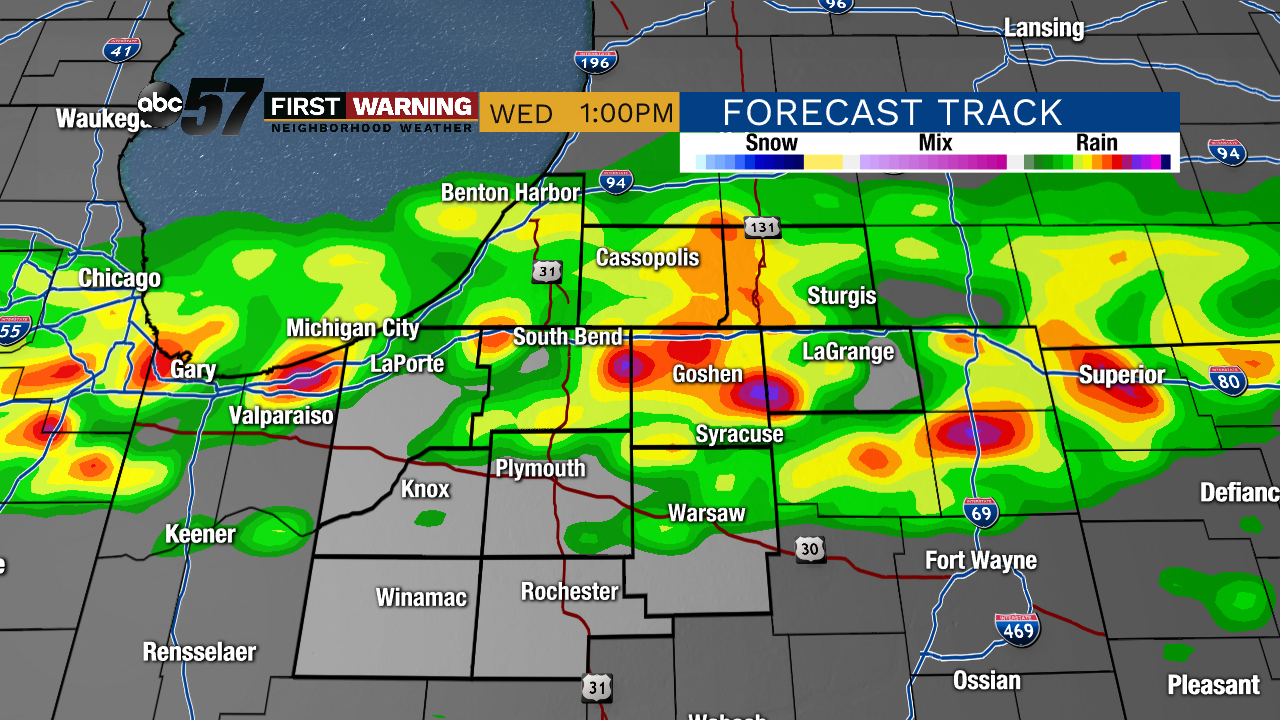
Steamy through Wednesday morning, the high humidity will fuel midday thunderstorms as a cold front cuts southward. The midday timing of storms will limit the severe threat, a threat that increase north to south and is likely highest closer to Kokomo and Indianapolis by mid afternoon. The biggest difference in the wake of this front is lower humidity. Thursday is warm, sunny but not humid. A slight surge in humidity Friday sparks an isolated chance of storms, then a beautiful summer weekend to follow.
Tonight: Muggy. Low 70.
Wednesday: Midday scattered storms. High 78.
Thursday: Mostly sunny. High 84.
Friday: Isolated storms. High 85.
Sign up for the ABC 57 Newsletter