Scattered storm threat overnight, much colder Friday

-
2:16

Notre Dame’s CJ Carr embraces growing expectations while leading...
-
2:34

Injuries sideline key linebackers as Notre Dame leans on depth...
-
0:58

U.S. Army increases maximum enlistment age from 35 to 42
-
2:08

Large hail, damaging winds and tornadoes possible Thursday
-
1:40

Nicholas Stanley appears in court, prosecutors push to prevent...
-
3:18

Expert breaks down high gas prices and factors impacting price...
-
2:08

Westview community rallies around boys’ basketball team headed...
-
2:06

The threat for severe weather has increased
-
2:16

More sunshine today with a severe risk tomorrow
-
0:32

Granger residents share input on proposed S.R. 23 roundabout
-
2:59

Seven local boards unanimously approve fire territory merger...
-
2:05

JobSpark helps inspire career exploration for middle school students

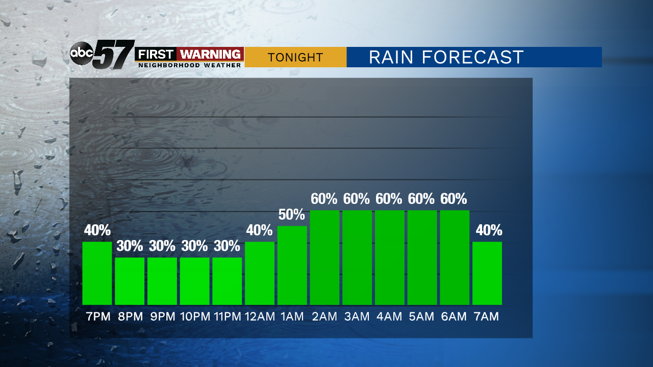
Widespread rain ends this evening and temperatures spike into the 60s. The milder conditions fuel the possibility of scattered thunderstorms through the early morning. Temperatures will fall sharply early Friday morning.
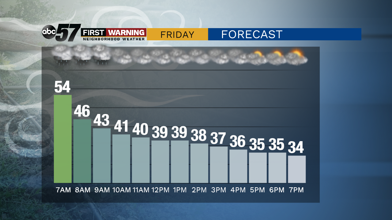
Friday temperatures only get colder. Falling from the 50s early to the mid-30s by the afternoon. Wind gusts could gust as high as 40 mph. Clouds clear into the weekend, chilly but fair Saturday and Sunday. Temperatures return to the 50s by the middle of next week. The pattern turns wet and possibly stormy again next Wednesday and Thursday.
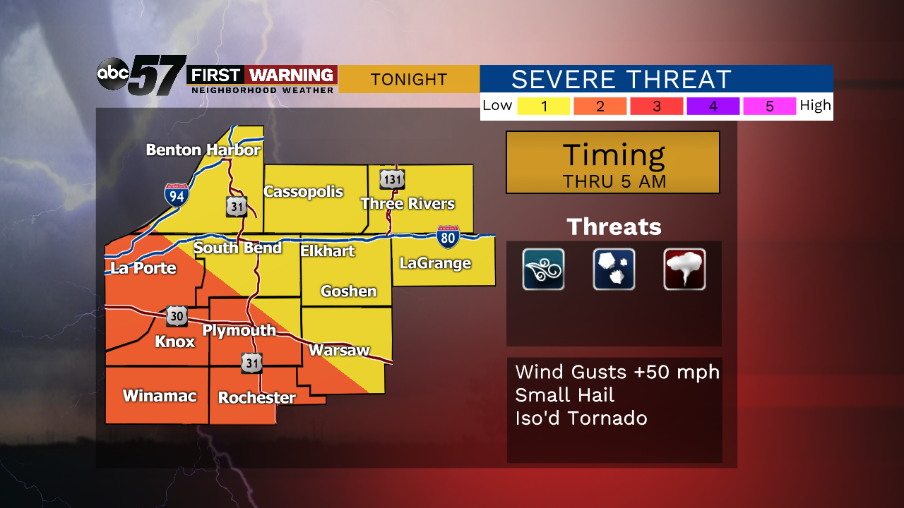
Tonight: Scattered storms, strong to severe possible. Low 54.
Friday: A few AM showers then partial clearing. Breezy with temperatures falling from 54.
Saturday: Mostly sunny. High 38.
Sunday: Mostly sunny. High of 42.