Showers and storms overnight but severe threat has lowered
By:
Tom Coomes
Posted: May 16, 2019 4:43 PM EDT

-
2:12

South Bend City Council passes resolution urging pause on Midwest...
-
0:46

Niles City Council vote yes on putting marijuana question on...
-
0:29

Multiple Fire Departments battle residential fire in Berrien...
-
2:10

Notre Dame men’s basketball embracing urgency as Shrewsberry...
-
2:37

Local Beef-A-Roo employees still owed paychecks as private equity...
-
1:42

More storms through 8:00 p.m.
-
1:06

2nd annual Inclusive Art Fair
-
2:20

Tracking severe weather through the mid-afternoon
-
3:17

Applications open for Fall Citizens Police Academy in South Bend
-
2:23

Elkhart County 4H Fair food vendors celebrate 50th year of business
-
2:16

Young football athletes learn about protecting their bodies,...
-
1:24

Storm track timing could be shifting

The mid-afternoon showers reduced our severe thereat for the area as storm energy dropped. There will still be showers and storms overnight, the main thereat would be heavy rain.
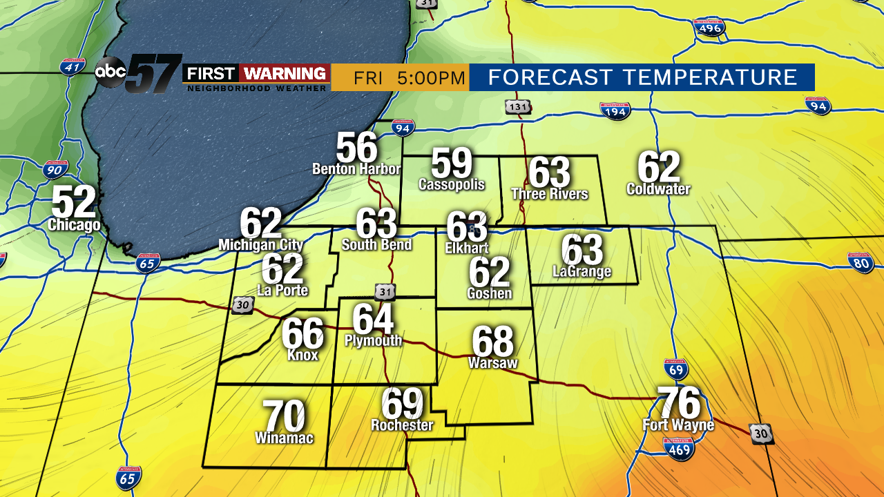
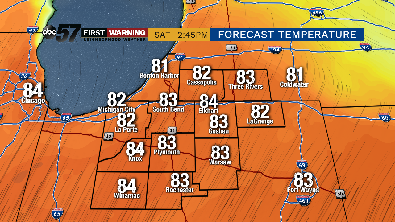
The front dips south Friday leaving Michiana in the cooler air, highs will be in the 60s with a chance of showers or a stray thunderstorm. The front surges north again Saturday and temperatures look to hit 80 for the first time in 2019. The building heat and humidity will fuel another round of showers and storms Sunday.
Tonight: Scattered storms, heavy rain possible, low of 58.
Friday: Morning showers, mostly cloudy, high of 66.
Saturday: Partly cloudy, high of 82.
Sunday: Afternoon thunderstorms, high of 78.
Sign up for the ABC 57 Newsletter