Snow continues to melt and the quiet weather remains

-
0:49

Gas leak at remains of Zimmy’s Tavern leads to temporary evacuation...
-
2:12

South Bend City Council passes resolution urging pause on Midwest...
-
0:46

Niles City Council vote yes on putting marijuana question on...
-
0:29

Multiple Fire Departments battle residential fire in Berrien...
-
2:10

Notre Dame men’s basketball embracing urgency as Shrewsberry...
-
2:37

Local Beef-A-Roo employees still owed paychecks as private equity...
-
1:42

More storms through 8:00 p.m.
-
1:06

2nd annual Inclusive Art Fair
-
2:20

Tracking severe weather through the mid-afternoon
-
3:17

Applications open for Fall Citizens Police Academy in South Bend
-
2:23

Elkhart County 4H Fair food vendors celebrate 50th year of business
-
2:16

Young football athletes learn about protecting their bodies,...

ABC57 First Warning Neighborhood Weather Forecast
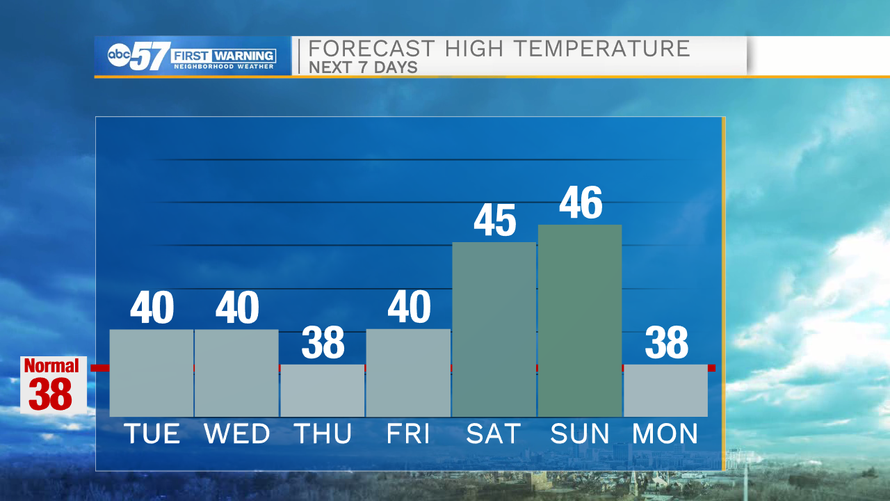
Tuesday, February 23rd, 2021
Clouds break up late this morning with daytime topping out at 40 degrees! We will be watching for potential fog development in the nights to come from the mix of all the melting snow and calming winds. A few more clouds on Wednesday with the chance of an isolated shower. More sunshine to come Thursday and Friday. Daytime highs will remain in the upper 30s to low 40s through Friday. Temperatures rise into the mid 40s over the weekend. We are just tracking the chance for minor precip on Saturday.
Today: AM clouds then partly cloudy. High 40.
Tonight: Partly to mostly cloudy. Low 32.
Wednesday: Mostly cloudy, isolated shower possible. High 40.
Thursday: Partly cloudy. High 38.