-
2:32

Gus Macker Three-on-Three Basketball Tournament is taking over...
-
1:44

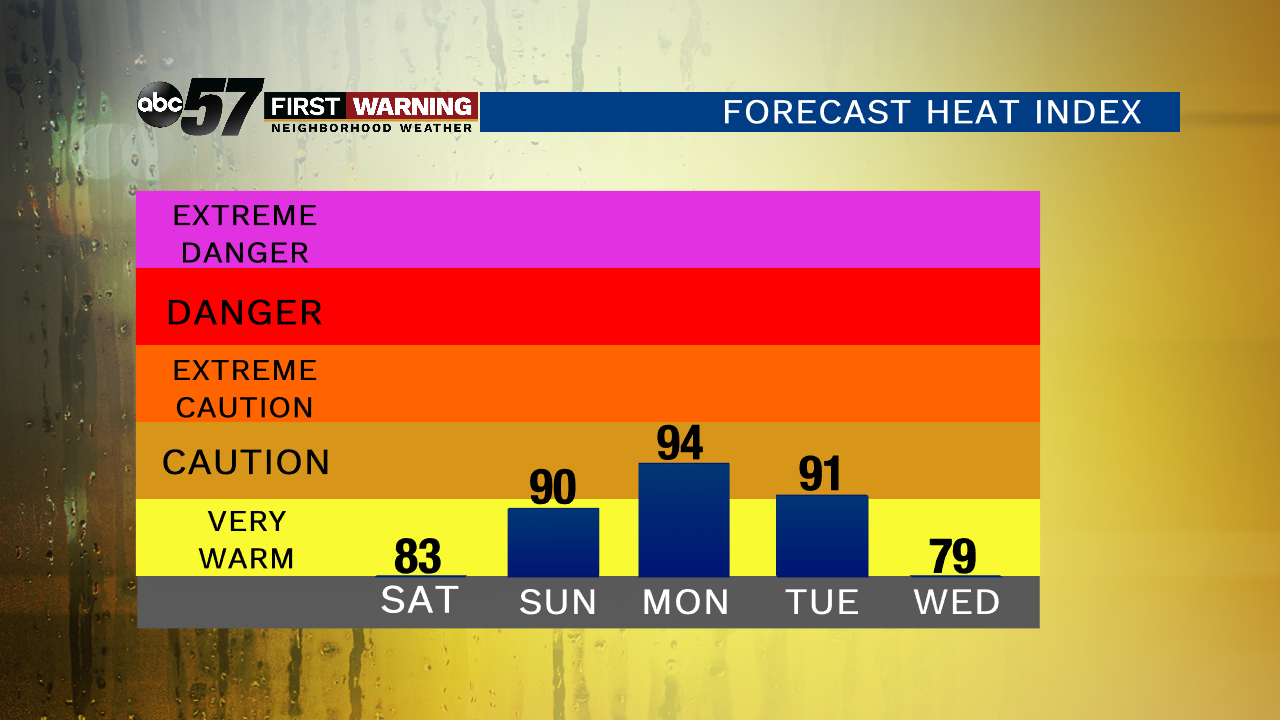
Feeling like a sauna next week
-
3:12

How to keep yourself and others protected during firework season
-
0:49

Showers creeping into Michiana
-
1:32

Judge approves $25 million water lawsuit settlement in Benton...
-
1:00

Scattered showers through the day
-
1:53

Hispanic Community Child Safety Meeting: A Call To Action
-
2:51

Obama Presidential Center features work of South Bend company
-
1:54

This week’s ABC57 Cub Reporter is Isaac Knefely
-
1:16

Real summer heat returns next week
-
2:28

South Bend storm drain mural project complete
-
5:17

Three local students return as national powerlifting champions

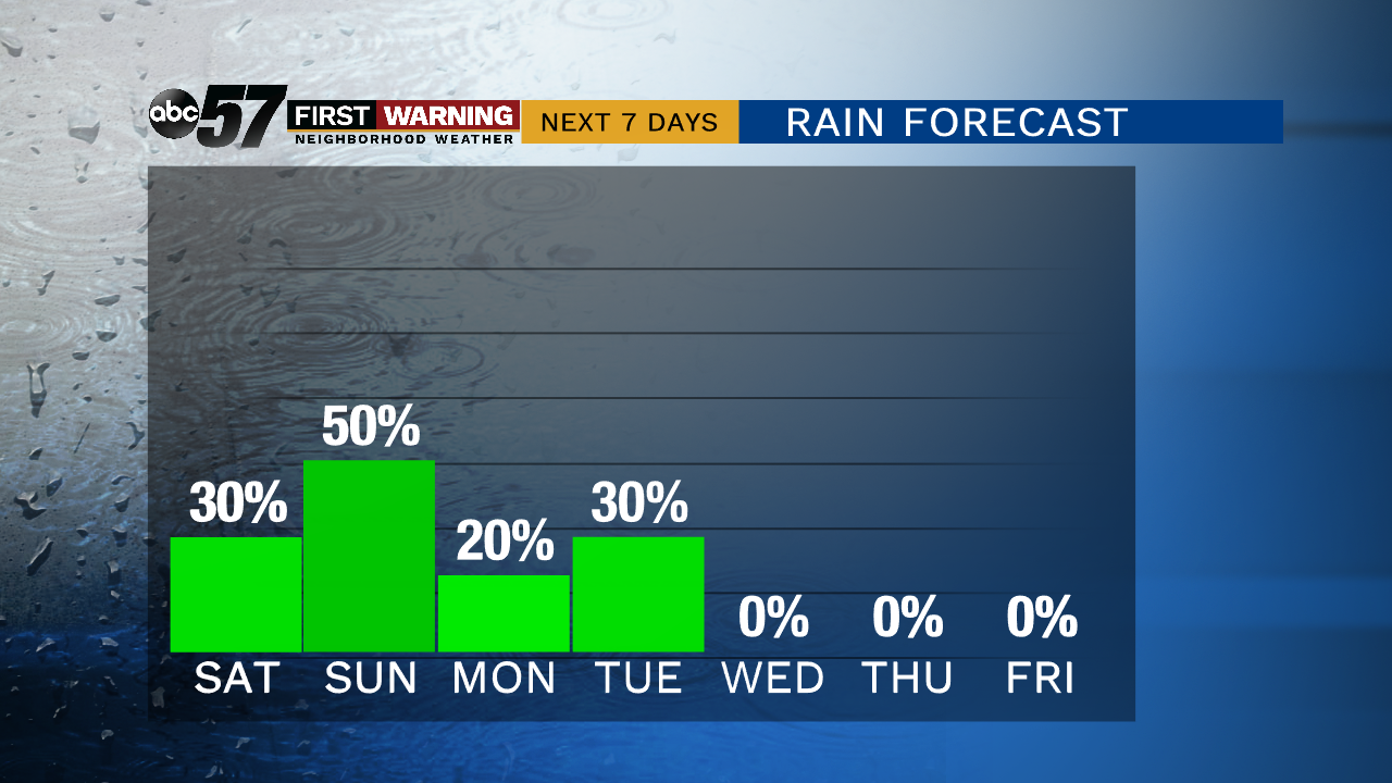
Isolated showers and thunderstorms are possible starting Friday evening. Severe weather and heavy rain are possible but that threat is also isolated.
A steamy and stormy pattern will last through the weekend with a chance of showers and thunderstorms Saturday and Sunday, Sunday looking to be the more likely day for rain. The overall severe threat is low but downpours are possible as are some isolated wind gusts. Temperatures rise through the weekend, peaking near 90 on Monday. The heat breaks by the middle of next week.
Tonight: Mostly cloudy, isolated showers and storms, low of 64.
Saturday: Scattered showers and storms, high of 82.
Sunday: Scattered showers and storms, high of 86.
Monday: Partly cloudy, isolated showers and storms, high of 88.