
-
0:49

Gas leak at remains of Zimmy’s Tavern leads to temporary evacuation...
-
2:12

South Bend City Council passes resolution urging pause on Midwest...
-
0:46

Niles City Council vote yes on putting marijuana question on...
-
0:29

Multiple Fire Departments battle residential fire in Berrien...
-
2:10

Notre Dame men’s basketball embracing urgency as Shrewsberry...
-
2:37

Local Beef-A-Roo employees still owed paychecks as private equity...
-
1:42

More storms through 8:00 p.m.
-
1:06

2nd annual Inclusive Art Fair
-
2:20

Tracking severe weather through the mid-afternoon
-
3:17

Applications open for Fall Citizens Police Academy in South Bend
-
2:23

Elkhart County 4H Fair food vendors celebrate 50th year of business
-
2:16

Young football athletes learn about protecting their bodies,...

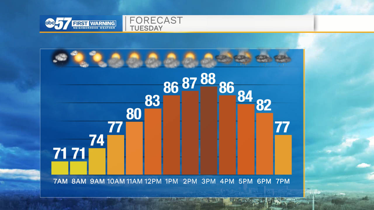
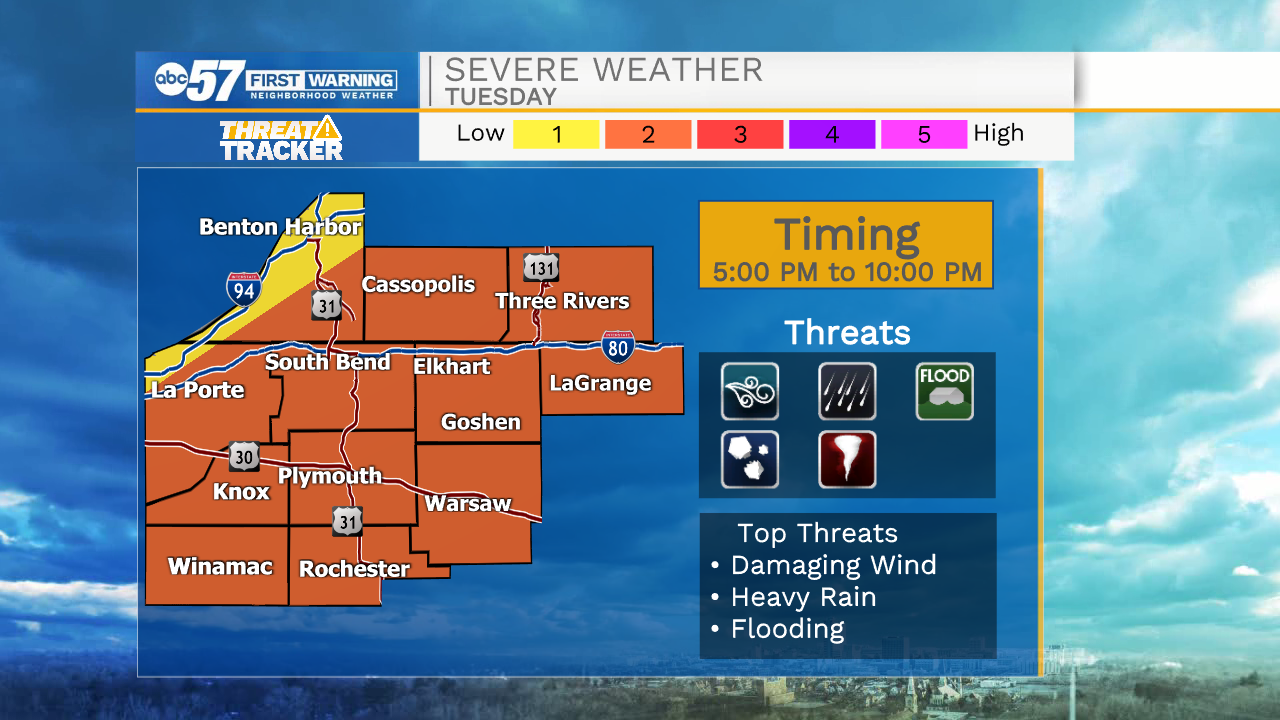
The heat, haze and humidity continue Tuesday. Focus turns to the cold front that will arrive Tuesday evening and the storms and severe potential. Storms will develop into a line that moves across the area, the main threat will be strong wind but heavy rain, hail, flooding and even a tornado are possible. The timing is 5:00 to 10:00 PM with areas north earlier and south later. This is not the best set-up for the strongest storms, but the timing and conditions are more favorable than recent events. There is a temporary break from the heat, Wednesday. Temperatures rise again into the weekend.
Tonight: Partly cloudy. Low 70.
Tuesday: Evening thunderstorms. High 90.
Wednesday: Partly cloudy. High 78.
Thursday: Mostly sunny. High 82
Sign up for the ABC 57 Newsletter