


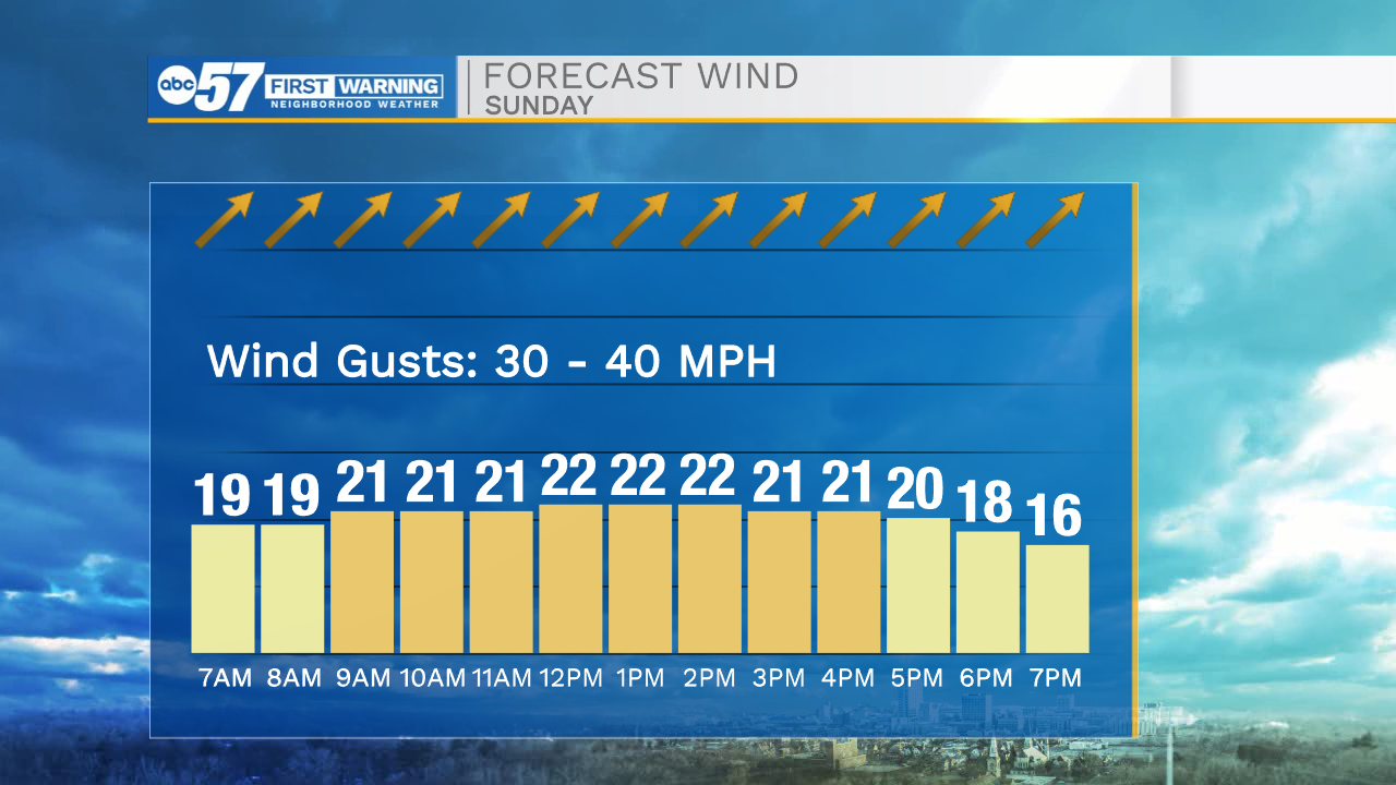
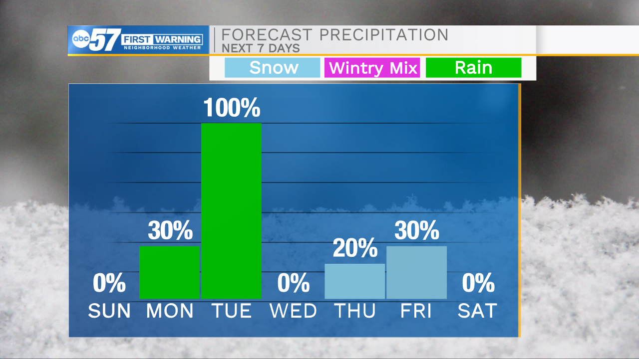
This morning our temperatures are warmer than they were yesterday, but with strong winds factored in, feel like temperatures are still in the single digits. Winds will stay very strong throughout the day with gusts reaching 30-40mph. These strong winds are rapidly moving warmer air into Michiana, that mixed with sunshine will help boost highs into the lower 40s today. The warmer air will allow for lots of snow melt, so the flooding concern is still high throughout the flood prone areas here in Michiana. Warmer temperatures will follow us into the work week with highs Monday in the mid 40s and Tuesday the lower 50s. Rain showers move into Michiana Monday evening and will stick around throughout Tuesday. Overall rain accumulations remain low at the moment, but it won’t take much to cause more flooding with already saturated soils. Highs will drop back into the 20s and 30s as we wrap next week up and head into next weekend.
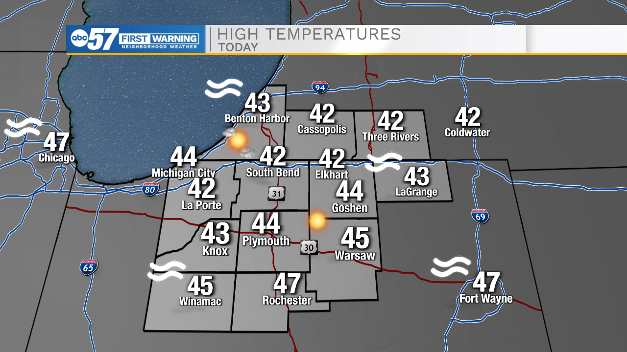
Today: Mostly sunny/strong winds. High 42.
Tonight: Partly cloudy. Low 35.
Tomorrow: Partly cloudy/PM Rain. High 45.
Tuesday: Scattered light rain. High 52.