South Bend has only seen temperatures reach 80° a total of four times this year. The hottest temperature thus far occurred on May 18th, when the mercury climbed to 85°. By June 5th of last year, South Bend had already seen 90° three times! Put simply, we haven't really had much summer-like weather.
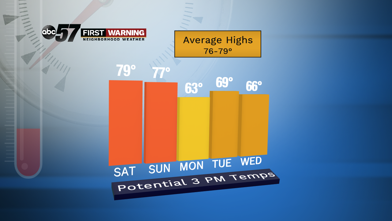 Potential high temps for the period June 8-12.
And, unfortunately, there won't be much over the next two weeks. Highs could flirt with 80° Friday and Saturday, but after that our chances at 80-degree-heat are
very low. Forecast models are showing good agreement on high temperatures in the 64-73° range beginning next Monday. The closer to Lake Michigan you are, the more likely you'll stay well down in the 60s.
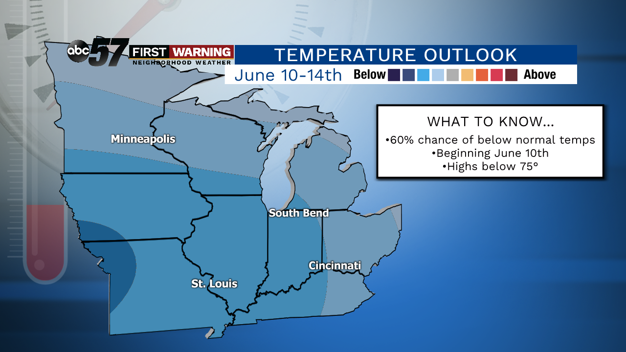 Chance of below normal temperatures during the period June 10-14.
CPC
Chance of below normal temperatures during the period June 10-14.
CPC
Regardless of where you are in Michiana, it will be cooler-than-normal for June standards beginning next Monday. It certainly won't be pool or beach weather despite some days featuring sunshine. Looking beyond early next week, the Climate Prediction Center has highlighted all of Michiana for having a pretty good chance of below normal temperatures for both their June 10-14th outlook and June 12-18th outlook.
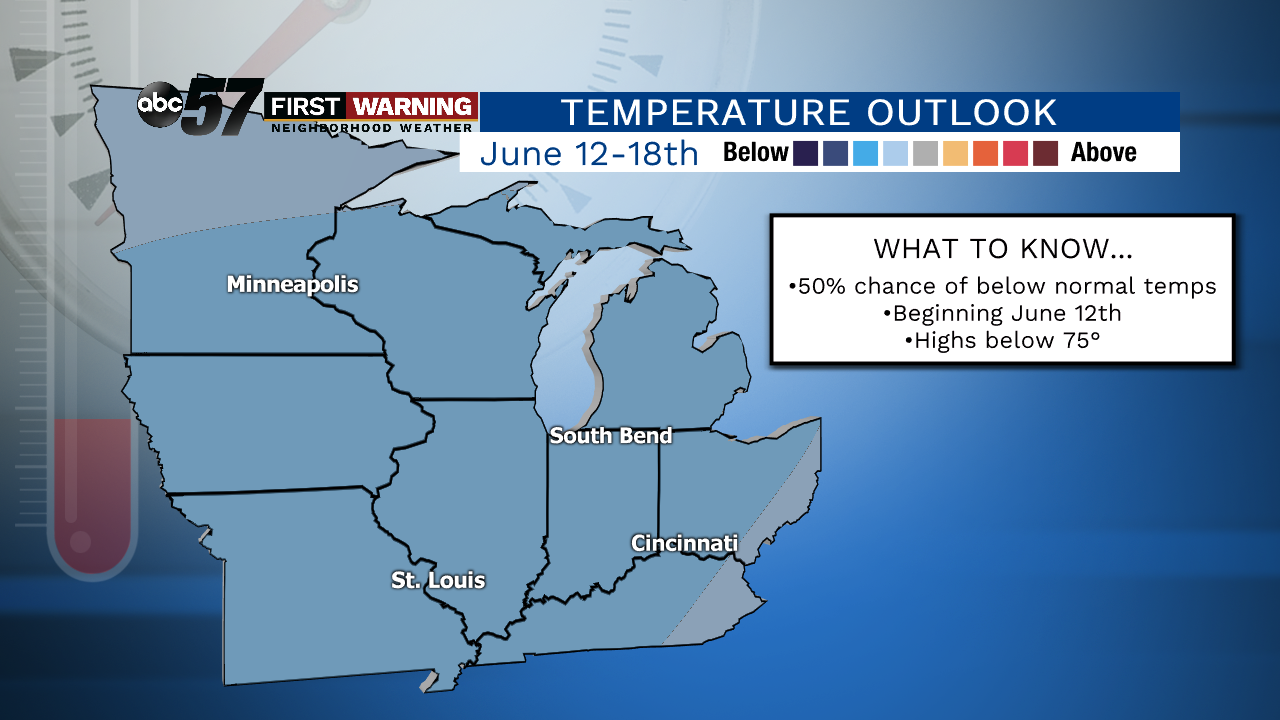 Probability of below normal temperatures during the period June 12-18.
CPC
Probability of below normal temperatures during the period June 12-18.
CPC
Despite the maps both showing blue, this does
not mean we'll be "cold." It means that our daily highs will likely be a couple degrees to several degrees below where they should be. And, with our typical temperatures being in the upper 70s in mid-June, we should expect highs to remain below 80° every day thru at least June 18th or so. Of course we could see a day or two around 80°, but the pattern overall favors 70s.
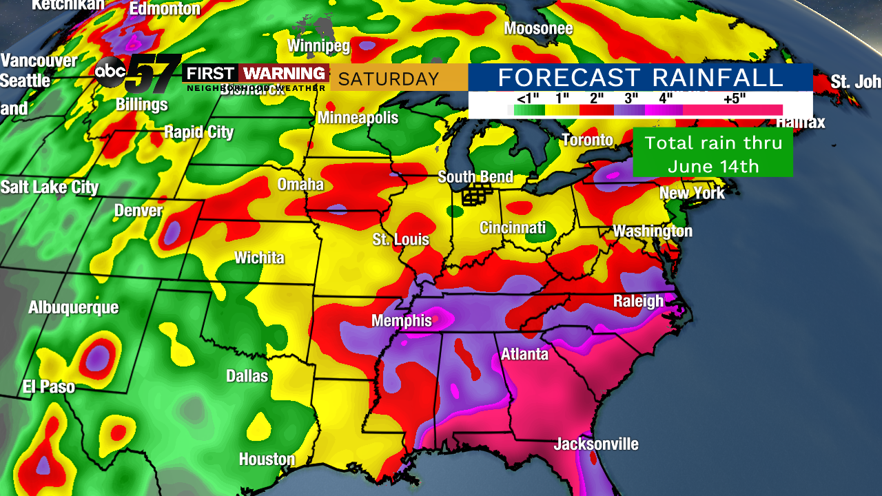 Possible rainfall thru June 14th.
Looking at rainfall over the next two weeks, it won't be as active as what we saw in May, but there will be a handful of rain chances. The heaviest of the rain over the next two weeks will mainly fall across the Southeast. The good news is that with the cooler temperatures expected, thunderstorms and severe weather look rather unlikely.
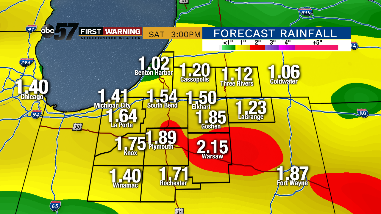 Potential rainfall amounts thru June 14th.
By June 14th, most models favor rainfall totals around an inch or so with a lack of heavy rain events. That would be good news. But as we know, things can and will change in the weather world, so be sure to stay tuned. What we can say for absolute certain, though, is that beginning next Monday, the pattern looks cool for June standards and not nearly as rainy/stormy as what we've been accustomed to seeing.
