Summer temperatures are trending warmer locally and nationally.


Summers locally and nationally continue a trend predicted by climate change. As we begin meteorological summer, this trend continues to get hotter.
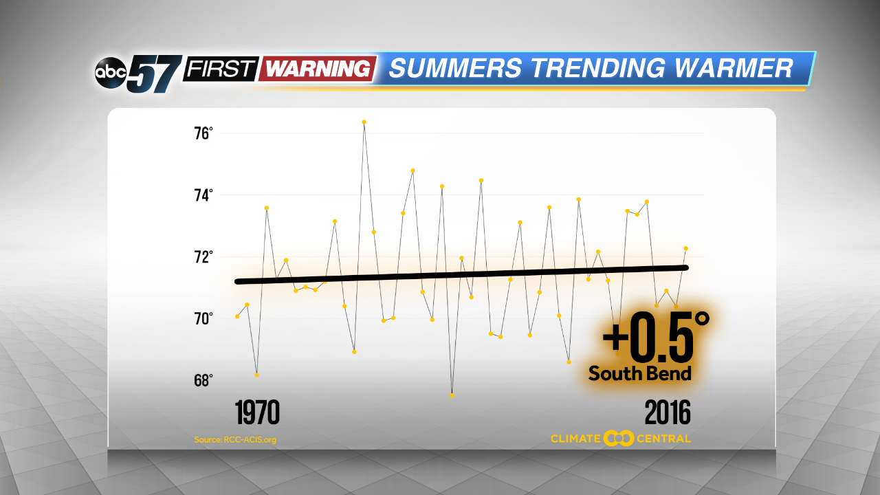 Mean summer temperature for South Bend since 1970
Since 1970 there’s been a steady rise in summer temperatures. Mean summer temperatures (average of all highs and lows) have risen 0.5° since 1970. That number may seem small, but it is significant.
More significant is Michiana is not alone. Most the United State has seen a steady climb in summer temperatures since 1970, the most significant rise seen in the southwest.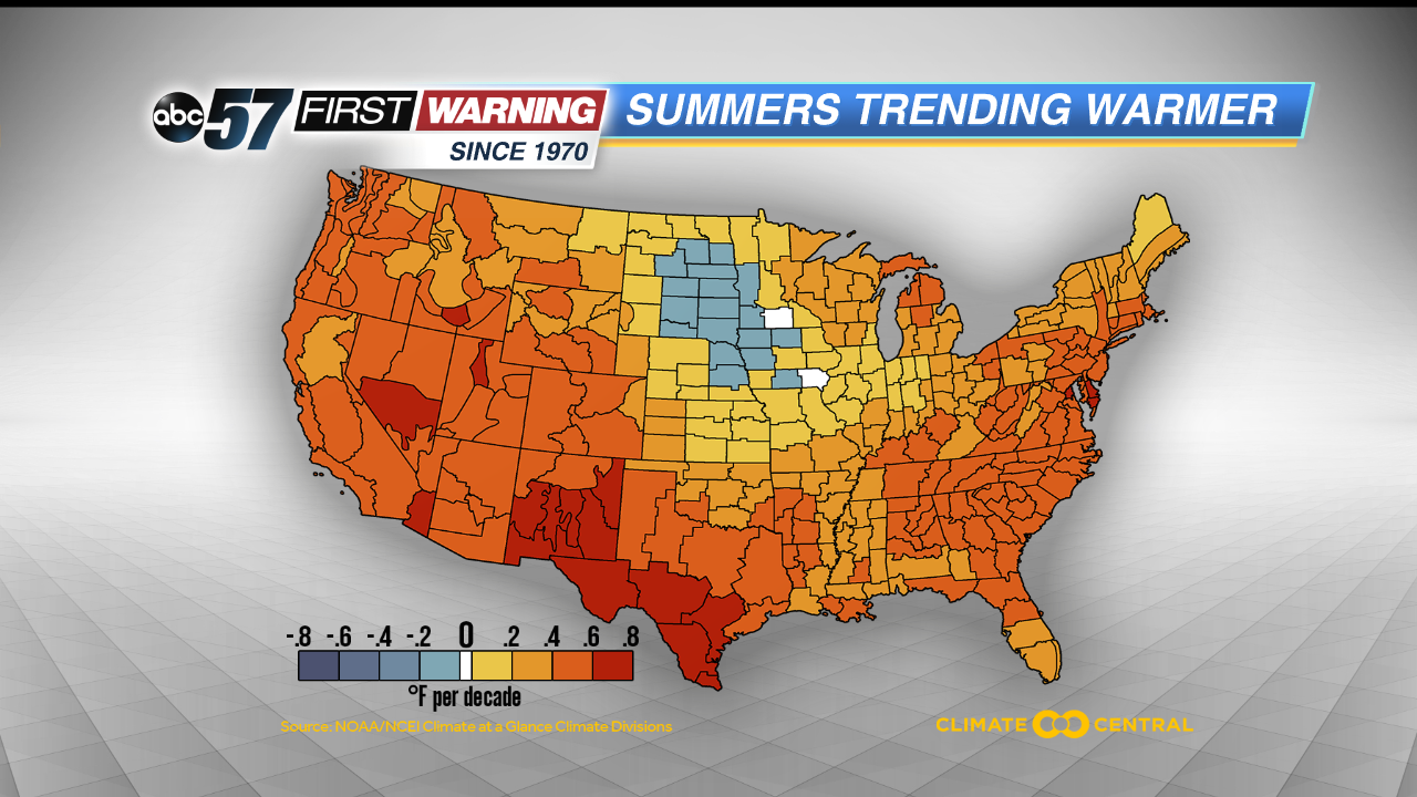 National Climate Division summer mean temperature analysis
What does this mean? There will still be hot days and milder days. However, the hotter days are lasting longer and the heat waves are more frequent than cool summers. Other growing trend isn’t just warmer days but muggier nights, where low temperatures don’t fall below 70°. The past few summers we’ve set record warmest lows for a number of dates.
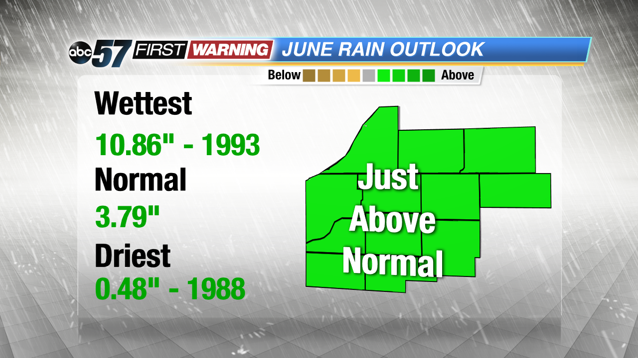
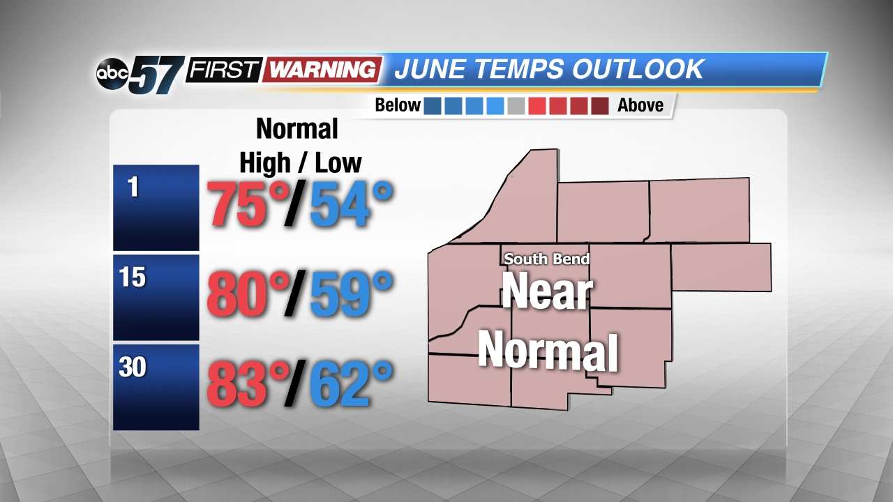
The start of meteorological summer 2017 looks to be warm and fairly dry. The June outlook calls for near to just above normal temperatures.
While the start of June looks mostly dry, the monthly outlook calls for another month of above normal rainfall. This year 4 of the first 5 months has above normal rainfall.