
-
0:50

Beautiful weekend starts this morning
-
2:32

Gus Macker Three-on-Three Basketball Tournament is taking over...
-
1:44

Feeling like a sauna next week
-
3:12

How to keep yourself and others protected during firework season
-
0:49

Showers creeping into Michiana
-
1:32

Judge approves $25 million water lawsuit settlement in Benton...
-
1:00

Scattered showers through the day
-
1:53

Hispanic Community Child Safety Meeting: A Call To Action
-
2:51

Obama Presidential Center features work of South Bend company
-
1:54

This week’s ABC57 Cub Reporter is Isaac Knefely
-
1:16

Real summer heat returns next week
-
2:28

South Bend storm drain mural project complete

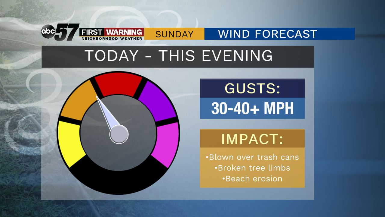
Skies will become mostly sunny today with highs in the lower 50s expected. We could see the warmest Groundhog Day on record in some spots today. However, it will be windy with gusts of 30 to 40 mph possible throughout Sunday. Clouds return quickly on Monday, with highs reaching the middle 40s. Rain develops Monday night across Michiana as our next rain and snow system arrives. While most of Tuesday will just be rainy, snow becomes more likely by late Wednesday.
Today: Mostly sunny and windy. High 52.
Tonight: Partly cloudy. Low 31.
Monday: Mostly cloudy. Rain develops at night. High 45.
Tuesday: Cloudy with rain showers, changing to snow showers late. High 38
Sign up for the ABC 57 Newsletter