
-
2:28

Kicking off day two of the Gus Macker Basketball Tournament
-
0:50

Beautiful weekend starts this morning
-
2:32

Gus Macker Three-on-Three Basketball Tournament is taking over...
-
1:44

Feeling like a sauna next week
-
3:12

How to keep yourself and others protected during firework season
-
0:49

Showers creeping into Michiana
-
1:32

Judge approves $25 million water lawsuit settlement in Benton...
-
1:00

Scattered showers through the day
-
1:53

Hispanic Community Child Safety Meeting: A Call To Action
-
2:51

Obama Presidential Center features work of South Bend company
-
1:54

This week’s ABC57 Cub Reporter is Isaac Knefely
-
1:16

Real summer heat returns next week

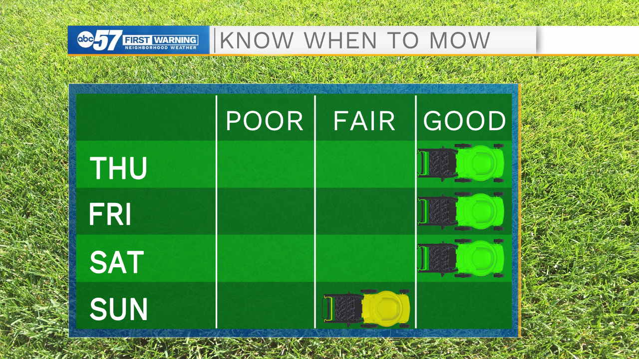
Isolated frost is possible again this morning for portions of Michiana as lows drop into the mid 30s. This afternoon temperatures will begin to warm into the mid to upper 60s under sunny skies. The threat of frost will move out of Michiana for Friday as lows are expected to hold in the upper 30s to lower 40s. Friday will be another nice day here in Michiana with highs in the upper 60s to lower 70s. Rain chances return this weekend, with the best chance being on Sunday. Rain chances will hold in the forecast throughout all of next week. Pop up showers and even a few isolated thunderstorms are possible. Highs next week will be in the low to mid 70s.

Today: Sunny. High 65.
Tonight: Mostly clear. Low 38.
Tomorrow: Mostly sunny. High 68.
Saturday: Partly cloudy. High 70.