

-
3:18

Marcus Freeman apologizes for sideline reaction to Aneyas Williams’...
-
3:49

Multiple shootings near Notre Dame leave community demanding...
-
2:06

Triton School Corporation sued over alleged failure to report...
-
2:01

Political candidates respond to violent weekend
-
3:03

Nicholas Stanley murder trial: Day one
-
4:14

Understanding A.I.’s risk to humanity
-
0:20

Water main break reported in Elkhart in Beardsley Avenue area;...
-
1:10

Temperatures cool just in time for Astronomical Fall
-
3:16

Violent weekend leaves three injured, two dead
-
2:06

Showers stay persistent on the final day of the Nappanee Apple...
-
1:39

Soggy weather persists, Drying out next week
-
1:10

Some breaks from the rain expected

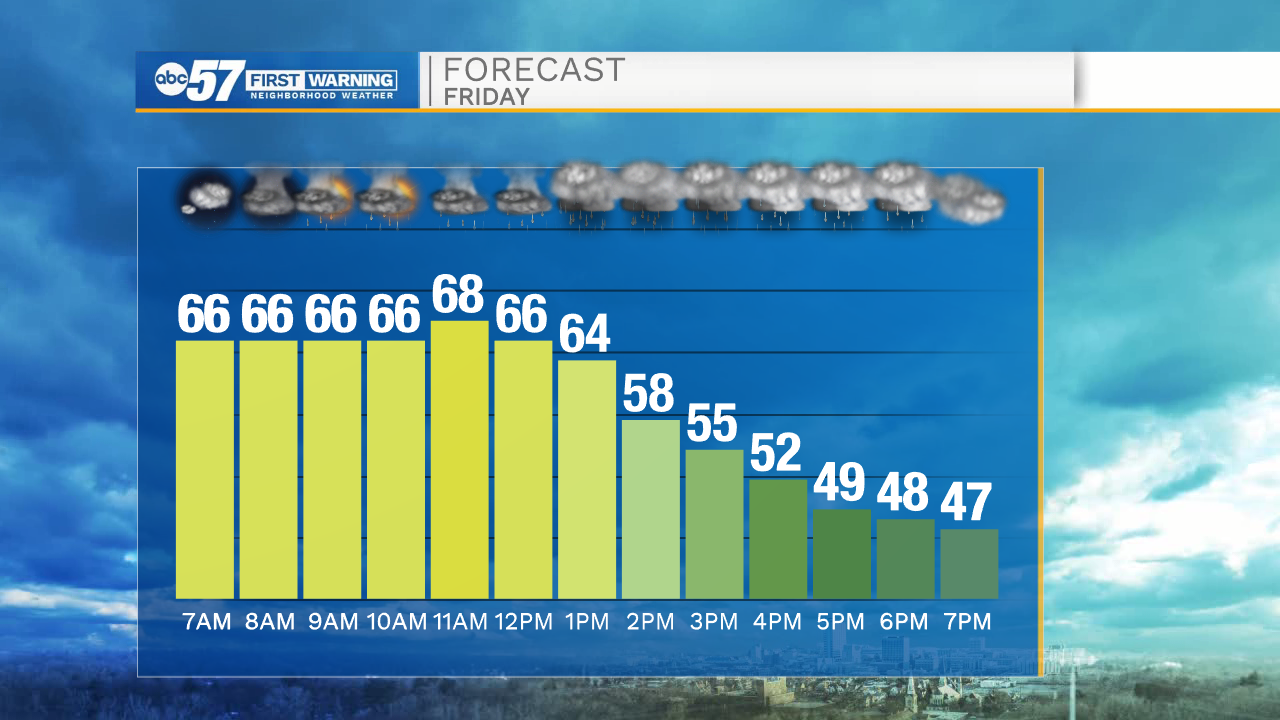
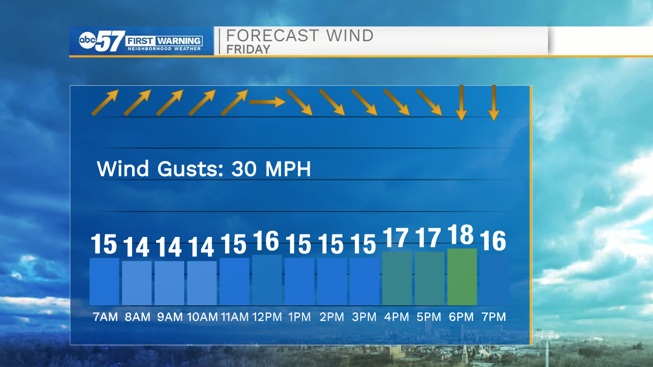
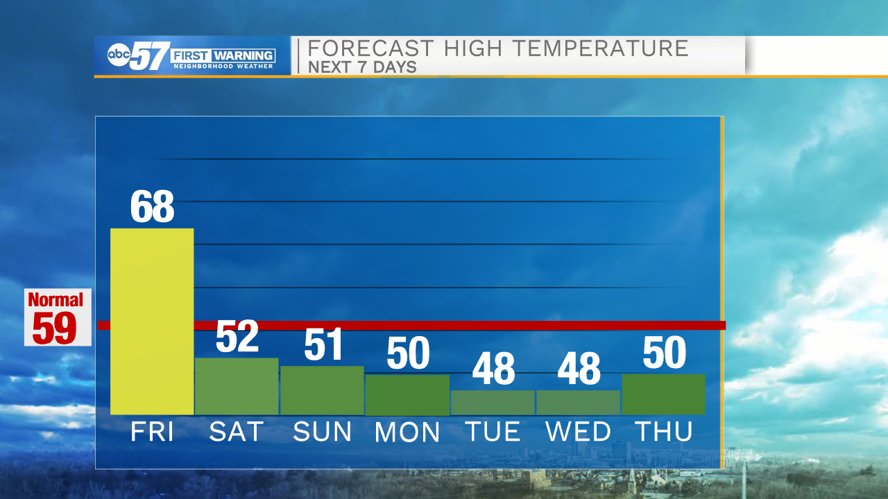
A dramatic drop in temperature happens Friday. After a mild night, temperature hold in mid-60s through the morning, spiking near 70 ahead of the cold front around noon. Scattered showers and thunderstorms also develop ahead of the front mid-morning with widespread rain/storms with the front, along with a sudden change in wind direction. Friday afternoon is damp and blustery as temperatures fall to the upper 40s by the evening. The weekend is cool and quiet with highs in the 50s.
Tonight: Partly cloudy. Low 65.
Friday: Scattered AM t-showers, Temperatures fall from 68 midday, blustery and damp afternoon.
Saturday: Partly cloudy. High 52.
Sunday: Mostly cloudy. High 51.
Sign up for the ABC 57 Newsletter