The heat breaks but the humidity surges with showers and storms
By:
Tom Coomes
Posted: May 29, 2018 5:00 PM EDT

-
2:10

Notre Dame men’s basketball embracing urgency as Shrewsberry...
-
2:37

Local Beef-A-Roo employees still owed paychecks as private equity...
-
1:42

More storms through 8:00 p.m.
-
1:06

2nd annual Inclusive Art Fair
-
2:20

Tracking severe weather through the mid-afternoon
-
3:17

Applications open for Fall Citizens Police Academy in South Bend
-
2:23

Elkhart County 4H Fair food vendors celebrate 50th year of business
-
2:16

Young football athletes learn about protecting their bodies,...
-
1:24

Storm track timing could be shifting
-
0:57

Unity Gardens brings music, food, and crafts for Westside BBQ...
-
1:50

Quiet evening, Storms after Midnight
-
0:57

Deer Creek Hunt Club throws a skeet shoot event for Deputy Jon...

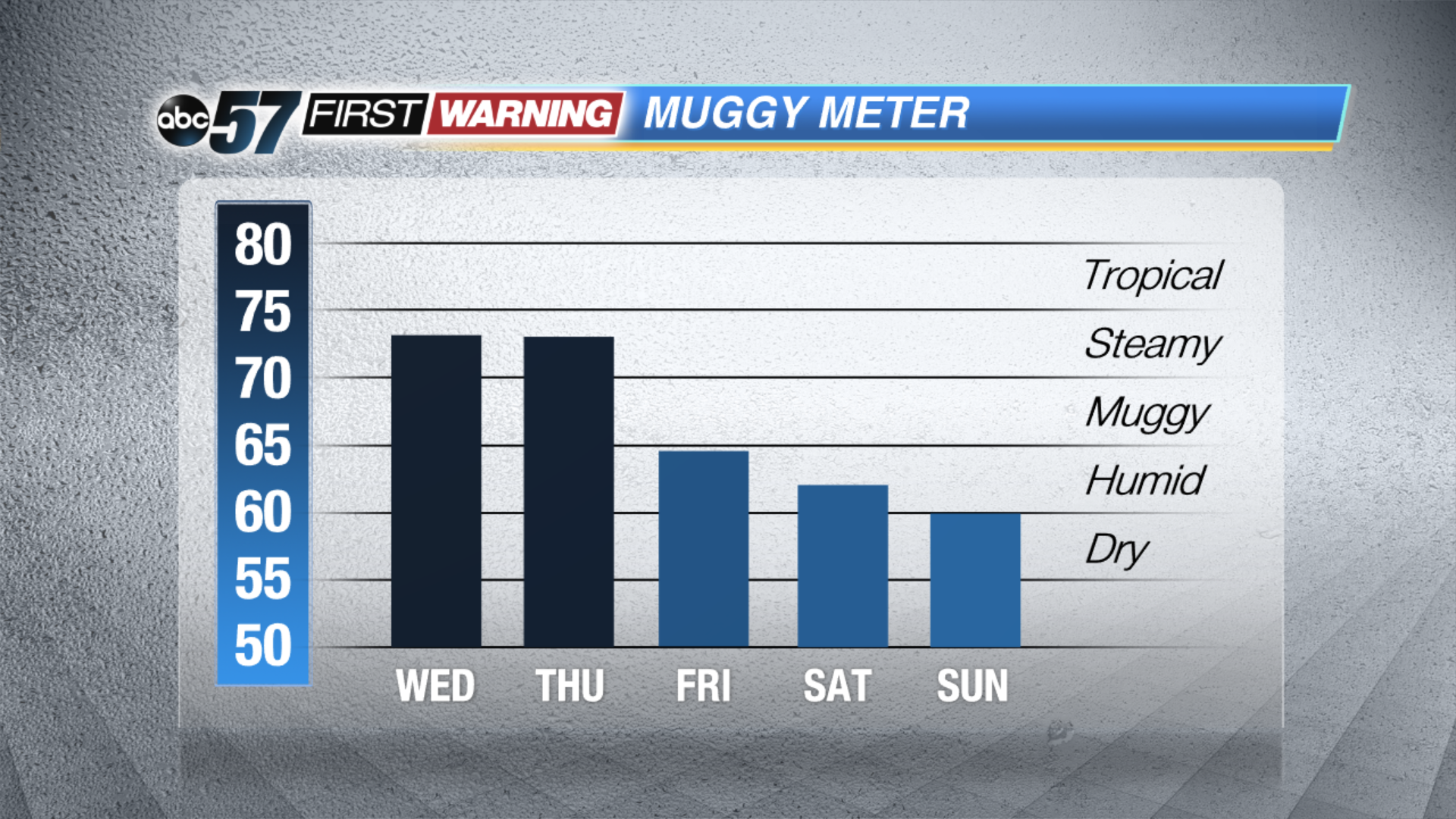
The heat breaks but the humidity stays steamy Wednesday and Thursday. The circulation that was once Alberto swings through Michiana Wednesday with heavy rain and thunderstorms in the afternoon. There is a small severe threat, with many ex-tropical systems there’s the possibility of brief spin-ups that are typically weak.
The rain and humidity clears to Friday with milder weather on tap for the weekend.
Tonight: Mostly cloud, isolated showers or storms, low of 70.
Wednesday: Chance of showers early with more widespread thunderstorms by late afternoon, high 84.
Thursday: Chance of showers, partly cloudy, high of 86.
Friday: Mostly sunny, highs in the mid-70s.
Sign up for the ABC 57 Newsletter